Leander, Texas
| Leander, Texas | |
|---|---|
| City | |
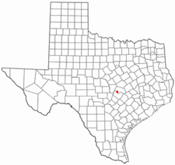 Location of Leander, Texas | |
 | |
| Coordinates: 30°33′40″N 97°51′37″W / 30.56111°N 97.86028°W | |
| Country | United States |
| State | Texas |
| Counties | Williamson, Travis |
| Area | |
| • Total | 7.5 sq mi (19.4 km2) |
| • Land | 7.5 sq mi (19.4 km2) |
| • Water | 0.0 sq mi (0.0 km2) |
| Elevation | 978 ft (298 m) |
| Population (2016) | |
| • Total | 37,889 |
| • Density | 1,016.2/sq mi (392.4/km2) |
| Time zone | Central (CST) (UTC-6) |
| • Summer (DST) | CDT (UTC-5) |
| ZIP codes | 78641, 78646 |
| Area code(s) | 512 & 737 |
| FIPS code | 48-42016[1] |
| GNIS feature ID | 1361023[2] |
Leander (/liˈændər/ lee-AN-dər) is a city in Williamson and Travis counties in the U.S. state of Texas. The population was 37,889 at the 2016 census estimate [3] It is the fourth fastest-growing city in the state of Texas, a suburb just north of Austin,[4] and is part of the Greater Austin metropolitan area. Leander was established in 1882 on land sold by the Austin and Northwestern Railroad Co. to prospective citizens.[5] The town was named in honor of Leander "Catfish" Brown, one of the railroad officials responsible for the completion of the line.[5][6]
It was near Leander that the Leanderthal Lady, a skeleton dating back 10,000 to 13,000 years, was discovered; the site was one of the earliest intact burials found in the United States.[7]
Geography
Leander is located at 30°33′40″N 97°51′37″W / 30.56111°N 97.86028°WCoordinates: 30°33′40″N 97°51′37″W / 30.56111°N 97.86028°W (30.561108, -97.860301),[8] about 22 miles northwest of Austin.
According to the United States Census Bureau, the city has a total area of 7.5 square miles (19.3 km²). None of the area is covered with water.
Transportation
Leander is a jurisdiction member of the Capital Metropolitan Transportation Authority (Capital Metro). The northern terminus for the Capital MetroRail Red Line is located at Leander Station and Park & Ride, located on U.S. Highway 183 north of Ranch to Market Road 2243. Leander Station also has access to several express bus lines, and includes a park and ride facility with 600 parking spaces.[9]
Education
Leander is the center of the Leander Independent School District. Schools in the district include Leander High School, Vista Ridge High School, Cedar Park High School, Charles Rouse High School, Vandegrift High School, Tom Glenn High School, Wiley Middle School (Bernice Knox Wiley Middle School), Leander Middle School, Henry Middle School, Running Brushy Middle School, Cedar Park Middle School, Canyon Ridge Middle school, Parkside Elementary School, Pleasant Hill Elementary School, Rutledge Elementary School, Whitestone Elementary School, Jim Plain Elementary School, and Block House Creek Elementary School, Winkley Elementary School, Camacho Elementary (S.T.E.M.) school and Bagdad Elementary School
Demographics
| Historical population | |||
|---|---|---|---|
| Census | Pop. | %± | |
| 1980 | 2,179 | — | |
| 1990 | 3,398 | 55.9% | |
| 2000 | 7,596 | 123.5% | |
| 2010 | 26,521 | 249.1% | |
| Est. 2015 | 37,889 | [10] | 42.9% |
As of the census[1] of 2000, there were 7,596 people, 2,522 households, and 2,042 families residing in the city. The population density was 1,016.2 people per square mile (392.6/km²). There were 2,612 housing units at an average density of 349.4 per square mile (135.0/km²). The racial makeup of the city was 86.22% White, 2.91% African American, 0.92% Native American, 0.51% Asian, 0.13% Pacific Islander, 6.94% from other races, and 2.37% from two or more races. Hispanic or Latino of any race were 15.94% of the population.
51.7% of households have children under the age of 18 living with them, 65.5% were married couples living together, 10.5% had a female householder with no husband present, and 19.0% were non-families. 14.8% of all households were made up of individuals and 3.6% had someone living alone who was 65 years of age or older. The average household size was 3.01 and the average family size was 3.33.
In the city the population was spread out with 33.5% under the age of 18, 7.6% from 18 to 24, 38.6% from 25 to 44, 15.7% from 45 to 64, and 4.6% who were 65 years of age or older. The median age was 30 years. For every 100 females there were 102.3 males. For every 100 females age 18 and over, there were 96.0 males.
The median income for a household in the city was $53,504, and the median income for a family was $55,051. Males had a median income of $36,021 versus $27,413 for females. The per capita income for the city was $20,263. About 2.5% of families and 4.2% of the population were below the poverty line, including 3.6% of those under age 18 and 3.0% of those age 65 or over.
2011 wildfires
On August 15 and September 5, 2011, Leander was the scene of two destructive wildfires that swept through two central neighborhoods, together burning 330 acres (130 ha) and destroying 26 homes. See 2011 Texas wildfires.
Notable people
- Leanderthal Lady "Leanne" (9000 B.C.) Recovery of an early human burial, one of the oldest and most complete in North America. The individual—a young female—was somewhere between 18 and 25 years at time of death. Archeologists nicknamed her Leanne (or the "Leanderthal Lady"), in reference to the nearby town of Leander, Texas.
- Paul Thompson Former starting quarterback for the Oklahoma Sooners. Led the Sooners in the 2007 Fiesta Bowl in a 42-43 losing effort against Boise State.
References
- 1 2 "American FactFinder". United States Census Bureau. Retrieved 2008-01-31.
- ↑ "US Board on Geographic Names". United States Geological Survey. 2007-10-25. Retrieved 2008-01-31.
- ↑ http://quickfacts.census.gov/qfd/states/48/4842016.html
- ↑ http://www.homecity.com/blog/growth-in-leander-is-booming
- 1 2 http://www.williamson-county-historical-commission.org/Leander/Leander_Texas_Williamson_County.html
- ↑ http://www.leandertx.gov/community/page/history-city-leander
- ↑ Texas Historical Commission. "Leanderthal Lady - Texas Historical Marker". StoppingPoints.
- ↑ "US Gazetteer files: 2010, 2000, and 1990". United States Census Bureau. 2011-02-12. Retrieved 2011-04-23.
- ↑ http://www.capmetro.org/metrorail.aspx?id=312
- ↑ "Annual Estimates of the Resident Population for Incorporated Places: April 1, 2010 to July 1, 2015". Retrieved July 2, 2016.
- ↑ "Census of Population and Housing". Census.gov. Retrieved June 4, 2015.
External links
- City of Leander
- Leander Chamber of Commerce
- Leander Public Library
- Leander Independent School District
- Leander News
- Leanderthal Lady's Burial
- Short History of Leander
- Real Estate/Property Information for Leander
- Leander from the Handbook of Texas Online
Municipalities and communities of Williamson County, Texas, United States | ||
|---|---|---|
| Cities | 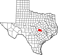 | |
| CDPs | ||
| Unincorporated communities | ||
| Ghost town | ||
| Footnotes | ‡This populated place also has portions in an adjacent county or counties | |
Municipalities and communities of Travis County, Texas, United States | ||
|---|---|---|
| Cities | 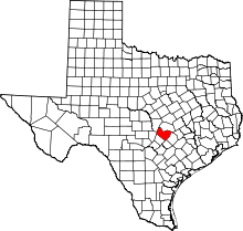 | |
| Villages | ||
| CDPs | ||
| Other unincorporated communities | ||
| Footnotes | ‡This populated place also has portions in an adjacent county or counties | |
| Central city |  | ||||||
|---|---|---|---|---|---|---|---|
| Satellite cities | |||||||
| Other communities | |||||||
| Counties |
| ||||||
| Parks and preserves |
| ||||||
| Geography | |||||||
| Bodies of water | |||||||
| Transportation | |||||||
