Le Perréon
| Le Perréon | |
|---|---|
|
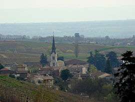
The church and surrounding buildings in Le Perréon | |
 Le Perréon | |
|
Location within Auvergne-Rhône-Alpes region  Le Perréon | |
| Coordinates: 46°03′49″N 4°36′04″E / 46.0636°N 4.6011°ECoordinates: 46°03′49″N 4°36′04″E / 46.0636°N 4.6011°E | |
| Country | France |
| Region | Auvergne-Rhône-Alpes |
| Department | Rhône |
| Arrondissement | Arrondissement of Villefranche-sur-Saône |
| Canton | Canton of Gleizé |
| Government | |
| • Mayor (2008–2014) | Yves Gros |
| Area1 | 14.58 km2 (5.63 sq mi) |
| Population (2005)2 | 1,340 |
| • Density | 92/km2 (240/sq mi) |
| Time zone | CET (UTC+1) |
| • Summer (DST) | CEST (UTC+2) |
| INSEE/Postal code | 69151 / 69460 |
| Elevation |
253–783 m (830–2,569 ft) (avg. 300 m or 980 ft) |
|
1 French Land Register data, which excludes lakes, ponds, glaciers > 1 km² (0.386 sq mi or 247 acres) and river estuaries. 2 Population without double counting: residents of multiple communes (e.g., students and military personnel) only counted once. | |
Le Perréon is a commune in the Rhône department in eastern France.
See also
References
| Wikimedia Commons has media related to Le Perréon. |
This article is issued from Wikipedia - version of the 2/11/2016. The text is available under the Creative Commons Attribution/Share Alike but additional terms may apply for the media files.