Le Manoir, Calvados
| Le Manoir | ||
|---|---|---|
|
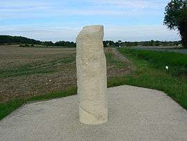
Milestone | ||
| ||
 Le Manoir | ||
|
Location within Normandy region  Le Manoir | ||
| Coordinates: 49°17′04″N 0°35′36″W / 49.2844°N 0.5933°WCoordinates: 49°17′04″N 0°35′36″W / 49.2844°N 0.5933°W | ||
| Country | France | |
| Region | Normandy | |
| Department | Calvados | |
| Arrondissement | Bayeux | |
| Canton | Ryes | |
| Intercommunality | Bayeux Intercom | |
| Government | ||
| • Mayor (2008–2014) | Yves Le Guillois | |
| Area1 | 5.88 km2 (2.27 sq mi) | |
| Population (2008)2 | 211 | |
| • Density | 36/km2 (93/sq mi) | |
| Time zone | CET (UTC+1) | |
| • Summer (DST) | CEST (UTC+2) | |
| INSEE/Postal code | 14400 / 14400 | |
| Elevation |
12–64 m (39–210 ft) (avg. 28 m or 92 ft) | |
|
1 French Land Register data, which excludes lakes, ponds, glaciers > 1 km² (0.386 sq mi or 247 acres) and river estuaries. 2 Population without double counting: residents of multiple communes (e.g., students and military personnel) only counted once. | ||
Le Manoir is a commune in the Calvados department in the Normandy region in northwestern France.
Population
| Historical population | ||
|---|---|---|
| Year | Pop. | ±% |
| 1962 | 137 | — |
| 1968 | 145 | +5.8% |
| 1975 | 147 | +1.4% |
| 1982 | 114 | −22.4% |
| 1990 | 107 | −6.1% |
| 1999 | 109 | +1.9% |
| 2008 | 211 | +93.6% |
See also
References
| Wikimedia Commons has media related to Le Manoir (Calvados). |
This article is issued from Wikipedia - version of the 3/16/2016. The text is available under the Creative Commons Attribution/Share Alike but additional terms may apply for the media files.