Lawrenceville–Vincennes International Airport
| Lawrenceville–Vincennes International Airport | |||||||||||||||||||
|---|---|---|---|---|---|---|---|---|---|---|---|---|---|---|---|---|---|---|---|
 USGS 2006 orthophoto | |||||||||||||||||||
| IATA: LWV – ICAO: KLWV – FAA LID: LWV | |||||||||||||||||||
| Summary | |||||||||||||||||||
| Airport type | Public | ||||||||||||||||||
| Owner | Bi-State Authority | ||||||||||||||||||
| Serves | Lawrenceville, Illinois / Vincennes, Indiana | ||||||||||||||||||
| Location | Allison Township, Lawrence County | ||||||||||||||||||
| Elevation AMSL | 430 ft / 131 m | ||||||||||||||||||
| Coordinates | 38°45′51″N 087°36′20″W / 38.76417°N 87.60556°WCoordinates: 38°45′51″N 087°36′20″W / 38.76417°N 87.60556°W | ||||||||||||||||||
| Map | |||||||||||||||||||
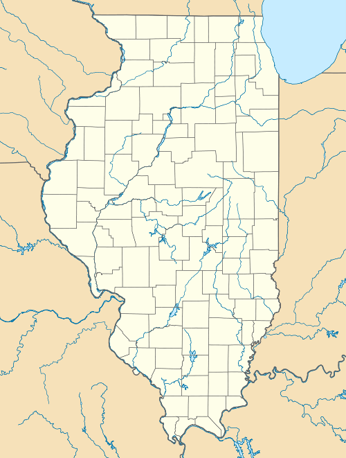
 LWV  LWV Location of airport in Illinois/United States | |||||||||||||||||||
| Runways | |||||||||||||||||||
| |||||||||||||||||||
| Statistics (2010) | |||||||||||||||||||
| |||||||||||||||||||
- for the World War II use of the airport, see George Army Airfield
Lawrenceville–Vincennes International Airport (IATA: LWV[2], ICAO: KLWV, FAA LID: LWV) is a public use airport in Lawrence County, Illinois, United States.[1] Owned by the Bi-State Authority, it is located three nautical miles (6 km) northeast of the city of Lawrenceville, Illinois[1] and also serves the city of Vincennes in Knox County, Indiana. This airport is included in the National Plan of Integrated Airport Systems for 2011–2015, which categorized it as a general aviation facility.[3]
History
Established in 1942 by the United States Army Air Forces. Known as George Army Airfield. Assigned to the Eastern Flying Training Command on August 10. Conducted Advanced two-engine flying training until transferred to I Troop Carrier Command on August 15, 1944. Placed in standby status September 1, 1944 with the drawdown of AAFTC's pilot training program. Declared surplus and turned over to the Army Corps of Engineers on September 30, 1945. Eventually discharged to the War Assets Administration (WAA) and became civil airport. [4] [5] [6]
Facilities and aircraft
Lawrenceville–Vincennes International Airport covers an area of 3,067 acres (1,241 ha) at an elevation of 430 feet (131 m) above mean sea level. It has two asphalt paved runways: 18/36 is 5,199 by 100 feet (1,585 x 30 m) and 9/27 is 5,198 by 100 feet (1,584 x 30 m). The airport also has one unpaved turf runway designated 4U/22U which measures 1,000 by 200 feet (305 x 61 m).[1]
For the 12-month period ending July 31, 2010, the airport had 35,000 aircraft operations, an average of 95 per day: 88% general aviation, 11% air taxi, and 1% military. At that time there were 77 aircraft based at this airport: 51% single-engine, 29% glider, 12% ultralight, 8% multi-engine, and 1% helicopter.[1]
Current activity
The Lawrenceville–Vincennes International Airport is home to the Wabash Valley Soaring club. It has been an educational soaring club for over 45 years, dedicated to helping others learn the art and skills of soaring safely. The club owns a fleet of six club gliders, three of which are two place trainers as well as two tow planes. There are also over 25 private sailplanes based at the field. The club has two hangars with a clubroom attached to the main hangar, and a climate controlled shop for maintaining the club fleet. The shop is used also for restoration of member projects. Many WVSA members are involved with the Vintage Sailplane Association and are active in the restoration and flying of older gliders and sailplanes. Over a long Fathers Day weekend, WVSA hosts the annual Midwest Vintage/Classic Sailplane Regatta. Many pilots bring vintage and classic gliders from all over the country for this annual event.
References
- 1 2 3 4 5 FAA Airport Master Record for LWV (Form 5010 PDF). Federal Aviation Administration. Effective November 15, 2012.
- ↑ "IATA Airport Code Search (LWV: Lawrenceville Municipal)". International Air Transport Association. Retrieved December 28, 2012.
- ↑ "2011–2015 NPIAS Report, Appendix A" (PDF, 2.03 MB). National Plan of Integrated Airport Systems. Federal Aviation Administration. October 4, 2010. External link in
|work=(help) - ↑
 This article incorporates public domain material from the Air Force Historical Research Agency website http://www.afhra.af.mil/.
 - ↑ Shaw, Frederick J. (2004), Locating Air Force Base Sites History’s Legacy, Air Force History and Museums Program, United States Air Force, Washington DC, 2004.
- ↑ Manning, Thomas A. (2005), History of Air Education and Training Command, 1942–2002. Office of History and Research, Headquarters, AETC, Randolph AFB, Texas ASIN: B000NYX3PC.
External links
- Mid-American Air Center, the fixed-base operator (FBO)
- Aerial image as of February 1998 from USGS The National Map
- FAA Terminal Procedures for LWV, effective November 10, 2016
- Resources for this airport:
- FAA airport information for LWV
- AirNav airport information for KLWV
- ASN accident history for LWV
- FlightAware airport information and live flight tracker
- NOAA/NWS latest weather observations
- SkyVector aeronautical chart, Terminal Procedures