Latur district
Coordinates: 18°24′N 76°35′E / 18.4°N 76.58°E
| Latur district लातूर जिल्हा | |
|---|---|
| District of Maharashtra | |
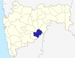 Location of Latur district in Maharashtra | |
| Country | India |
| State | Maharashtra |
| Administrative division | Aurangabad division |
| Headquarters | Latur |
| Tehsils | 1. Latur, 2. Udgir, 3. Ahmedpur, 4. Ausa, 5. Nilanga, 6. Renapur, 7. Chakur, 8. Deoni, 9. Shirur Anantpal, 10. Jalkot. |
| Government | |
| • Lok Sabha constituencies | 2 (partial) Latur & Osmanabad |
| • Assembly seats | 6 |
| Area | |
| • Total | 7,157 km2 (2,763 sq mi) |
| Population (2011) | |
| • Total | 2,455,543 |
| • Density | 340/km2 (890/sq mi) |
| • Urban | 25.47% |
| Demographics | |
| • Literacy | 79.03% |
| • Sex ratio | 924 |
| Website | Official website |
| Latur District 25th Anniversary |
|---|
Latur district (Marathi: लातूर जिल्हा) is a district in Maharashtra state of India. Latur city is the district headquarters and is the 16th largest city in the state of Maharashtra.[1] The district is primarily agricultural. Urban population comprises 25.47% of the total population.[2]
History
Latur has an ancient history, which probably dates to the Rashtrakuta period. It was home to a branch of Rashtrakutas which ruled the Deccan 753-973 AD. The first Rashtrakuta king Dantidurga was from Lattalur, probably the ancient name for Latur. Anecdotally, Ratnapur is mentioned as a name for Latur.
The King Amoghavarsha of Avinash developed Latur city, originally the native place of the Rashtrakutas. The Rashtrakutas who succeeded the Chalukyas of Badami in 753 AD called themselves the residents of Lattalur.
It was, over the centuries, ruled by the Satavahanas, the Sakas, the Chalukyas, the Yadavas of Deogiri, the Delhi Sultans, the Bahamani rulers of South India, Adilshahi, and the Mughals.
In the 17th century, it became part of the independent princely state of Hyderabad. Under Hyderabad the tax system was reformed and many of the exploitive taxing practices were ended.[3] In 1905 it was merged with surrounding areas, renamed Latur tehsil, and became part of Osmanabad district, which until 1948 was a part of Hyderabad state under the Nizam. The chief of Nizam's Razakar army Qasim Rizwi was from Latur.
After independence and the merger of Hyderabad with the Indian Union, Osmanabad became part of Bombay Province. In 1960, with the creation of Maharashtra, Osmanabad was one of its districts. On August 15, 1982, a separate Latur district was carved out of Osmanabad district.
Geography
Latur district is in the Marathwada region in Maharashtra in India, located between 17°52' North to 18°50' North and 76°18' East to 79°12' East in the Deccan plateau. It has an average elevation of 631 metres (2070 ft) above mean sea level.
The district may be divided into two regions — the Balaghat plateau and the northeastern region consisting of Ahmadpur and Udgir. The entire district of Latur is on the Balaghat plateau, 540 to 638 metres from the mean sea level.
Latur District is bound by Nanded District to the northeast; the state border with Karnataka to the east and southeast; Osmanabad District to the south-west; Beed District to the west; and Parbhani District to the northwest.
On 30 September an earthquake struck Latur.
It is the 16 largest city in Maharashtra. It is also the fastest growing city in ASIA.
Climate
Average rainfall in the district is 600 to 800 mm. This is usually during the monsoon months from July to October. Moderate temperatures are mainly observed. The rainfall is unpredictable in tune with the Indian monsoon. Summers begin from early March to July. Summers are dry and hot. The temperature ranges from 24 °C to 39.6 °C, though at the peak they may reach 41 °C. November to January is the winter season. Temperatures at the peak drop to single digits but usually they hover around 13.9 °C to 21.8 °C sometimes lowers up to 11 °C. January to March are the months with moderate temperatures.
Average rainfall in the district is 600 to 800 mm. This is usually during the monsoon months from July to October. Moderate temperatures are mainly observed. The rainfall is unpredictable in tune with the Indian monsoon. Summers begin from early March to July. Summers are dry and hot. The temperature ranges from 24 °C to 39.6 °C, though at the peak they may reach 41 °C. November to January is the winter season. Temperatures at the peak drop to single digits but usually they hover around 13.9 °C to 21.8 °C sometimes lowers up to 11 °C. January to March are the months with moderate temperatures.
Rivers, lakes and dams
The district lies in the Godavari river basin. Much of the water used in the district comes from the Manjira River, which suffered from environmental degradation and silting in the late 20th and early 21st centuries.[4][5] Other major rivers of the district are the Terna (Tirna), Rena, Manar, Tawarja (Tawarjo), Tiru and Gharni.[6] These rivers and a number of smaller ones are dammed to provide both irrigation and drinking water.[7] Large dams include the Devargan Dam, Gharni Dam, Masalga Dam, Sakol Dam on the Sol River, Tawarja Dam, and Tiru Dam.[7] On the northern plains of the district there are three main rivers, the Manyad, the Lendi (a tributary of the Teru), and the Teru (Tiru).[8]
Demographics
In the 2001 Indian census, Latur had a population of 2,080,285.[9] Males constituted 52% and females 48% of the population. Latur had an average literacy rate of 72%, higher than the national average of 59.5%, with male literacy at 77%, and female literacy at 63%. In 2001 in Latur, 14% of the population was under 6 years of age. For every 1000 males age 6 and older, there were 935 females.[9]
According to the 2011 census Latur district had a population of 2,455,543,[2] roughly equal to the nation of Kuwait[10] or the US state of Nevada.[11] This gives it a ranking of 181st among the districts of India (out of a total of 640).[2] The district had a population density of 343 inhabitants per square kilometre (890/sq mi).[2] Its population growth rate over the decade 2001-2011 was 18.04%.[2] Latur had a sex ratio of 924 females for every 1000 males,[2] and a literacy rate of 79.03%.[2]
The primary language is Marathi. Kannada, Telugu, Urdu, Hindi, Bengali and Rajasthani are also spoken.[12]
Culture and Religion
Fairs and festivals: Shri Siddeshwar fair at Latur is held every year. Thousands of people attend the Gangaram Maharaj Samadhi every Ekadashi at Hattibet in Udgir tehsil.
In January 2011, the first ever 'Latur Festival' was organised on the 10th, 11 and 12 January under the guidance of Shri Amitji Deshmukh. The grand success of this event has now ensured a permanent spot on the cultural calendar. Now this will be an annual fixture. The event is organised by the Latur Club and managed by Indian Magic Eye Pvt. Ltd.
Education
List of educational institutions in Latur District
Higher education
Latur has developed as a good educational center in Maharashtra over the years.
In past few years, Latur has emerged as an educational hub for higher education. There are many institutions which offer degree level (which include bachelor's degree, master's degree) education. Most of the well established professional degree colleges are located in Latur city, many have recently been erected in sub-urban area. Being renowned for its glorious results, Latur city drags many students from different parts of state.
Primary and secondary education
There are as many as 1284 primary schools run by and 487 private schools affiliated to the Education department of Latur District Council . The primary medium of teaching in most of these schools is Marathi. However; many schools observe English, Semi-English, Urdu medium of teaching.Latur is famous for its Latur pattern which has given toppers to the state for many years in HSC and SSC exams conducted by MSBSHSE.
Divisions
Administratively the district is divided into five subdivisions namely Latur, Nilanga, Ausa, Ahmadpur and Udgir, and further divided into ten talukas & ten Panchayat Samitis. These are Latur, Udgir, Ahmedpur, Ausa, Nilanga, Renapur, Chakur, Deoni, Shirur Anantpal, and Jalkot. Latur city is the administrative headquarters of the district. There are around 945 villages & 786 Gram Panchayats in the district.
There are six Vidhan Sabha constituencies in Lutur District. These are Latur City, Latur Rural, Udgir, Ausa, Nilanga and Ahmedpur.[13] The district votes in two Lok Sabha constituencies Osmanabad for Ausa, and Latur for the other five.[14]
Cities and towns
Latur city is only a municipal corporation in the district Udgir, Ahmadpur, Ausa, Nilanga are the major urban centers in the district and all have Municipal Councils. The following are the twenty-eight largest villages, administered by gram panchayats, followed by their 2001 population:
- Bhada 10000
- Murud 20,552
- Chakur 16,122
- Killari 15,259
- Nalegaon 14,983
- Aurad Shahajani 12,894
- Renapur 11,596
- Deoni 11,276
- Pangaon 10,521
- Kingaon 9,665
- Shirur Tajband 9,191
- Shirur Anantpal 8,682
- Kasarshirshi (Kasarsirsi) 8,139
- Wadhawana 8,132
- Jalkot 7,912
- Wadwal Nagnath 7,289
- Sakol 7,018
- Hadolti 7,013
- Ujani 6,434
- Matola 6,393
- Kharola 6,260
- Babhalgaon 6,013
- Halgara 5,844
- Handarguli 5,801
- Chapoli 5,778
- Nitoor (Nitur) 5,751
- Lohara 5,682
- Chincholi Raowadi 5,678
- Ashiv 6549
- Karepur 7000
Attractions
The city is a tourist hub, surrounded with many historical monuments including the Kharosa Caves, as well as Sri Satya Sai Baba Temple.
Pilgrimage centers
Forts
There are some forts in and around Latur District, including:
Tourist spots
- Wadwal Nagnath - This small hillock near Chakur is home to hundreds of rare species of plants, most of them believed to be of medicinal use in Ayurveda. Every year, yatra is held here when thousands of pilgrims from the district and nearby throng to Wadwal.
- Sai Nandanwan - Another tourist spot near Chakur. Recently developed. Spread into nearly 400 acres (1.6 km2), it has mango plantations, water park and amusement park. A temple of Satya Sai Baba is situated in the middle of the park.
- Kharosa - It has caves carved in the laterite rocks. Believed to be dated as back as to the 8th century AD.
- Latur - There are many small-big attractions. Siddheshwar temple, Viraat Hanuman mandir, Nana-Nani Park are to name a few.
- Lohara- A village in Udgir Taluka known for the Mahadev Bet (hill) & Gabeisaheb Bet. Beninath maharaj math is a famous trust, run from the time of Nizam shahi dynasty.
- Bhakaskheda - An ancient famousJagdamba devi temple which is from ancient time.
- Devarjan - A small hill in Udgir taluka with a shrine on the top.
- Dongraj -A village in chakur tehsil known for Malleppa temple of lord shiva situated at border of five villages. The pilgrimage at Dongraj is very famous which organised at Malleppa Temple during shravani months and temple of sant Ambadas Maharaj. Various Games organised during pilgrimage .
Economy
Latur was one of the important trading hub during the time of Nizam of Hyderabad. It is an industrial center as well as agriculture based economy. Latur is the rising Industrial Hub Of Marathwada.
Latur is known all over India for the Quality and Quantity of Pulses that it produces and especially Toor Dall a.k.a. Arhar dal or Pegion Peas. Latur is also a major trading center for Urad, Moong and Channa along with TUR. Also it is known for trading in Oil Seeds mainly Sun-flower and Soya Bean, kardi (safflower),nutcrackers, locks, brassware, milk powder, ginning and pressing. It is also famous for the sugar mills like Manjra, Saker Karkhana, Vikas, Jagruti etc.
Transport
Air
Latur Airport is located near Chincholiraowadi, northwest of Latur city. The Airport was constructed in 1991 by Public Works Department (PWD) and then handed over to MIDC. It was upgraded at a cost of nearly Rs.140 million and is being operated on a 99-year lease by Reliance Airport Developers (RADPL).[15] There is no scheduled air service currently from latur airport although the airport sees 14 to 16 aircraft movements a month.[16]
Highways
Total road length of Latur district is 13,642 km. Several State Highways criss cross Latur district. They include:
- Ratnagiri-Kolhapur-Solapur-Latur-Nanded-Yavatmal-Wardha-Nagpur (NH 204)
- Nagpur—Bori—Adhampur State Highway (SH )
- Daund—Barsi—Osmanabad—Bantal—Ausa State Highway (SH 77)
- Miraj—Pandharpur—Barshi—Latur State Highway (SH 02)
- Manjarsumba—Kaij—Lokhandi—Savargaon State Highway.
Bus routes to the district headquarters connect 96% of the villages.
The municipal bus system operates buses that serve the region and connect places in Latur City. The State Transport buses of MSRTC serves all villages in the district.
Railway Lines
All railway lines through Latur are broad gauge. They belong to Central Railway
Latur railway station was built again when the Barshi railway line was converted from narrow gauge to broad gauge. The railway gauge was converted in September 2007 from Latur to Osmanabad and in October 2008 from Osmanabad to Kurduvadi. Latur is now is connected to Mumbai by a direct train via Kurduvadi (train number 1006 from Latur and 1005 from Mumbai). It is connected to Hydrabad by train number 7013 that originates at Osmanabad.[17] With the introduction of train number 1005 via Kurduvadi in October 2008, the earlier train connecting Latur to Latur Road, Parbhani and Aurangabad was discontinued.
The important railway stations are Latur, Latur Road and Udgir. The district has 148 km of railways of which 83 km is broad gauge and 65 km is narrow gauge.
The railway line from Latur to Kurduwadi to Miraj was narrow gauge. The Kurduwadi-Pandharpur section towards Miraj was converted to broad gauge in 2002. The Latur to Osmanabad section was converted to broad gauge in September 2007. (Osmanabad did not lie on the narrow gauge railway line and the alignment was changed for the new broad gauge track to pass through Osmanabad.) The Osmanabad-Kurduwadi section of broad gauge track became operational in October 2008. The Pandharpur-Miraj section is still narrow gauge and the conversion to broad gauge is low on priority. But it will be very important route to Goa if pandharpur-miraj is converted to broadgauge, as the people here agriculture-based but have no market. Trains will help them achieve Konkan and Goan markets and hence the poor economy of these people will improve.
Sports
The Maharashtra Cricket Association is planning to construct their home ground near Latur City. Also a Divisional sports complex have been sanctioned for Latur region, which would cater to the needs of players in Latur, Osmanabad and Nanded districts.
National Level Kabaddi and Basket Ball were held in Latur district. Latur Region is still awaiting to get a Krida Prabodhini.
Medical Facilities
Latur District is served by 12 government hospitals, 46 Primary Health Centers, 19 dispensaries and 234 primary health support groups. A Super Specialty Hospital is taking place in Latur which would benefit to the patients in 11 adjoining districts.
In addition to these there are a large number of private hospitals; Jatal Hospital & Research Center, Gugle Memorial Hospital, Alpha Super Speciality Hospital, Yeshwantrao Chavan Rural Hospital and Latur Cancer Hospital are the famous ones.
In Latur Two Medical Colleges 1) Govt. Medical College & Hospital 2) MIMSR Medical College & Hospital.
Communication
Post and telegraph services: Only 250 villages of total 914 died (1991 census) had post offices, serving 52.27% of the rural population.
Media and Communication
Newspapers: jagar mediaEkamt is the first Maharashtra District news paper daily having an internet edition along with an epaper. Marathwada Neta- which are the leading newspaper of the region, while Yeshwant, Lokmat, Bhukamp,- Sakaal & Punyanagri and are other daily newspapers published in the regional language.
Latur Earthquake of 1993
Latur had a devastating, though only midly severe, earthquake on 30 September 1993 resulting in a huge loss of life. The earthquake measured only 6.3 on the Richter scale but more than 30,000 people were estimated to have died mainly due to poor construction of houses and village huts made of stones which just collapsed on people who were fast asleep in early morning hours. It struck southern Marathwada region of Maharashtra state in central-western part of India and affected Latur, Beed, Osmanabad and adjoining districts about 400 km south-east of Mumbai (Bombay). It was an intra-plate earthquake. Latur was almost completely destroyed and life came to a standstill. The earthquake's focus was around 12 km deep - relatively shallow causing shock waves to cause more damage. The number of lives lost was high as the earthquake occurred at 3.56 a.m. local time when people were fast asleep.
After the earthquake, seismic zones were reclassified and building codes and standards were revised all over India.

See also
Websites
- Official website of Collector & District Magistrate, LATUR.
- Official website of District Council, LATUR
- latur1.com information about Latur
References
- ↑ In the 2011 census, Latur City had a population of 382,754."Provisional Population Totals, Census of India 2011: Urban Agglomerations/Cities having population 1 lakh and above" (PDF). p. 6. Archived (PDF) from the original on 2 April 2013.
- 1 2 3 4 5 6 7 "District Census 2011". Registrar General & Census Commissioner, India. 2011. Retrieved 2011-09-30.
- ↑ "Vision 2032: Chapter 25 Revenue Administration, Land Record and Implementation of Land Laws: Latur District" (PDF). Latur District.
- ↑ "In dry Latur, villagers revive a dead river". The Times of India. 10 May 2016. Archived from the original on 10 May 2016.
- ↑ "Latur Drinking Water Crisis highlights absence of Water Allocation Policy and Management". South Asia Network on Dams, Rivers and People. 20 April 2016.
- ↑ "Latur District Map: Rivers and Tributaries in Latur". Maps of India. Archived from the original on 10 May 2016.
- 1 2 "Dams in Godavari Basin". Water Resources Information System.
- ↑ "Latur District: District Profile: Rivers and tributaries". District Administration Latur. Archived from the original on 8 June 2015.
- 1 2 "Census of India 2001: Data from the 2001 Census, including cities, villages and towns (Provisional)". Census Commission of India. Archived from the original on 2004-06-16. Retrieved 2008-11-01.
- ↑ US Directorate of Intelligence. "Country Comparison:Population". Retrieved 2011-10-01.
Kuwait 2,595,62
- ↑ "2010 Resident Population Data". U. S. Census Bureau. Retrieved 2011-09-30.
Nevada 2,700,551
- ↑ http://latur.nic.in/html/ataglance.htm
- ↑ "Assembly Constituencies-Post delimitation: Maharashtra: Latur District" (PDF). National Informatics Centre, Government of India.
- ↑ "Election Commission website" (PDF).
- ↑ "Reliance Airport gets five projects on lease". Times of India. 6 Aug 2009. Retrieved 19 September 2011.
- ↑ "Vilasrao Deshmukh's demise: VVIP flow congests airports". DNA. 15 Aug 2012. Retrieved 18 Aug 2012.
- ↑ Train Timetable Latur
- ↑ http://jagarnews.com/
External links
 |
Beed district | Parbhani district | Nanded district | |
| |
||||
| ||||
| | ||||
| Osmanabad district | Bidar district, Karnataka |
| Topics | |||||||||||||||||||||||
|---|---|---|---|---|---|---|---|---|---|---|---|---|---|---|---|---|---|---|---|---|---|---|---|
| Regions | |||||||||||||||||||||||
| Divisions and Districts |
| ||||||||||||||||||||||
| Million-plus cities in Maharashtra | |||||||||||||||||||||||
| Other cities with municipal corporations | |||||||||||||||||||||||
Portal: Maharashtra | |||||||||||||||||||||||
Latur district topics | ||
|---|---|---|
| History | | |
| Cities and towns | ||
| Buildings and landmarks | ||
| Transport | ||
| Education | ||
| Lok Sabha constituencies | ||
| Vidhan Sabha constituencies | ||
| Personalities | ||
| Neighborhoods | ||
| Topics | |||||||||||||||||||||||
|---|---|---|---|---|---|---|---|---|---|---|---|---|---|---|---|---|---|---|---|---|---|---|---|
| Regions | |||||||||||||||||||||||
| Divisions and Districts |
| ||||||||||||||||||||||
| Million-plus cities in Maharashtra | |||||||||||||||||||||||
| Other cities with municipal corporations | |||||||||||||||||||||||
Portal: Maharashtra | |||||||||||||||||||||||