Latur
| Latur लातूर (ಲಟ್ಟಲೂರು) | |
|---|---|
| City | |
 Latur Location in Maharashtra, India | |
| Coordinates: 18°24′N 76°34′E / 18.40°N 76.56°ECoordinates: 18°24′N 76°34′E / 18.40°N 76.56°E | |
| Country |
|
| State | Maharashtra |
| Region | Aurangabad division |
| District | Latur |
| Settled | Possibly 7th century AD |
| Government | |
| • Body | Latur Municipal Corporation |
| • Mayor | Deepak Sul |
| Area[1] | |
| • Total | 32.56 km2 (12.57 sq mi) |
| Elevation | 515 m (1,690 ft) |
| Population (2011) | |
| • Total | 382,940[2] |
| Demonym(s) | Laturkar |
| Languages | |
| • Official | Marathi |
| • Other | Hindi, Urdu |
| Time zone | IST (UTC+5:30) |
| PIN |
|
| Telephone code | 91-2382 |
| Vehicle registration | MH-24 |
| Sex ratio | 923.54 ♀/1000 ♂ |
| Literacy | 96.76 |
| Distance from Mumbai | 497 kilometres (309 mi) E (land) |
| Distance from Hyderabad | 337 kilometres (209 mi) NW (land) |
| Distance from Aurangabad, Maharashtra | 294 kilometres (183 mi) SE (land) |
| Climate | BSh (Köppen) |
| Precipitation | 666 millimetres (26.2 in) |
| Avg. summer temperature | 41 °C (106 °F) |
| Avg. winter temperature | 13 °C (55 °F) |
| http://www.citypopulation.de/world/Agglomerations.html | |
Latur (Marathi: लातूर) is a city in the Marathwada region in the Maharashtra state of India. It is the headquarters of Latur District and Latur Taluka. The city is a tourist hub, surrounded by many historical monuments, including the Kharosa Caves.
History
Latur has an ancient history, which probably dates to the Rashtrakuta period. It was home to a branch of Rashtrakutas which ruled the Deccan from 753 to 973 AD. The first Rashtrakuta king, Dantidurga, was from Lattalur (Kannada: ಲಟ್ಟಲೂರು), probably the ancient name for Latur. Ratnapur is also mentioned as an historic name for Latur.[3]
The King Amoghavarsha of Rashtrakutas developed the Latur city, originally the native place of the Rashtrakutas. The Rashtrakutas who succeeded the Chalukyas of Badami in 753 AD called themselves the residents of Lattalut.
It was, over the centuries, variously ruled by the Satavahanas, the Sakas, the Chalukyas, the Yadavas of Deogiri, the Delhi Sultans, the Bahamani rulers of South India, Adilshahi, and the Mughals.
Later in the 19th century, Latur became part of the independent princely state of Hyderabad. In 1905 it was merged with surrounding areas and renamed Latur tehsil, becoming part of Osmanabad district. Before 1948, Latur was a part of Hyderabad State under Nizam. The chief of Nizam's Razakar army, Qasim Rizwi, was from Latur.
After Indian independence and the merger of Hyderabad with the Indian Union, Osmanabad became part of Bombay Province. In 1960, with the creation of Maharashtra, Latur became one of its districts. On August 16, 1982, a separate Latur district was carved out of Osmanabad district.
Politics in Latur and Prominent Politicians in Latur
Latur is called the city of politicians. Keshavrao Sonawane was the first minister from Latur region who was in the cabinet of Maharashtra Chief Minister Vasantrao Naik, as Co-Operative minister, 1962-1967.[4] Ex-chief minister Vilasrao Deshmukh was born in Babhalgaon village, Latur. The city is the birthplace of other politicians, such as Shivraj Patil, Diliprao Deshmukh, Vilasrao Deshmukh (whose son is Bollywood actor Riteish Deshmukh), and Keshavrao Sonawane.
Education and research
Latur has developed into a strong educational hub for secondary, higher secondary, and university education. Latur is known throughout Maharashtra for its "Latur Pattern". Junior colleges in Latur have a good record of Engineering and Medical competitive Entrance Exam Results.[5] The term Latur Pattern went popular because of the private coaching classes in the city. Since a lot of students from Latur schools and colleges score exceptionally well in SSC and HSC board exams, the city is sometimes referred to as Oxford city for the students. Students from nearby places who want to pursue higher education, come to the city of Latur. Most of the students come to Latur for joining reputed schools and colleges.
Basic and higher education
Public schools (known locally as municipality schools) are run by the LMC, and are affiliated with the MSBSHSE. Private schools are run by educational trusts or individuals. They are usually affiliated with either the state board or national education boards, such as the ICSE or CBSE boards.
University education
Due to more than 140 colleges and Nanded University being situated in Latur, the city is known as an educational hub in Marathwada. Many of the students studying in the colleges and the University are from nearby districts. Most colleges in Latur are affiliated with the Nanded University.
The M. S. Bidve Engineering College, Latur, founded in 1983, is one of the oldest engineering colleges in Marathwada. The Maharashtra Institute of Medical Science & Research Latur was founded in 1988 by social activist Vishwanath Karad. This trust currently maintains and operates 63 institutes in and around Latur. Maitree Foundation, founded in 2000, works in the field of capacity building of rural youth and women. They have worked with more than 1000 SHGs.
The Border Security Force Training Centre, Chakur, and the Disaster Management Training Institute were established in Latur in 2005 and 2008, respectively.
Dayanand Law College was established by the Dayanand Education Society. Established medical schools such as the Government Medical College, Manjara Ayurvedic College, and Maitree Foundation's Maitree Institute of Management & Technology, Latur, train students from all over Latur and Maharashtra.
Geography and climate
| Latur | ||||||||||||||||||||||||||||||||||||||||||||||||||||||||||||
|---|---|---|---|---|---|---|---|---|---|---|---|---|---|---|---|---|---|---|---|---|---|---|---|---|---|---|---|---|---|---|---|---|---|---|---|---|---|---|---|---|---|---|---|---|---|---|---|---|---|---|---|---|---|---|---|---|---|---|---|---|
| Climate chart (explanation) | ||||||||||||||||||||||||||||||||||||||||||||||||||||||||||||
| ||||||||||||||||||||||||||||||||||||||||||||||||||||||||||||
| ||||||||||||||||||||||||||||||||||||||||||||||||||||||||||||
Latur is situated 636 metres above mean sea level, on the Balaghat plateau, near the Maharashtra–Karnataka state boundary. It receives its drinking water from the nearby Manjira River, which suffered from environmental degradation and silting in the late 20th and early 21st centuries.[6] As a result of this and lack of implementation of a water management strategy, during the drought of the 2010s the city ran out of water.[7][8]
Temperature : Annual temperatures in Latur range from 13 to 41 °C (55 to 106 °F), with the most comfortable time to visit in the winter, which is October to February. The highest temperature ever recorded was 45.8 °C (114.4 °F). The lowest recorded temperature was 6.9 °C (44.4 °F). In the cold season the district is sometimes affected by cold waves in association with the eastward passage of western disturbances across north India, when the minimum temperature may drop down to about 2 to 4 °C (36 to 39 °F).[9]
Rainfall : Most of the rainfall occurs in the monsoon season from June to September. Rainfall varies from 9.0 to 693 mm/month. Average annual rainfall is 725 mm.
Latur earthquake of 1993
Latur had a devastating intraplate earthquake on 30 September 1993 resulting in a huge loss of life. The earthquake measured only 6.3 on the Richter scale but around 10,000 people were estimated to have died [10] and 30,000 injured mainly due to poor construction of houses and village huts made of stones which collapsed on people who were fast asleep in early morning hours. It struck southern Marathwada region of Maharashtra state in central-western part of India and affected Latur, Beed, Osmanabad and adjoining districts about 400 km south-east of Mumbai. Latur was almost completely destroyed and life came to a standstill. The earthquake's focus was around 12 km deep (relatively shallow), causing shock waves to cause more damage. The number of lives lost was high as the earthquake occurred at 3:53 a.m. local time, when people were fast asleep. After the earthquake, seismic zones were reclassified and building codes and standards were revised all over India.
Trade and industries
| Population growth | |||
|---|---|---|---|
| Census | Pop. | %± | |
| 1931 | 29,000 | — | |
| 1971 | 67,000 | — | |
| 1981 | 101,000 | 50.7% | |
| 1991 | 159,200 | 57.6% | |
| 2001 | 299,179 | 87.9% | |
| 2011 | 438,918 | 46.7% | |
| Source:Census of India[11] | |||
The city is a major sugarcane and edible oils, soyabean, grapes and mango production centre. A fine blend of mango with locally grown mangoes was developed as Keshar Amba.
Till 1990, Latur languished as a city, remaining an industrially backward. In 1960, region of Marathwada was merged with Maharashtra. This was the time when the industrial development of the Marathwada region began, propelled through designated backward area benefits. And it was only when the MIDC (Maharashtra Industrial Development Corporation) began acquiring land and setting up industrial estates that it began to grow. but still the majority small and medium scale industries are agriculture based and not industry based.
City is now home to some best known brands. There are Tinna Oils, Kirti Gold, Videocon, Kalantry Group's Agro Processing, Shivshankar Udyog (Brand: Silver Coins), dal manufacturing units to name a few. Many players have their manufacturing bases in Latur, in the sectors of Agro Processing and Edible Oils and consumer durables, plastic processing, aluminium processing, agriculture and biotech. Among Agro Processing Ramkee Infrastructure along with IL&FS would be starting their plant in Latur, which is Largest Agro Based SEZ in Maharashtra.
Latur has the largest trading centre for soyabean in India. The green city is inside what is called 'Sugar Belt' of Maharashtra. The district has more than eleven sugar factories, which makes it among the highest sugar-producing districts of India. It also has oil seeds, commodities and fruit market.
Latur is also known for high quality grapes and houses many state and privately owned cold storage facilities. A grape wine park spread over 1.42 square kilometres (350 acres) has been established near Ausa, 18 km from Latur city. A brand new Latur Food Park, spread across 1.2 square kilometres (300 acres) is under construction at Additional MIDC Latur. Latur is major transport junction to south India.
Latur sugar belt
The Latur region is known as the "Sugar Belt of India". This region houses over eleven large sugar factories. Most of the sugar factories of the Latur sugar belt work on the co-operative basis. Latur got its title "Sugar Belt of India" largely due to the efforts of its cooperative political leader Keshavrao Sonawane, who was instrumental in setting up several co-operative institutions in Latur, Osmanabad, and elsewhere in Maharashtra.
Latur Food Park
The park is being planned on a 50-acre (200,000 m2) plot at Harangul near Latur city. Ramky (India) is the consultant for the project. The location is best suited for processing grapes, turmeric, mangoes, pomegranates, citrus fruits and custard apple. Common facilities planned are cold-storage, effluent treatment and social infrastructure.
Information technology: Latur IT Park
The city now has an Infotech Park with state-of-the-art facilities waiting for Information Technology companies to start their operations. Latur Infotech Park has state-of-the-art modern facilities for software companies. The park is located in an attractive locality surrounded by greenery in Old MIDC. The IT park has total build-up area of 24,866 sq ft (2,310.1 m2) with 32 units.
MIDC industrial areas in Latur
- Latur Industrial Area
- Additional Latur Phase I Industrial Area
- Additional Latur Phase II Industrial Area
- Latur Co-Operative Industrial Estate
- Murud taluka Co-Operative Industrial Estate
- Chakur Co-Operative Industrial Estate
- Udaygiri Co-Operative Industrial Estate
- Ausa Industrial Area
- Ahmedpur Industrial Area
- Nilanga Industrial Area
- Udgir Industrial Area
Specialised industrial parks and export zones in Latur
- Latur Food Park
- Latur Infotech Park
- Latur Integrated Textile Park, Latur
- Bombay Rayon Fashions, Latur
- Grape Yards, Ausa
Chamber of Commerce and industry associations
- Latur Chamber of Commerce, Latur
- Latur Manufacturers Association, MIDC
- Engineers and Architects Association, Latur
- Latur Builders Association, Latur
- Computers and Media Dealers Association (CMDA), Latur
- Latur Branch of the Western India Regional Council of the Institute of Chartered Accountants of India
Banking and financial services
In the first decade of the 21st century, Latur has seen a spurt in financial activities, with almost all public sector and private banks opening branches, including the State Bank of India, State Bank of Hyderabad, Allahabad Bank, Axis Bank, Bank of Baroda, HDFC Bank, ICICI Bank, IDBI Bank, Bank of India, Latur District Central Co-Operative Bank Ltd (est. 1984), Latur Urban Co-op Bank (est. 1990), Laxmi Urban Co-op Bank Ltd (est. 1997), Bank of Maharashtra (regional office), Oriental Bank of Commerce, UCO Bank, Vijaya Bank, Vikas Co-Operative Bank Ltd (est. 2001), etc.
Administration and politics
Local administration
Latur earlier had a Municipal Council, which was established in 1952. Latur Municipal Corporation (LMC) is the local civil body. It is divided into five zones. the Municipal Corporation area is about 117.78 square kilometres (45.48 sq mi). It was elevated to the status of Municipal Corporation by the State Government in 2011.
The Urban Development Dept., Govt. of Maharashtra expressed its desire vide letter dated 30/10/2006 to notify fringe area of Latur and appoint CIDCO as its Special Planning Authority. CIDCO has submitted its proposal to notify the fringe area measuring approx. 26541.00 ha. inclusive of urbanisable zone of about 16696 ha. Govt. has appointed CIDCO as Special Planning Authority. The notified area covers 40 villages on the fringe of Latur Municipal Corporation. It is envisaged in the project not to acquire 100% land but to adopt minimum land acquisition model for development of infrastructure and growth corridors.
The city is divided in 70 electoral wards called as Prabhag and each ward is represented by a Corporator (called as Nagarsevak) elected by the people from each ward. LMC is responsible for providing basic amenities like drinking water, drainage facility,road,street lights, healthcare facilities, primary schools,etc. LMC collects its revenue from the urban taxes which are imposed on citizens. The administration is headed by the Commissioner of Municipal Corporation; an I.A.S. Officer, assisted by the other officers of different departments.
State and central administration
Latur contributes one seat to the Lok Sabha. The seat is currently held by Dr.Sunil Gaikawad, MP of the BJP. It also holds one seat for the Assembly - Latur Indian National Congress. In latest constituency arrangements made by Election Commission of India, Latur will contribute one Loksabha seat, and two state assembly seats, i.e. Latur City and Latur Rural.
Media and communication
Newspapers: Lokmat, Sakal, and Ekmat are the most widely read Marathi newspapers in Marathwada. Bhukamp, Lokasha, Lokman, Marathwada Neta, Punyanagri, Rajdharma, Sanchar, Sarathi Samachar, Tarun Bharat, and Yashwant are other daily newspapers published in Marathi.
Radio: The city has been sanctioned a FM radio station - All India Radio. But Laturkars are still waiting for the same, as AIR have not yet started functioning in the City.
Internet: Internet facilities are provided by several suppliers, with BSNL, Flash Broadband Pvt. Ltd. METAMAX, Tata Indicom, Reliance, Hathway [MCN] & Intek Broadband Services providing a broadband service.
Demographics
Latur's population, as of the 2011 census, is 382,940.[2]
Transport
Road
Latur is connected by roads with various major cities of Maharashtra and other states. Road connectivity is excellent and road connecting to Mumbai, Pune, Nagpur, Kolhapur, Sangli, Aurangabad are being upgraded into four-lane highway. Latur city has one national highway running through it, NH 361.
Intercity
The scheme of nationalisation of passenger transport services was started as early as 1932 by the State of Hyderabad, which was one of the pioneers in the field of public road transport, first in collaboration with the railways and then as a separate Government Department. After the reorganisation of the Indian states and with an effective date from 1 July 1961, the Marathwada State Transport was amalgamated with the Bombay State Road Transport Corporation into the Maharashtra State Road Transport Corporation.[12][13] The "Maharashtra State Road Transport Corporation" (MSRTC)[14] and numerous other private bus operators provide a bus service to all parts of the state.
The "Maharashtra State Road Transport Corporation" (MSRTC) and numerous other private bus operators provide a bus service to all parts of the state. Private buses have an established network to connect the city with all the major cities in Maharashtra and other states.
Intracity transport
"Latur Municipal Transport" (LMT) is an intra-city bus service which covers almost all parts of the city and also connects to the more distant industrial suburbs. LMT (Latur Municipal Transport) intra-city buses ply throughout the city including the outskirts and connect different parts of the city and adjoining suburbs together.
Air
Latur is served by Latur Airport, which is near Chincholiraowadi, 12 kilometres (7.5 mi) northwest of the city. The Airport facilities include aircraft fuelling, night landing with navigational aids, aircraft parking, CAT VII airport fire fighting and rescue service. A well equipped terminal building has VIP lounges, departure and arrival lounges, transit suites and snooze cabins, visitors' waiting area, and a cafeteria.
Rail
History
The Latur-Miraj Railway was established by the British in latur
The Latur-Miraj Railway (metre gauge) runs for 391 miles (629 km) north-west from Latur city to Miraj on the south-western section of the Great Indian Peninsula Railway and was built between 1929 and 1931.
Present
Latur (Station Code: LUR) is a station located on the Latur-Miraj section of the Solapur railway division (SUR) of the Central Railway zone (CR). The Manmad-Kacheguda broad-gauge railway line, which emanates from the Vikarabad-Latur-Road-Parli trunk route at Latur Road, is an important artery of traffic in Latur district, its importance resting on the fact that it has opened for traffic the coal tract in the Marathwada region. It also serves as a link between Aurangabad and Hyderabad, in Andhra Pradesh; and it was formerly the only route, as there were no good roads in the Marathwada region.
Latur has rail connectivity with Manmad, Aurangabad, Nanded, Parbhani, Parli Vaijnath, Osmanabad, Gangakhed, Mudkhed, Adilabad, Nagpur, Basar, Nizamabad, Nasik, Mumbai, Pune, Daund, and Kachiguda (HYB). Latur will become a junction due to increase in rail traffic, as it is going to be connected with Tirupati, Hubli, Coimbatore, and Delhi.
Departures from Latur (LUR)
| Train No. | Name | Type | Destination | Dept. Days | Sch. Time |
|---|---|---|---|---|---|
| 17614 | Hazur Sahib Nanded-Pune Express | Exp | Pune Jn (PUNE) | x x x x x x S | 02.50 |
| 17613 | Pune Nanded Express | Exp | Hazur Sahib Nanded (NED) | S x x x x x x | 04.10 |
| 11403 | Nagpur Kolhapur Express | Exp | Shahu Maharaj Terminus (KOP) | S x x W x x x | 05.30 |
| 17014 | Hyderabad-Pune Express | Exp | Pune Jn. (PUNE) | x M x W x x S | 06.30 |
| 17013 | Pune-Hyderabad Express | Exp | Hyderabad (HYB) | x M x W x x S | 21.05 |
| 22108 | Latur-Mumbai CST Superfast Express | Exp | Mumbai CST (CSTM) | S M T W T F S | 22.30 |
| 11404 | Kolhapur-Nagpur Express | Exp | Nagpur Junction (NGP) | x M x x x F x | 21.40 |
Tourist attractions
- Siddheshwar & Ratneshwar Temple: Situated about 2 km. from the city. Latur city has the beautiful Siddheswar temple built by King Tamradwaj. It is a gramdaivat of latur town.
- Ganj Golai: Latur city has the famous 'Ganjgolai' as the central place of the city. The town planner Shri Faiyajuddin prepared the plan for the 'Ganjgolai Chowk'. The main building of the Golai is a huge two-storied structure which was constructed around the year 1917. In the middle of the circular structure is the temple of Goddess Ambabai. There are 16 roads connecting to this Golai and along these roads are separate markets selling all kinds of traditional local wares such as gold ornaments to footwear and food items from chilli to jaggery. Thus, the 'Ganjgolai' has become the main commercial and trade centre of this city.
- Surat Shahvali Darga: The Darga of Surat Shahvalli also deserve mention as the beautiful monuments of the city.
- Flyover: The first bridge of its kind in Latur, it was built in the centre of the city, at Shivaji Chowk. Some scenes of the Bollywood movie Zameen were shot here.
- Kharosa Caves: Is a small village situated at 45 km from Latur city. The beautiful sculptures of Buddha,Narsimha, Shiv Parvati, Kartikeya, Ravan are the example of the cultural heritage of this land. According to the historians these caves were built in the 6th century during the Gupta period.Two More temples are situated on the top.1. Renuka Devi Mandir 2. Pirpasha Darga
- Astavinayak Temple: Shri Ashtavinayak Mandir is located in Shivaji Nagar, Latur. Constructed in 1989, it is a new mandir famous for its beauty, there being gardens on both sides of the temple, as well as some artificial fountains in front. Facing towards the front there is a 8 to 9-feet-tall statue of Lord Shiva.
- Hattibet-Devarjan: This is a beautiful place near Udgir. On a small hill is the Samadhi of Gangaram Maharaj. The place is also famous for cave carvings. The place has given birth to several freedom fighters who lost their lives in the Hyderabad freedom struggle.
- Kasarshirshi: Kasarshirshi is a small town with historical significance. Ancient inscriptions dated around 696-697 AD have been found here.
- Udgir fort: Udgir is one of the most important towns of Latur district. Udgir has a great historical significance. It has witnessed the war between the Marathas and the Nizam of Hyderabad which took place in 1761. The Marathas led by Sadashivrao Bhau defeated the Nizam and the treaty of Udgir was signed. The fort of Udgir stands in all its glory speaking volumes about the Indian history and Indian culture. The fort is bounded by a 40 feet (12 m) deep trench as the fort is built at the ground level. In the fort are several palaces Durbar halls and most importantly the Samadhi of Udaygir Maharaj which is 60 feet (18 m) under the normal ground level. This is a place of great reverence to the people of the region. The fort has some rare inscriptions written in Arabic and Persian.
- Wadwal Nagnath Bet (Hill): is famous for its unique feature of producing a very rare species of Ayurvedic bushes and plants. It is 16.5 km away from Chakur and 39 km from Latur city. The hill is of 600– 700 feet (210 m) height from the ground and is 3 km near the Wadwal-Nagnath village.
- Handarguli: is famous of Bull market. one of the Famous Bull market in India.
- Ausa: This is a taluka headquarters, just 20 km away from Latur. Ausa also has an old historical fort which today is in ruins. The place has a huge temple of Virnath Maharaj, built by his son Mallinath Maharaj about 300 years ago.
- Ausa Fort: This fort is situated in a depression surrounded by high ground on all the sides, so that from its highest point one can have a view of approaching armies, even at a great distance, while the main parts of the fort remain hidden. Almost square in shape, the fort is surrounded by a moat or khandak (ditch), nearly 36.58 metres (120 ft) in width, now nearly dry.
- Other attractions: An Ideal Gateway to Religious Destinations namely Malegaon, Parli Vaijnath, Tuljapur, Pandharpur, Akkalkot, Ganagapur, Shani Shingnapur, Aundha Nagnath, Bidar, Satya Sai Deosthan all of which are well connected by road and railways to the city.
Gallery
 Hutatma Smarak


Geographical location
 |
Mumbai | Ambajogai, Parbhani | Ahmedpur, Nanded | |
| Pune, Barsi | |
Udgir, Nizamabad | ||
| ||||
| | ||||
| Solapur, Osmanabad | Ausa, Gulbarga, Tuljapur | Omerga, Bidar |
See also
References
- ↑ "Gazetteers Department - Latur" (in Marathi). Government of Maharashtra. 2010. Archived from the original on 14 June 2011. Retrieved 31 December 2015.
- 1 2 "City Census 2011". Indian Population Census 2011. Retrieved 17 November 2016.
- ↑ "Latur District Map: History of Latur". Maps of India. Archived from the original on 10 May 2016.
- ↑ "अमित देशमुखांचे मंत्रिपद हुकले, फौजिया खान यांचे राज्यमंत्रिपद सुरक्षित" [Amit Deshmukh not picked for Cabinet, Fauzia Khan is Minister of State Security]. Divyamarathi.com (in Marathi). 30 May 2014. Retrieved 15 March 2016.
- ↑ "What is Latur Pattern?". Mylaturpattern.com. 25 August 2009. Retrieved 15 November 2013.
- ↑ "In dry Latur, villagers revive a dead river". The Times of India. 10 May 2016. Archived from the original on 10 May 2016.
- ↑ "Latur Drinking Water Crisis highlights absence of Water Allocation Policy and Management". South Asia Network on Dams, Rivers and People. 20 April 2016.
- ↑ Gokhale, Nihar (8 September 2015). "Water supply once a month: lessons to be learnt from Latur". Catch News (Rajasthan Patrika Group). Archived from the original on 11 September 2015.
- ↑ Maharashtra government web site Archived 13 February 2009 at the Wayback Machine.
- ↑ "The September 29, 1993, M6.4 Killari, Maharashtra Earthquake in Central India, EERI Newsletter, Vol. 28, No. 1, January 1994" (PDF). Retrieved 15 March 2016.
- ↑ Census of India cited by Planning Department, Directorate of Economics and Statistics, Government of Maharashtra. "Maharashtra At a Glance" (PDF). Economic Survey of Maharashtra, 2002–03 (in Marathi and English). Government of Maharashtra. Archived from the original (PDF) on 3 March 2009.; see also "Economic Survey of Maharashtra, 2014–15" (PDF). Government of Maharashtra. Archived (PDF) from the original on 23 April 2015.
- ↑ "Maharashtra State Road Transport Corporation".
- ↑ "MSRTC - Maharashtra State Road Transport Corporation: History". Maharashtra State Road Transport Corporation. Archived from the original on 10 January 2016.
- ↑ "Latur Division". Maharashtra State Road Transport Corporation.
External links
Latur district topics | ||
|---|---|---|
| History | 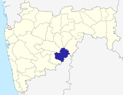 | |
| Cities and towns | ||
| Buildings and landmarks | ||
| Transport | ||
| Education | ||
| Lok Sabha constituencies | ||
| Vidhan Sabha constituencies | ||
| Personalities | ||
| Neighborhoods | ||
| Topics | |||||||||||||||||||||||
|---|---|---|---|---|---|---|---|---|---|---|---|---|---|---|---|---|---|---|---|---|---|---|---|
| Regions | |||||||||||||||||||||||
| Divisions and Districts |
| ||||||||||||||||||||||
| Million-plus cities in Maharashtra | |||||||||||||||||||||||
| Other cities with municipal corporations | |||||||||||||||||||||||
Portal: Maharashtra | |||||||||||||||||||||||