Latrobe Valley
| Latrobe Valley Victoria | |||||||||||||
|---|---|---|---|---|---|---|---|---|---|---|---|---|---|
 A view of part of the Latrobe Valley, from Tyers lookout, 2013. | |||||||||||||
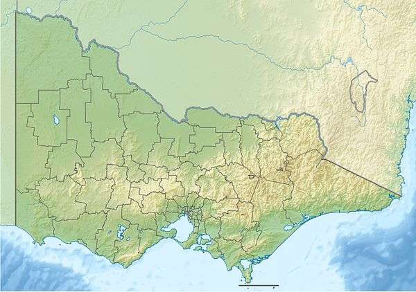
 Approximate Latrobe Valley area, comprising the Baw Baw Shire and City of Latrobe local government areas. | |||||||||||||
 Latrobe Valley | |||||||||||||
| Coordinates | 38°10′50″S 146°16′42″E / 38.18056°S 146.27833°ECoordinates: 38°10′50″S 146°16′42″E / 38.18056°S 146.27833°E | ||||||||||||
| Population | 125,000 | ||||||||||||
| LGA(s) | |||||||||||||
| Region | Gippsland | ||||||||||||
| |||||||||||||
| |||||||||||||
| Regions of Gippsland |
|---|
| East West South Central Latrobe Valley |
The Latrobe Valley is an inland geographical district and urban area of the Gippsland region in the state of Victoria, Australia. The district lies east of the Melbourne and nestled between the Strzelecki Ranges to the south and the Baw Baw Ranges, part of the Great Dividing Range, to the north. Mount Baw Baw (1,567 m (5,141 ft)) is the highest peak to the north of the Latrobe Valley, due north of Moe. The highest peak to the south is Mt Tassie (740 m (2,430 ft)), south of Traralgon.
The area has four major centres, from west to east, Warragul, Moe, Morwell and Traralgon, with minor centres including Churchill, Yinnar, Glengarry, and Tyers. The population of the Latrobe Valley is approximately 125,000.
The valley draws its name from the Latrobe River which flows eastward, through the valley. According to Les Blake, in 1841 William Adams Brodribb, an early settler,[1] named the river in honour of Charles La Trobe, Lieutenant Governor of the Port Phillip District.[2] A. W. Reed also attributes Brodribb to naming the river in honour of La Trobe; yet Reed claims that the river was discovered by Angus McMillan in 1840 who named the watercourse as Glengarry River.[3]
Geography
While the Latrobe River flows into Lake Wellington to the east of Sale and includes in its drainage basin a significant part of central Gippsland, the region conventionally known as the Latrobe Valley occupies an inland area between the Strzelecki Ranges and Baw Baw Ranges between Drouin and Rosedale - with four major urban areas Warragul, Moe, Morwell and Traralgon, between the Strzelecki Ranges to the south and the westernmost reaches of the Victorian Alps to the north.
Climate
It has a temperate climate meaning mild temperatures with large amounts of rain, the occasional frost and snow on neighbouring hills. February is the warmest month in the Latrobe Valley with an average temperature range of 12.5 to 26.4 °C (54.5 to 79.5 °F) and the coldest month is July with an average temperature range of 3.6 to 13.5 °C (38.5 to 56.3 °F). The most rain occurs in late winter and spring, and average yearly rainfall is approximately 800 millimetres (31 in).
Temperatures on Mount Baw Baw, to the north of Moe, generally peak around 10 to 12 °C (18 to 22 °F) cooler than the major urban areas during the day.
Demographics
There are three major population centres in the Latrobe Valley, all located within the City of Latrobe local government area:
- Moe – west Latrobe Valley
- Morwell – central Latrobe Valley
- Traralgon – eastern Latrobe Valley
The primary hospital is the Latrobe Regional Hospital located on the Princes Highway between Morwell and Traralgon.
Smaller towns are Tyers, Newborough, Yinnar, Yallourn North, Churchill (site of the local campus of Federation University) and Boolarra.
Economy
Key industry sectors include power generation, paper manufacture, timber mills, agriculture, dairy, timber, information technology, engineering and education. The valley provides 85% of Victoria’s electricity and has a substantial engineering sector supporting the power generation, pulp and paper production and food processing industries, etc. The tertiary education sector attracts local, interstate and international students.
Logging is also an important industry in the hills to the north and south, with a major paper mill located at Maryvale, near Morwell. In the rugged north of the region is located the historic gold-mining town of Walhalla, amid mountains forming the west of Alpine National Park and nearby Baw Baw National Park, which includes a small winter ski resort.
Industry


The Latrobe Valley is significant as the centre of Victoria's energy industry, specifically the mining and burning of brown coal to produce electricity. The area produces a total of approximately 85% of the electricity for the entire state of Victoria and supplies some electricity to New South Wales and Tasmania. The valley is home to four of the highest electricity producing thermal power stations in Australia. Power plants located in the Latrobe Valley include Hazelwood Power Station, Loy Yang Power Stations A & B, Yallourn Power Station, Jeeralang Power Station (Gas) and the Energy Brix Power Station.
Governance
Local government within the Latrobe Valley is administered by the Latrobe City Council and the Baw Baw Shire Council.
Latrobe City LGA has a population of approximately 75,000 with four major population centres: Moe, Morwell, Churchill and Traralgon, with smaller townships including Boolarra, Glengarry, Toongabbie, Tyers, Traralgon South, Yallourn North, and Yinnar, with the administrative headquarters located in Morwell.
Transport
The Princes Freeway runs through Latrobe Valley, bypassing most major rural cities and connecting the region to both Melbourne and East Gippsland. The centrally located centre of Moe is approximately 1 hour and 30 minutes drive from the central business district of Melbourne.
V/Line runs a rail service from metropolitan Melbourne to the Latrobe Valley and also runs services that go through the Latrobe Valley to East Gippsland. Some rail services run limited express to the Latrobe Valley – stopping in the major population centres of Warragul, Moe, Morwell and Traralgon. Other services – including the Gippslander rail service – stop at all stations in the area. Services to the Latrobe Valley run between Melbourne and Traralgon, whilst Gippsland services run between Melbourne and Bairnsdale. The Latrobe Valley/Gippsland rail line is connected to the metropolitan Melbourne Pakenham line.
Latrobe Valley Bus Lines are operated by Valley Transit, which runs connecting bus services in the Latrobe Valley area between Moe and Traralgon – consisting of inter-city services that run between Moe and Traralgon to nearby towns such as Morwell, Churchill and Yallourn North – and connecting town services that run in each major centre.
Latrobe Valley Airport (IATA: LTB, ICAO: YLTV) is located in the Latrobe Valley approximately two hours east of Melbourne, off Princes Highway, on the west side of Traralgon.
Education
The Gippsland campus of Federation University is home to 2,000 on-campus students, 5,000 off-campus students and nearly 400 staff. The campus sits in the Latrobe Valley town of Churchill, 142 kilometres (88 mi) east of Melbourne on 63 hectares (160 acres) of landscaped grounds. The campus offers many undergraduate degrees, and attracts many students from the Latrobe Valley, East and West Gippsland. The Gippsland Medical School, offering postgraduate entry Bachelor of Medicine / Bachelor of Surgery (MBBS) courses was officially opened by the Federal Minister for Health and Ageing, Nicola Roxon on 5 June 2008, providing students with a unique opportunity to learn medicine in a rural setting working with rural practitioners.
Sport
Australian Rules Football
The area has a rich and intricate Australian Football history. There are currently approximately thirty players on Australian Football League team lists from the Latrobe Valley and Gippsland. The region is represented in the Victoria State TAC Cup Under 18's competition by the Gippsland Power. Gippsland Power played its first season in the TAC Cup competition in 1993. The Power have won one premiership to date in 2005 – and been runner-up on two occasions in 1999 and 2010. Over sixty players have been drafted from Gippsland Power onto Australian Football League club lists since the first player was drafted in 1993. Gippsland Power has had three players win the TAC Cup Under 18's Morrish Medal – the award for the best and fairest player in the TAC Cup as voted by the umpires; Matthew Stolarczyk in 1999, Jarryd Blair in 2008 and Dyson Heppell in 2010.
Football leagues
The Gippsland League Football competition is the largest league in the region and one of the largest and highest standard football leagues in Victoria outside of Melbourne. Five of the ten teams in the Gippsland League are based in the Latrobe Valley. The most recent premiership won in the Gippsland League (or equivalent) by a team based in the Latrobe Valley was Traralgon Maroons in 2005. The Mid Gippsland Football League is the second largest football league in the area and comprises 10 teams – all of which are exclusively based in the Latrobe Valley. Nine of the ten teams in the Gippsland Soccer League are based in the Latrobe Valley (the other team is based in Sale).
Racing Industry

The Moe Racing Club schedules around fourteen race meetings a year. The racecourse is in Waterloo Road within a very short walk of the Moe central business district and V/Line train station. Raceday race calling can be heard in the central business district of Moe during race meetings. The two largest race meeting in Moe are the GPG Mobil Moe Cup meeting in mid October – which is one of the largest regional race meetings outside of Melbourne on the Victorian Racing calendar – and the Melbourne Cup Day meeting on the first Tuesday in November. The Moe Racing Club is the largest capacity racecourse in Gippsland. The club also offers members and guests other facilities, including Turfside Tabaret, the Turfside Bistro and the Turfside Function Centre.
Glenview Park in Traralgon hosts both horse and greyhound racing. Traralgon greyhounds race at the Glenview Park Racing Complex which is owned by the Latrobe City Council. It was specifically designed for the racing of horses and greyhounds. The inaugural greyhound race was held in 1973. Typical greyhound races at Glenview are run over a distance of 298, 513, 658 and 730 meters.
Other sports
There are a large number of golf courses in the Latrobe Valley area within an approximate 35 km radius of Moe. They include the Moe Golf Club, nestled next to Lake Narracan, Churchill & Monash Golf Club, which is located near Federation University Campus in Churchill, and Yallourn Golf Club at Newborough.
Media
Newspapers
The area is serviced by the Latrobe Valley Express, which is delivered free of charge to residences in the Latrobe Valley region twice per week on Monday & Thursday and has a current circulation of approximately 34,128 (CAB). There is also the Moe-Narracan News, the Morwell-Churchill Advertiser and the Traralgon Journal, which is distributed free of charge once per week on Tuesday and has a circulation of approximately 11,034 (CAB).
The now defunct Latrobe Valley Voice was a new paper to the region, having been established in March 2011. The Latrobe Valley Voice was delivered free of charge to over 30,000 residences in the Latrobe Valley region on Wednesdays. The paper collapsed on 7 May 2011 after its financial backers withdrew their support.
Radio
Warragul commercial radio stations Star FM and 3GG service this region along with all five ABC radio networks and several community and narrowcast stations including Gippsland FM.
TRFM and Gold1242 are commercial radio stations servicing the Latrobe Valley and East Gippsland.
Television
Commercial Melbourne based television networks such as the Seven, Nine and Ten networks are all re-broadcast in the Latrobe Valley by their regional affiliates, which are Prime7, WIN Television and Southern Cross Ten respectively. All three channels have local commercials placed on their broadcasts and WIN TV also broadcasts a local news bulletin from Monday to Friday at 6.30 pm.
New channels broadcast by the commercial networks in addition to the ones listed above are available on the digital service called Freeview (Australia) to viewers in Moe and the Gippsland \ Latrobe Valley region. These channels include One HD, Eleven, 7Two, 7mate, GEM and GO!.
Most Melbourne channels (Seven Network, Channel Nine, Channel Ten) can be received in analogue and more clearly in digital in Moe with a suitable roof-top antenna. Both national public broadcasters, Australian Broadcasting Corporation including channels ABC1, ABC2, ABC3, ABC News 24 and Special Broadcasting Service including SBS One and SBS Two, are broadcast to the Latrobe Valley from the TV tower at Mount Tassie, as well as from the Dandenong Ranges transmitters located east of Melbourne.
See also
References
- ↑ Finch, Janette; Teale, Ruth (1969). "Brodribb, William Adams (1809 - 1886)". Australian Dictionary of Biography. Canberra: Australian National University.
- ↑ Blake, Les (1977). Place names of Victoria. Adelaide: Rigby. p. 294. ISBN 0-727-00250-3.
- ↑ Reed, A. W. (1973). Place names of Australia. Frenchs Forest: Reed Books. p. 135. ISBN 0-589-50128-3.