Lasbela District
| Lasbela District | |
|---|---|
| District | |
|
Map of Balochistan with Lasbela District highlighted | |
| Coordinates: 20°13′38″N 66°18′22″E / 20.22722°N 66.30611°E | |
| Country | Pakistan |
| Province | Balochistan |
| Established | June 1954[1] |
| Headquarters | Uthal |
| Government | |
| • Deputy Commissioner | Syed Zulfiqar Shah Hashmi |
| • Commissioner | Muhammad Hashim Ghilzai |
| Area | |
| • Total | 12,574 km2 (4,855 sq mi) |
| Population (2015 Estimate) | |
| • Total | 512,917 |
| • Density | 29.02/km2 (75.2/sq mi) |
| Time zone | PST (UTC+5) |
| Number of Tehsils | 5 |
| Website | www.lasbeladistrictgovt.com |
Lasbela (Urdu and Balochi: لسبیلہ) is a coastal district of Balochistan province of Pakistan. It became a separate district in Kalat Division on 30 June 1954. Uthal is the district headquarters. The district is divided into Five Tehsil and 22 union councils.
Administration
The district of Lasbela is administratively divided in five tehsils and 22 Union Councils [2]
History

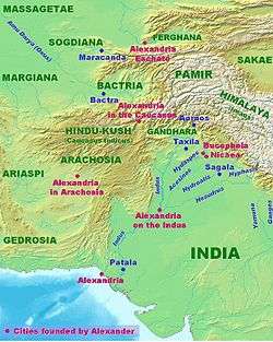
Alexander the Great passed through Lasbela on his way back to Babylon after conquering Northwestern India. In 711 CE, the Arab general, Muhammad bin Qasim passed through Lasbela on his way to Sindh.
The area now covered by the district was formerly the Las Bela state of the British Indian Empire, with internal autonomy from British India. From August 1947 to March 1948 it was fully independent under Ghulam Qadir Khan, then after he acceded to Pakistan it was one of the princely states of Pakistan. From 3 October 1952 to 14 October 1955, it state was a member of the Baluchistan States Union but retaining internal autonomy. That came to an end in 1955, when Las Bela was incorporated into the new West Pakistan province.
Geography
The main river is the Porali with its tributaries, Winder and Wirhab rivers.[3] Other rivers are the Phor and Hingol which rise in Awaran District before flowing through Lasbela on their way to the Arabian Sea.
Demographics
The majority of population speaks either Lasi dialect of Sindhi and very few of the population speak Balochi. The population of Lasbela was estimated to be over 124,0000 in 2014. In 1998, the overall population was 98.33% Muslim Lasi and Baloch .[4] Of the remaining, 1.37% were Hindus and 0.14% Christian.[4] In 1998, about 37% of the population resided in the urban areas.[4] In 1998, 22.3% of the population was literate with 32.16% of the males and 10.46% of the females.[4]
Education
The Lasbela University of Agriculture, Water and Marine Science is located in Uthal.
Economy
In the south east oil refinery has been constructed in 2014,oil refinery capable of processing 120,000 barrels of oil. Furthermore a power station is located adjacent to refinery, that produces about 1350 MW of power.[5] Several Cement plant is also located there.[6] Marble factory is also located.[7][8] Also one of the world largest ship breaking yard is located in Lesbella coast [9]
Sites of interest
Shrines
|
|
- Ghos-e-Zaman Sufi Sain Baba Abu Bakar Darwaish, Kuk Lakhra
Historical buildings and archaeological sites
At Bela:
- Shah Jamai Mosque
- Tomb of General Muhammad ibn Haroon
- Tomb of Colonel Robert Sandeman
- Karia Pir
- Sassi Waro-Chodo (Sassi's Spring), near Paboni Naka, about 68 km from Karachi.[10]
- Bakkar Buthi, a small Harappan site located in the remote mountainous area to the east of the Las Bela plain.[11]
- Shehr-e-Roghan
- (Tomb of Sirtaj Baba)Haji Murad Gotth Shahidi winder
References
- ↑ History of Lasbela - Las Bela District Government
- ↑
- ↑ 1998 Population Census Report of Lasbela, Population Census Organisation, Government of Pakistan, Islamabad, 1999, Pg 2
- 1 2 3 4 1998 Population Census Report of Lasbela, Population Census Organisation, Government of Pakistan, Islamabad, 1999, Pg 24
- ↑
- ↑
- ↑
- ↑
- ↑
- ↑ Archaeological sites and historical monuments - Lasbela Government
- ↑ Bakkar Buthi- Lasbela Government
Educational Inistitute
External links
| Wikimedia Commons has media related to Lasbela District. |
Coordinates: 25°45′N 66°35′E / 25.750°N 66.583°E
