Las Flecheras Airport
| Las Flecheras Airport San Fernando De Apure Airport | |||||||||||
|---|---|---|---|---|---|---|---|---|---|---|---|
| IATA: SFD – ICAO: SVSR | |||||||||||
| Summary | |||||||||||
| Airport type | Public | ||||||||||
| Serves | San Fernando de Apure | ||||||||||
| Elevation AMSL | 154 ft / 47 m | ||||||||||
| Coordinates | 7°53′00″N 67°26′40″W / 7.88333°N 67.44444°WCoordinates: 7°53′00″N 67°26′40″W / 7.88333°N 67.44444°W | ||||||||||
| Map | |||||||||||
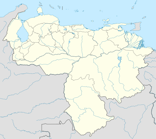
 SFD Location of the airport in Venezuela | |||||||||||
| Runways | |||||||||||
| |||||||||||
Las Flecheras Airport (Spanish: Aeropuerto Las Flecheras) (IATA: SFD, ICAO: SVSR) is an airport serving the city of San Fernando de Apure, the capital of the Apure state in Venezuela. The runway is just east of the city, along the Apure River.
The San Fernando non-directional beacon (Ident: SFD) and VOR-DME (Ident: SFD) are located on the field.[3][4][5]
Airlines and destinations
| Airlines | Destinations |
|---|---|
| Avior Airlines (Next Opening) | Caracas |
| Conviasa | Barinas |
See also
 Venezuela portal
 Aviation portal
- Transport in Venezuela
- List of airports in Venezuela
References
- ↑ Airport information for SFD at Great Circle Mapper.
- ↑ Google Maps - San Fernando
- ↑ SFD VOR
- ↑ SFD NDB
- ↑ SkyVector Aeronautical Charts
External links
- OpenStreetMaps - Las Flecheras
- OurAirports - San Fernando
- SkyVector - San Fernando
- Airport information for SVSR at World Aero Data. Data current as of October 2006.
- Accident history for SFD at Aviation Safety Network
This article is issued from Wikipedia - version of the 12/4/2016. The text is available under the Creative Commons Attribution/Share Alike but additional terms may apply for the media files.