Lanneplaà
| Lanneplaà | |
|---|---|
|
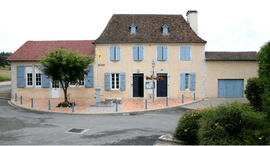
Town hall of Lanneplaà. | |
 Lanneplaà | |
|
Location within Nouvelle-Aquitaine region  Lanneplaà | |
| Coordinates: 43°27′45″N 0°49′11″W / 43.4625°N 0.8197°WCoordinates: 43°27′45″N 0°49′11″W / 43.4625°N 0.8197°W | |
| Country | France |
| Region | Nouvelle-Aquitaine |
| Department | Pyrénées-Atlantiques |
| Arrondissement | Pau |
| Canton | Orthez |
| Intercommunality | Communauté de communes du canton d'Orthez |
| Government | |
| • Mayor (2014-2020) | Aline Langlès |
| Area1 | 7.26 km2 (2.80 sq mi) |
| Population (2012)2 | 324 |
| • Density | 45/km2 (120/sq mi) |
| Time zone | CET (UTC+1) |
| • Summer (DST) | CEST (UTC+2) |
| INSEE/Postal code | 64312 / 64300 |
| Elevation |
70–207 m (230–679 ft) (avg. 90 m or 300 ft) |
|
1 French Land Register data, which excludes lakes, ponds, glaciers > 1 km² (0.386 sq mi or 247 acres) and river estuaries. 2 Population without double counting: residents of multiple communes (e.g., students and military personnel) only counted once. | |
Lanneplaà is a commune in the Pyrénées-Atlantiques department in south-western France.
The inhabitants of the commune are known as Lanneplanais or Lanneplanaises .[1]
Geography
Location
Lanneplaà is located some 5 km south-west of Orthez.
Access
Access to the commune is by road D23 from Orthez and by road D267. « Route de Sainte-Suzanne » is another access. The A64 autoroute passes in Orthez the nearest exit being Exit ![]() 8 some 9 km north-east of the commune. The commune is mostly farmland with scattered forests.[2]
8 some 9 km north-east of the commune. The commune is mostly farmland with scattered forests.[2]
Hydrography
The commune is crossed by a tributary of Laà, the stream of Moulins, and a tributaryof Saleys, the arriou of Mondran.
Places and hamlets
- Baraillot[3]
- Bédat[3]
- Bonnecase[3]
- Bosc[3]
- Bounobre[3]
- Bouzoum[3]
- Bracot[3]
- Cabes[3]
- Cambran[3]
- Camdeborde[3]
- Campagne[3]
- Cassiau[3]
- Cassou[3]
- Caubeigt[3]
- Cossié[3]
- Couyet[3]
- Daban[3]
- Goeytes[3]
- Gréchès[3]
- Hau[3]
- Hittos[3]
- Jannette[3]
- Labièle[3]
- Laborde[3]
- Labourdette[3]
- Lacabane[3]
- Lacoste[3]
- Lahourcade[3]
- Lalanne[3]
- Lasserre[3]
- Laubaret[3]
- Laya[3]
- Montardon[3]
- Moulin (le)[3]
- Payrot[3]
- Peyran[3]
- Peyroulou[3]
- Poey[3]
- Poundic[3]
- Pouquet[3]
- Pourére[3]
- Poursioubes[3]
- Sarrail[3]
- Sarrouille[3]
Neighbouring communes and villages[2]
- Salles-Mongiscard North at 4.21 km
- Orthez Northeast at 5.03 km
- L'Hôpital-d'Orion Southwest at 3.72 km
- Ozenx-Montestrucq South at 2.88 km
Distances are calculated as the crow flies compared to neighboring villages town halls
 |
Salles-Mongiscard | Orthez | | |
| |
||||
| ||||
| | ||||
| L'Hôpital-d'Orion, | Ozenx-Montestrucq |
Toponymy
| Name | Century / year | Source | Origin |
|---|---|---|---|
| Lanepla | 10th century[4] | cartulaire de Sorde[5] / Raymond | |
| Lane-Pla et Lanne-Pla' | 1172[6] | cartulaire de Sorde[5] / Raymond | |
| Laneplan | 1323[4] | cartulaire d'Orthez[7] / Raymond | |
| Llaneplaa | 1385[6] | ||
| Lanaplaa | 1536[4] | Raymond | Béarn[8] |
| Lanaplan | 1538[4] | Raymond | Béarn[8] |
| Lanneplâa | end 18th century[6] | carte de Cassini / Cassini | |
| Lanneplaa | 1793[9] | Cassini | |
| Lanneplau | 1801[9] | Bulletin des lois / Cassini | |
| Lanneplàa | 1863 | Topographical Dictionary Béarn-Pays basque[4] / Raymond | |
| Lanneplaà |
Lanneplaà as for origin the Gascon lana (resulting from the Gaulish language landa, "lande"(moor)) and plana ("plane"[6] ("flat")).
Lanneplaà thus indicates a plain of Meadow.
History
Paul Raymond noted that the municipality had a Lay Abbey, vassal of the Viscounts of Béarn.
On 1385 , Lanneplaà depended on the bailiwick of Larbaig and there were 39 fires.
Administration
| Mayor | Term start | Term end | Party |
|---|---|---|---|
| Jacques Laulhé | 1977 | 2001 | Independent politician |
| Jacques Laulhé | 2001 | 2008 | Independent politician |
| Jacques Laulhé | 2008 | 2014 | Independent politician |
| Aline Langlès | 2014 | 2020 | Independent politician |
See also
References
- ↑ (French)
- 1 2
- 1 2 3 4 5 6 7 8 9 10 11 12 13 14 15 16 17 18 19 20 21 22 23 24 25 26 27 28 29 30 31 32 33 34 35 36 37 38 39 40 41 42 43 44 Géoportail - IGN. "Géoportail". Retrieved May 13, 2014.
- 1 2 3 4 5 Paul Raymond, Topographical Dictionary Béarn-Pays basque
- 1 2 Cartulaire de l'abbaye Saint-Jean de Sorde, publié par extraits dans les preuves de l'Histoire de Béarn de Pierre de Marca
- 1 2 3 4 Michel Grosclaude, Edicions reclams & Édition Cairn - 2006, ed., Dictionnaire toponymique des communes, Béarn, p. 296, ISBN 2 35068 005 3
- ↑ Cartulaire d'Orthez, dit Martinet, manuscrit du XIVe au XVIIe siècle - Archives de la mairie d'Orthez
- 1 2 Manuscrit du XVIe au XVIIIe siècle - Archives départementales des Pyrénées-Atlantiques
- 1 2 "Lanneplaà". Des villages de Cassini aux communes d'aujourd'hui. Retrieved 28 April 2015. Archived on the site of l'École des hautes études en sciences sociales.
| Wikimedia Commons has media related to Lanneplaà. |