Langwedel
For Langwedel in Schleswig-Holstein, see Langwedel, Schleswig-Holstein.
| Langwedel | ||
|---|---|---|
| ||
 Langwedel | ||
Location of Langwedel within Verden district 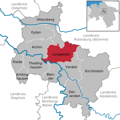
 | ||
| Coordinates: 52°58′N 9°13′E / 52.967°N 9.217°ECoordinates: 52°58′N 9°13′E / 52.967°N 9.217°E | ||
| Country | Germany | |
| State | Lower Saxony | |
| District | Verden | |
| Government | ||
| • Mayor | Andreas Brandt (SPD) | |
| Area | ||
| • Total | 76.11 km2 (29.39 sq mi) | |
| Population (2015-12-31)[1] | ||
| • Total | 14,414 | |
| • Density | 190/km2 (490/sq mi) | |
| Time zone | CET/CEST (UTC+1/+2) | |
| Postal codes | 27299 | |
| Dialling codes | 04232, 04235 | |
| Vehicle registration | VER | |
| Website | www.langwedel.de | |

Langwedel is a municipality in the district of Verden, in Lower Saxony, Germany. It is situated on the right bank of the Weser, approx. 7 km northwest of Verden, and 30 km southeast of Bremen.
Langwedel belonged to the Prince-Bishopric of Verden, established in 1180. In 1648 the Prince-Bishopric was transformed into the Principality of Verden, which was first ruled in personal union by the Swedish Crown - interrupted by a Danish occupation (1712–1715) - and from 1715 on by the Hanoverian Crown. The Kingdom of Hanover incorporated the Principality in a real union and the Princely territory, including Langwedel, became part of the new Stade Region, established in 1823.
Towns and municipalities in Verden (district) | ||
|---|---|---|
References
This article is issued from Wikipedia - version of the 6/21/2015. The text is available under the Creative Commons Attribution/Share Alike but additional terms may apply for the media files.