Lancaster, Kentucky
| Lancaster, Kentucky | |
|---|---|
| City | |
|
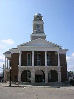
Garrard County courthouse in Lancaster | |
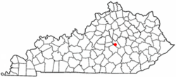 Location of Lancaster, Kentucky | |
| Coordinates: 37°37′7″N 84°34′46″W / 37.61861°N 84.57944°WCoordinates: 37°37′7″N 84°34′46″W / 37.61861°N 84.57944°W | |
| Country | United States |
| State | Kentucky |
| County | Garrard |
| Established | 1797 |
| Incorporated | 1837 |
| Named for | Lancaster, Pennsylvania |
| Area | |
| • Total | 1.8 sq mi (4.6 km2) |
| • Land | 1.8 sq mi (4.6 km2) |
| • Water | 0.0 sq mi (0.0 km2) |
| Elevation | 1,027 ft (313 m) |
| Population (2010) | |
| • Total | 3,442 |
| • Density | 1,912.3/sq mi (784.3/km2) |
| Time zone | Eastern (EST) (UTC-5) |
| • Summer (DST) | EDT (UTC-4) |
| ZIP codes | 40444, 40446 |
| Area code(s) | 859 |
| FIPS code | 21-43840 |
| GNIS feature ID | 0495946 |
Lancaster local /ˈlæŋkəstər/[1] is a home rule-class city[2] in Garrard County, Kentucky, in the United States. It is the seat of its county.[3] As of the year 2010 U.S. census, the city population was 3,442.
Located south of Lexington, Lancaster is the site of the Kennedy House, sometimes said to have been the setting for Uncle Tom's Cabin. The Civil War training base Camp Dick Robinson was located nearby. The Garrard County High School in town is the home of the "Golden Lions".
Geography
Lancaster is located at 37°37′7″N 84°34′46″W / 37.61861°N 84.57944°W (37.618625, -84.579433).[4] According to the United States Census Bureau, the city has a total area of 1.8 square miles (4.7 km2), all land.
History
In 1797, Capt. William Buford donated land for the establishment of a town around the site of Maj. Andrew Wallace's settlement at Wallace Crossroads. The surveying and platting was completed over the next year by Joseph Bledsoe Jr and the community was named Lancaster for the Pennsylvania town, either because one of its settlers came from there[5] or because the town was designed on a similar plan.[1] The post office was established in 1801 and operated under the name Lancaster Court House until 1811.[1] The city was formally incorporated by the state assembly in 1837.[6]
Demographics
| Historical population | |||
|---|---|---|---|
| Census | Pop. | %± | |
| 1800 | 103 | — | |
| 1810 | 260 | 152.4% | |
| 1830 | 570 | — | |
| 1840 | 480 | −15.8% | |
| 1860 | 721 | — | |
| 1870 | 741 | 2.8% | |
| 1880 | 1,234 | 66.5% | |
| 1900 | 1,640 | — | |
| 1910 | 1,507 | −8.1% | |
| 1920 | 2,166 | 43.7% | |
| 1930 | 1,630 | −24.7% | |
| 1940 | 1,999 | 22.6% | |
| 1950 | 2,402 | 20.2% | |
| 1960 | 3,021 | 25.8% | |
| 1970 | 3,230 | 6.9% | |
| 1980 | 3,365 | 4.2% | |
| 1990 | 3,421 | 1.7% | |
| 2000 | 3,734 | 9.1% | |
| 2010 | 3,442 | −7.8% | |
| Est. 2015 | 3,864 | [7] | 12.3% |
As of the census[9] of 2000, there were 3,734 people, 1,585 households, and 1,020 families residing in the city. The population density was 2,100.4 people per square mile (809.9/km²). There were 1,758 housing units at an average density of 988.9 per square mile (381.3/km²). The racial makeup of the city was 88.14% White, 9.61% African American, 0.08% Native American, 1.12% from other races, and 1.04% from two or more races. Hispanic or Latino of any race were 1.96% of the population.
There were 1,585 households out of which 29.1% had children under the age of 18 living with them, 45.2% were married couples living together, 15.6% had a female householder with no husband present, and 35.6% were non-families. 32.5% of all households were made up of individuals and 17.1% had someone living alone who was 65 years of age or older. The average household size was 2.29 and the average family size was 2.89.
In the city the population was spread out with 23.0% under the age of 18, 9.6% from 18 to 24, 26.5% from 25 to 44, 19.7% from 45 to 64, and 21.1% who were 65 years of age or older. The median age was 38 years. For every 100 females there were 83.5 males. For every 100 females age 18 and over, there were 76.6 males.
The median income for a household in the city was $26,175, and the median income for a family was $31,355. Males had a median income of $26,849 versus $21,108 for females. The per capita income for the city was $13,793. About 16.9% of families and 21.1% of the population were below the poverty line, including 27.0% of those under age 18 and 17.5% of those age 65 or over.
Notable people
- Simeon H. Anderson was a United States Representative from Kentucky.
- William J. Landram attorney and colonel of the 19th Kentucky Infantry; brevet brigadier general, March 13, 1865.
- Jonathan Shell is the current representative for House District 36 in the Kentucky House of Representatives.
- William Owsley was an American politician and jurist who became the sixteenth Governor of Kentucky.
- Lewis L. Walker was United States Congressman 1928 to 1930.[10]
Climate
The climate in this area is characterized by hot, humid summers and generally mild to cool winters. According to the Köppen Climate Classification system, Lancaster has a humid subtropical climate, abbreviated "Cfa" on climate maps.[11]
References
- 1 2 3 Rennick, Robert. Kentucky Place Names, p. 165. University Press of Kentucky (Lexington), 1987. Accessed 6 Aug 2013.
- ↑ "Summary and Reference Guide to House Bill 331 City Classification Reform" (PDF). Kentucky League of Cities. Retrieved December 30, 2014.
- ↑ "Find a County". National Association of Counties. Retrieved 2011-06-07.
- ↑ "US Gazetteer files: 2010, 2000, and 1990". United States Census Bureau. 2011-02-12. Retrieved 2011-04-23.
- ↑ Hogan, Roseann Reinemuth (1992). Kentucky Ancestry: A Guide to Genealogical and Historical Research. Ancestry Publishing. p. 237. Retrieved 26 July 2013.
- ↑ Commonwealth of Kentucky. Office of the Secretary of State. Land Office. "Hanson, Kentucky". Accessed 1 Aug 2013.
- ↑ "Annual Estimates of the Resident Population for Incorporated Places: April 1, 2010 to July 1, 2015". Retrieved July 2, 2016.
- ↑ "Census of Population and Housing". Census.gov. Retrieved June 4, 2015.
- ↑ "American FactFinder". United States Census Bureau. Retrieved 2008-01-31.
- ↑ personal knowledge
- ↑ Climate Summary for Lancaster, Kentucky
Municipalities and communities of Garrard County, Kentucky, United States | ||
|---|---|---|
| City | 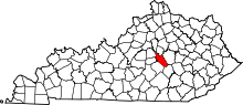 | |
| Unincorporated communities | ||