Lamoille Canyon Road
| |
|---|---|
|
Forest Route 660 Lamoille Canyon Scenic Byway | |
| Route information | |
| Maintained by USFS | |
| Length: | 12.1 mi[1] (19.5 km) |
| Major junctions | |
| North end: |
|
| South end: | Ruby Crest National Recreation Trail in Lamoille Canyon |
| Highway system | |
|
Forest Highways National Forest Scenic Byways | |

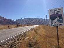
Lamoille Canyon Road, also known as Lamoille Canyon Scenic Byway, is a 12-mile-long (19 km)[2] National Forest Scenic Byway in Elko County, Nevada in the western United States. The road traverses Lamoille Canyon in the Ruby Mountains of northeastern Nevada, and it is administered by the Ruby Mountains Ranger District of the Humboldt-Toiyabe National Forest.[3]
Route description

Lamoille Canyon Road is officially designated National Forest Road 660 (NF 660). It starts near the eastern terminus of State Route 227 (SR 227) just west of the small town of Lamoille and proceeds south toward the entrance of Lamoille Canyon. From the entrance, the road winds southeast and then south up the canyon, rising from a base elevation of around 6,000 feet (1,800 m) to about 8,800 feet (2,700 m), where the road ends at a large parking area with multiple trailheads. Throughout its length, the road is undivided and two-lanes wide (one each way) with a speed limit of 35 mph (56 km/h).The road is not plowed in the winter, when it is used for winter recreation such as cross-country skiing and snowmobiling. Motor vehicle access to the upper end of the road is generally limited to the months of June through October, though this is partly dependent on snowfall. In contrast, the section of the road below 7,000 feet (2,100 m) is usually motor-vehicle accessible for most of the year.
Points of interest
Powerhouse Picnic Area, Camp Lamoille, Thomas Canyon Campground, Changing Canyon Nature Trail, Terraces Picnic Area and Roads End Trailhead are all located along Lamoille Canyon Road. The Roads End Trailhead is the northern terminus of the Ruby Crest National Recreation Trail.
History
Lamoille Canyon Road was constructed by the Civilian Conservation Corps in the 1930s and 1940s.[2]
References
- ↑ Google (November 10, 2014). "NF-660" (Map). Google Maps. Google. Retrieved November 10, 2014.
- 1 2 "Scenic Drives Nevada: Lamoille Canyon Road". The Weather Channel. Retrieved October 8, 2013.
- ↑ "Humboldt-Toiyabe National Forest: Lamoille Canyon Scenic Byway". U.S. Forest Service. Retrieved October 8, 2013.
External links
 Media related to Lamoille Canyon Road at Wikimedia Commons