Lakin, Kansas
| Lakin, Kansas | |
|---|---|
| City | |
|
Downtown Lakin (2010) | |
 Location within Kearny County (left) and Kansas (right) | |
 KDOT map of Kearny County (legend) | |
| Coordinates: 37°56′25″N 101°15′31″W / 37.94028°N 101.25861°WCoordinates: 37°56′25″N 101°15′31″W / 37.94028°N 101.25861°W | |
| Country | United States |
| State | Kansas |
| County | Kearny |
| Area[1] | |
| • Total | 0.98 sq mi (2.54 km2) |
| • Land | 0.98 sq mi (2.54 km2) |
| • Water | 0 sq mi (0 km2) |
| Elevation | 3,002 ft (915 m) |
| Population (2010)[2] | |
| • Total | 2,216 |
| • Estimate (2015)[3] | 2,202 |
| • Density | 2,300/sq mi (870/km2) |
| Time zone | Central (CST) (UTC-6) |
| • Summer (DST) | CDT (UTC-5) |
| ZIP code | 67860 |
| Area code(s) | 620 |
| FIPS code | 20-38175 [4] |
| GNIS feature ID | 0471593 [5] |
| Website | LakinKansas.org |

Lakin is a city in and the county seat of Kearny County, Kansas, United States.[6] As of the 2010 census, the city population was 2,216.[7]
History
Lakin was founded in 1874.[8] It was named for David Long Lakin, former treasurer of the Atchison, Topeka and Santa Fe Railway.[9][10]
A post office has been in operation in Lakin since March 1874.[11] Lakin was designated county seat in 1888.[12]
Geography
According to the United States Census Bureau, the city has a total area of 0.98 square miles (2.54 km2), all of it land.[1]
Demographics
| Historical population | |||
|---|---|---|---|
| Census | Pop. | %± | |
| 1890 | 258 | — | |
| 1900 | 259 | 0.4% | |
| 1910 | 337 | 30.1% | |
| 1920 | 556 | 65.0% | |
| 1930 | 739 | 32.9% | |
| 1940 | 709 | −4.1% | |
| 1950 | 1,618 | 128.2% | |
| 1960 | 1,432 | −11.5% | |
| 1970 | 1,570 | 9.6% | |
| 1980 | 1,823 | 16.1% | |
| 1990 | 2,060 | 13.0% | |
| 2000 | 2,316 | 12.4% | |
| 2010 | 2,216 | −4.3% | |
| Est. 2015 | 2,202 | [3] | −0.6% |
| U.S. Decennial Census | |||

2010 census
As of the census[2] of 2010, there were 2,216 people, 781 households, and 573 families residing in the city. The population density was 2,261.2 inhabitants per square mile (873.1/km2). There were 851 housing units at an average density of 868.4 per square mile (335.3/km2). The racial makeup of the city was 87.7% White, 0.3% African American, 0.9% Native American, 8.7% from other races, and 2.4% from two or more races. Hispanic or Latino of any race were 28.9% of the population.
There were 781 households of which 43.0% had children under the age of 18 living with them, 54.9% were married couples living together, 11.8% had a female householder with no husband present, 6.7% had a male householder with no wife present, and 26.6% were non-families. 24.2% of all households were made up of individuals and 11.2% had someone living alone who was 65 years of age or older. The average household size was 2.73 and the average family size was 3.23.
The median age in the city was 34.5 years. 30.1% of residents were under the age of 18; 8.8% were between the ages of 18 and 24; 23.1% were from 25 to 44; 23.6% were from 45 to 64; and 14.5% were 65 years of age or older. The gender makeup of the city was 50.6% male and 49.4% female.
2000 census
As of the census[4] of 2000, there were 2,316 people, 823 households, and 604 families residing in the city. The population density was 2,480.0 people per square mile (961.5/km²). There were 883 housing units at an average density of 945.5 per square mile (366.6/km²). The racial makeup of the city was 81.56% White, 0.82% African American, 1.34% Native American, 0.35% Asian, 14.16% from other races, and 1.77% from two or more races. Hispanic or Latino of any race were 24.96% of the population.
There were 823 households out of which 42.3% had children under the age of 18 living with them, 59.2% were married couples living together, 10.1% had a female householder with no husband present, and 26.5% were non-families. 24.1% of all households were made up of individuals and 10.6% had someone living alone who was 65 years of age or older. The average household size was 2.80 and the average family size was 3.32.
In the city the population was spread out with 34.2% under the age of 18, 8.9% from 18 to 24, 28.1% from 25 to 44, 18.3% from 45 to 64, and 10.6% who were 65 years of age or older. The median age was 32 years. For every 100 females there were 101.9 males. For every 100 females age 18 and over, there were 93.5 males.
The median income for a household in the city was $38,875, and the median income for a family was $44,688. Males had a median income of $31,086 versus $20,433 for females. The per capita income for the city was $15,531. About 6.9% of families and 10.4% of the population were below the poverty line, including 15.3% of those under age 18 and 6.1% of those age 65 or over.
Climate
| Climate data for Lakin, Kansas (1981–2010) | |||||||||||||
|---|---|---|---|---|---|---|---|---|---|---|---|---|---|
| Month | Jan | Feb | Mar | Apr | May | Jun | Jul | Aug | Sep | Oct | Nov | Dec | Year |
| Average high °F (°C) | 45.2 (7.3) |
49.0 (9.4) |
58.1 (14.5) |
68.0 (20) |
77.5 (25.3) |
87.7 (30.9) |
93.5 (34.2) |
91.3 (32.9) |
83.1 (28.4) |
70.6 (21.4) |
56.8 (13.8) |
45.6 (7.6) |
68.9 (20.5) |
| Average low °F (°C) | 18.1 (−7.7) |
21.3 (−5.9) |
29.0 (−1.7) |
38.2 (3.4) |
49.4 (9.7) |
59.1 (15.1) |
64.4 (18) |
63.1 (17.3) |
53.9 (12.2) |
41.1 (5.1) |
28.0 (−2.2) |
19.0 (−7.2) |
40.4 (4.7) |
| Average precipitation inches (mm) | 0.34 (8.6) |
0.46 (11.7) |
0.98 (24.9) |
1.55 (39.4) |
2.54 (64.5) |
3.19 (81) |
2.88 (73.2) |
2.65 (67.3) |
1.54 (39.1) |
1.42 (36.1) |
0.59 (15) |
0.60 (15.2) |
18.74 (476) |
| Average snowfall inches (cm) | 5.1 (13) |
3.8 (9.7) |
3.9 (9.9) |
1.1 (2.8) |
0.0 (0) |
0.0 (0) |
0.0 (0) |
0.0 (0) |
0.0 (0) |
0.4 (1) |
0.7 (1.8) |
3.5 (8.9) |
18.4 (46.7) |
| Source: NOAA[13] | |||||||||||||
Gallery
 Lakin welcome sign
 O'Loughlin Windmill in Lakin
 Kansas Highway 25 runs though Lakin
Notable people
- Aron Dees - American country music singer
- Frank Luther - American country music singer
See also
References
- 1 2 "US Gazetteer files 2010". United States Census Bureau. Retrieved 2012-07-06.
- 1 2 "American FactFinder". United States Census Bureau. Retrieved 2012-07-06.
- 1 2 "Annual Estimates of the Resident Population for Incorporated Places: April 1, 2010 to July 1, 2015". Retrieved July 2, 2016.
- 1 2 "American FactFinder". United States Census Bureau. Retrieved 2008-01-31.
- ↑ "US Board on Geographic Names". United States Geological Survey. 2007-10-25. Retrieved 2008-01-31.
- ↑ "Find a County". National Association of Counties. Retrieved 2011-06-07.
- ↑ "2010 City Population and Housing Occupancy Status". U.S. Census Bureau. Retrieved March 27, 2011.
- ↑ Kansas State Historical Society (1916). Biennial Report of the Board of Directors of the Kansas State Historical Society. Kansas State Printing Plant. p. 215.
- ↑ Atchison, Topeka, and Santa Fe Railway : Annual Meetings, and Directors and Officers : Volumes 7; AT&SF Railway; 1902. (12MB PDF)
- ↑ Gannett, Henry (1905). The Origin of Certain Place Names in the United States. Government Printing Office. p. 179.
- ↑ "Kansas Post Offices, 1828-1961 (archived)". Kansas Historical Society. Archived from the original on October 9, 2013. Retrieved 11 June 2014.
- ↑ Blackmar, Frank Wilson (1912). Kansas: A Cyclopedia of State History, Volume 2. Standard Publishing Company. p. 93.
- ↑ "NOWData - NOAA Online Weather Data". National Oceanic and Atmospheric Administration. Retrieved May 6, 2013.
Further reading
- The Story of the Marking of the Santa Fe Trail by the Daughters of the American Revolution in Kansas and the State of Kansas; Almira Cordry; Crane Co; 164 pages; 1915.
- History of the State of Kansas; William G. Cutler; A.T. Andreas Publisher; 1883. (Online HTML eBook)
- Kansas : A Cyclopedia of State History, Embracing Events, Institutions, Industries, Counties, Cities, Towns, Prominent Persons, Etc; 3 Volumes; Frank W. Blackmar; Standard Publishing Co; 944 / 955 / 824 pages; 1912. (Volume1 - Download 54MB PDF eBook),(Volume2 - Download 53MB PDF eBook), (Volume3 - Download 33MB PDF eBook)
External links
| Wikimedia Commons has media related to Lakin, Kansas. |
- City
- Schools
- USD 215, local school district
- Maps
- Lakin City Map, KDOT
Municipalities and communities of Kearny County, Kansas, United States | ||
|---|---|---|
| Cities | 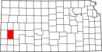 | |
| Townships | ||