Lakewood Airport
| Lakewood Airport | |||||||||||
|---|---|---|---|---|---|---|---|---|---|---|---|
| IATA: none – ICAO: none – FAA LID: N12 | |||||||||||
| Summary | |||||||||||
| Airport type | Public | ||||||||||
| Owner | Lakewood Township | ||||||||||
| Serves | Lakewood, New Jersey | ||||||||||
| Location | Ocean County, New Jersey | ||||||||||
| Elevation AMSL | 43 ft / 13 m | ||||||||||
| Coordinates | 40°04′00″N 074°10′40″W / 40.06667°N 74.17778°WCoordinates: 40°04′00″N 074°10′40″W / 40.06667°N 74.17778°W | ||||||||||
| Map | |||||||||||
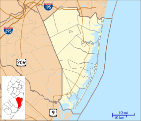 N12 Location in Ocean County, New Jersey | |||||||||||
| Runways | |||||||||||
| |||||||||||
| Statistics (2011) | |||||||||||
| |||||||||||
Lakewood Airport (FAA LID: N12) is a public use airport located three nautical miles (6 km) southeast of the central business district of Lakewood, in Ocean County, New Jersey, United States. The airport is owned by Lakewood Township.[1] It is included in the National Plan of Integrated Airport Systems for 2011–2015, which categorized it as a general aviation facility.[2]
The airport is home to the Pineland Composite Squadron of the Civil Air Patrol, unit number NER-NJ-096.
Facilities and aircraft
Lakewood Airport covers an area of 192 acres (78 ha) at an elevation of 43 feet (13 m) above mean sea level. It has one runway designated 6/24 with an asphalt surface measuring 2,912 by 60 feet (888 x 18 m).[1]
For the 12-month period ending December 31, 2011, the airport had 16,040 general aviation aircraft operations, an average of 43 per day. At that time there were 47 aircraft based at this airport: 94% single-engine and 6% multi-engine.[1]
See also
References
- 1 2 3 4 FAA Airport Master Record for N12 (Form 5010 PDF). Federal Aviation Administration. Effective November 15, 2012.
- ↑ "2011–2015 NPIAS Report, Appendix A" (PDF, 2.03 MB). National Plan of Integrated Airport Systems. Federal Aviation Administration. October 4, 2010. External link in
|work=(help)
External links
- Airport page at Lakewood Township website
- Lakewood Airport (N12) from New Jersey DOT Airport Directory
- Aerial image as of March 1995 from USGS The National Map
- FAA Terminal Procedures for N12, effective November 10, 2016
- Resources for this airport:
- FAA airport information for N12
- AirNav airport information for N12
- FlightAware airport information and live flight tracker
- SkyVector aeronautical chart for N12