Lakeland Highlands, Florida
| Lakeland Highlands, Florida | |
|---|---|
| CDP | |
 Location in Polk County and the state of Florida | |
| Coordinates: 27°57′48″N 81°56′58″W / 27.96333°N 81.94944°WCoordinates: 27°57′48″N 81°56′58″W / 27.96333°N 81.94944°W | |
| Country | United States |
| State | Florida |
| County | Polk |
| Area | |
| • Total | 6.2 sq mi (16 km2) |
| • Land | 5.6 sq mi (14.5 km2) |
| • Water | 0.6 sq mi (1.5 km2) |
| Elevation | 223 ft (68 m) |
| Population (2000) | |
| • Total | 12,557 |
| • Density | 2,025.3/sq mi (784.8/km2) |
| Time zone | Eastern (EST) (UTC-5) |
| • Summer (DST) | EDT (UTC-4) |
| FIPS code | 12-38262[1] |
| GNIS feature ID | 1867161[2] |
Lakeland Highlands is a census-designated place (CDP) in Polk County, Florida, United States. The population was 12,557 at the 2000 census. It is part of the Lakeland–Winter Haven Metropolitan Statistical Area.
Lakeland Highlands is an affluent area south of Lakeland city limits. Its schools include, George W. Jenkins Senior High School (named after the founder of Publix Supermarkets, based in Lakeland), Lakeland Highlands Middle School and Valleyview Elementary. This area is experiencing high growth with new subdivisions being developed every year.
Geography
Lakeland Highlands is located at 27°57′48″N 81°56′58″W / 27.96333°N 81.94944°W (27.963351, -81.949439).[3]
According to the United States Census Bureau, the CDP has a total area of 6.2 square miles (16 km2), of which 5.6 square miles (15 km2) is land and 0.6 square miles (1.6 km2) (9.25%) is water.
Demographics
| Historical population | |||
|---|---|---|---|
| Census | Pop. | %± | |
| 1980 | 10,426 | — | |
| 1990 | 9,972 | −4.4% | |
| 2000 | 12,557 | 25.9% | |
| source:[4] | |||
As of the census[1] of 2000, there were 12,557 people, 4,501 households, and 3,740 families residing in the CDP. The population density was 2,248.8 people per square mile (868.9/km²). There were 4,748 housing units at an average density of 850.3/sq mi (328.5/km²). The racial makeup of the CDP was 94.21% White, 2.47% African American, 0.20% Native American, 1.66% Asian, 0.02% Pacific Islander, 0.48% from other races, and 0.97% from two or more races. Hispanic or Latino of any race were 3.85% of the population.
There were 4,501 households out of which 39.4% had children under the age of 18 living with them, 74.0% were married couples living together, 6.8% had a female householder with no husband present, and 16.9% were non-families. 14.2% of all households were made up of individuals and 6.2% had someone living alone who was 65 years of age or older. The average household size was 2.79 and the average family size was 3.08.
In the CDP the population was spread out with 27.3% under the age of 18, 5.8% from 18 to 24, 24.7% from 25 to 44, 29.2% from 45 to 64, and 13.1% who were 65 years of age or older. The median age was 41 years. For every 100 females there were 94.7 males. For every 100 females age 18 and over, there were 93.0 males.
The median income for a household in the CDP was $66,053, and the median income for a family was $71,176. Males had a median income of $50,714 versus $30,018 for females. The per capita income for the CDP was $31,122. About 2.1% of families and 3.3% of the population were below the poverty line, including 3.0% of those under age 18 and 3.7% of those age 65 or over.
References
- 1 2 "American FactFinder". United States Census Bureau. Retrieved 2008-01-31.
- ↑ "US Board on Geographic Names". United States Geological Survey. 2007-10-25. Retrieved 2008-01-31.
- ↑ "US Gazetteer files: 2010, 2000, and 1990". United States Census Bureau. 2011-02-12. Retrieved 2011-04-23.
- ↑ "CENSUS OF POPULATION AND HOUSING (1790-2000)". U.S. Census Bureau. Retrieved 2010-07-17.
External links
Municipalities and communities of Polk County, Florida, United States | ||
|---|---|---|
| Cities | 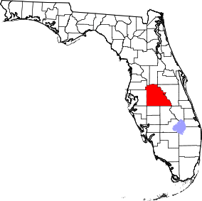 | |
| Towns | ||
| Village | ||
| CDPs | ||
| Unincorporated communities | ||
| Ghost town | ||
| Footnotes | ‡This populated place also has portions in an adjacent county or counties | |