Lakeland, Georgia
| Lakeland, Georgia | |
|---|---|
| City | |
|
Lakeland City Hall and Lakeland Police Department | |
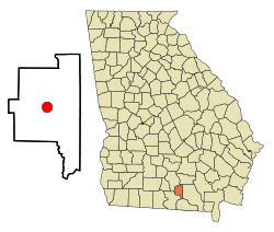 Location in Lanier County and the state of Georgia | |
| Coordinates: 31°2′21″N 83°4′13″W / 31.03917°N 83.07028°WCoordinates: 31°2′21″N 83°4′13″W / 31.03917°N 83.07028°W | |
| Country | United States |
| State | Georgia |
| County | Lanier |
| Area | |
| • Total | 3.1 sq mi (8.1 km2) |
| • Land | 3.1 sq mi (8 km2) |
| • Water | 0 sq mi (0.1 km2) |
| Elevation | 200 ft (61 m) |
| Population (2000) | |
| • Total | 2,730 |
| • Density | 880.6/sq mi (337/km2) |
| Time zone | Eastern (EST) (UTC-5) |
| • Summer (DST) | EDT (UTC-4) |
| ZIP code | 31635 |
| Area code(s) | 229 |
| FIPS code | 13-44592[1] |
| GNIS feature ID | 0356347[2] |

Lakeland is a city in Lanier County, Georgia, United States. The city is the county seat of Lanier County.[3] It is part of the Valdosta, Georgia Metropolitan Statistical Area. The population was 2,730 at the 2000 census.
Originally called Alapaha and then Milltown or Mill Town, Lakeland received its current name in 1925 in honor of its proximity to Grand Bay Lake, Lake Erma, and Banks Lake.[4] For many years, Lakeland owned and operated its own railroad.
Numerous festivals are held in the county throughout each year. One, is the Flatlanders Frolic Arts and Crafts Show. This event features bluegrass music, a road race and various other Labor Day weekend events. Also held in Lanier County is the Living Murals Celebration held in the Spring and most recently the Georgia Deep Woods Deerfest, a festival featuring wild game suppers and firearms giveaways.
History
By the early 1840s, a community known as Alapaha had come into existence along the road from Waresboro, Georgia to Troupville, Georgia. By the late 1850s, Alapaha had become known as Milltown. Lakeland, originally known as Milltown. Milltown was incorporated in 1901. In 1919, Milltown was designated seat of the newly formed Lanier County. In 1928, the city was incorporated and renamed to its present form of Lakeland.[5]
Geography
Lakeland is located at 31°2′21″N 83°4′13″W / 31.03917°N 83.07028°W (31.039214, -83.070397).[6]
According to the United States Census Bureau, the city has a total area of 3.1 square miles (8.0 km2), of which, 3.1 square miles (8.0 km2) of it is land and 0.04 square miles (0.10 km2) of it (1.28%) is water.
Demographics
| Historical population | |||
|---|---|---|---|
| Census | Pop. | %± | |
| 1910 | 1,247 | — | |
| 1920 | 860 | −31.0% | |
| 1930 | 1,006 | 17.0% | |
| 1940 | 1,502 | 49.3% | |
| 1950 | 1,551 | 3.3% | |
| 1960 | 2,236 | 44.2% | |
| 1970 | 2,569 | 14.9% | |
| 1980 | 2,647 | 3.0% | |
| 1990 | 2,467 | −6.8% | |
| 2000 | 2,730 | 10.7% | |
| 2010 | 3,366 | 23.3% | |
| Est. 2015 | 3,322 | [7] | −1.3% |
As of the census[1] of 2000, there were 2,730 people, 966 households, and 661 families residing in the city. The population density was 881.0 people per square mile (340.0/km²). There were 1,162 housing units at an average density of 375.0 per square mile (144.7/km²). The racial makeup of the city was 67.18% White, 29.27% African American, 0.66% Native American, 0.48% Asian, 0.77% from other races, and 1.65% from two or more races. Hispanic or Latino of any race were 2.86% of the population.
There were 966 households out of which 34.3% had children under the age of 18 living with them, 42.7% were married couples living together, 20.5% had a female householder with no husband present, and 31.5% were non-families. 29.0% of all households were made up of individuals and 14.1% had someone living alone who was 65 years of age or older. The average household size was 2.54 and the average family size was 3.10.
In the city the population was spread out with 26.6% under the age of 18, 11.8% from 18 to 24, 28.9% from 25 to 44, 19.1% from 45 to 64, and 13.6% who were 65 years of age or older. The median age was 34 years. For every 100 females there were 102.5 males. For every 100 females age 18 and over, there were 103.9 males.
The median income for a household in the city was $22,346, and the median income for a family was $28,487. Males had a median income of $23,457 versus $19,276 for females. The per capita income for the city was $13,156. About 25.3% of families and 28.8% of the population were below the poverty line, including 38.9% of those under age 18 and 33.3% of those age 65 or over.
Education
Lanier County School District
The Lanier County School District holds grades pre-school to grade twelve, and consists of one elementary school, a middle school, and a high school.[9] The district has 94 full-time teachers and over 1,345 students.[10]
- Lanier County Primary School
- Lanier County Elementary School
- Lanier County Middle School
- Lanier County High School
References
| Wikimedia Commons has media related to Lakeland, Georgia. |
- 1 2 "American FactFinder". United States Census Bureau. Retrieved 2008-01-31.
- ↑ "US Board on Geographic Names". United States Geological Survey. 2007-10-25. Retrieved 2008-01-31.
- ↑ "Find a County". National Association of Counties. Retrieved 2011-06-07.
- ↑ Poling, Dean. "LAKELAND: The past makes a new present » May 2007". Valdosta Scene. Retrieved 2013-03-27.
- ↑ Hellmann, Paul T. (May 13, 2013). Historical Gazetteer of the United States. Routledge. p. 235. Retrieved 30 November 2013.
- ↑ "US Gazetteer files: 2010, 2000, and 1990". United States Census Bureau. 2011-02-12. Retrieved 2011-04-23.
- ↑ "Annual Estimates of the Resident Population for Incorporated Places: April 1, 2010 to July 1, 2015". Retrieved July 2, 2016.
- ↑ "Census of Population and Housing". Census.gov. Retrieved June 4, 2015.
- ↑ Georgia Board of Education, Retrieved June 22, 2010.
- ↑ School Stats, Retrieved June 22, 2010.
Municipalities and communities of Lanier County, Georgia, United States | ||
|---|---|---|
| City |  | |
| Unincorporated community | ||