Lake Ohau
| Lake Ohau | |
|---|---|
 | |
| Location | Mackenzie Basin, Waitaki District, Canterbury region, South Island |
| Coordinates | 44°15′S 169°51′E / 44.250°S 169.850°ECoordinates: 44°15′S 169°51′E / 44.250°S 169.850°E |
| Type | glacial lake |
| Primary inflows | Hopkins, Dobson |
| Primary outflows | Ohau |
| Catchment area | 1,198 km² [1] |
| Basin countries | New Zealand |
| Surface area | 54 km² [1] |
| Average depth | 74 m [1] |
| Max. depth | 129 m [1] |
| Water volume | 4.02 km³ [1] |
| Surface elevation | 520 m |
| References | [1] |

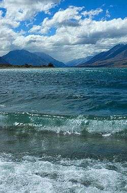
Lake Ohau[2] is a glacial lake in the Mackenzie Basin of New Zealand's South Island. It is fed by the Hopkins and Dobson rivers, which have their headwaters in the Southern Alps, and has its outflow in the Ohau River, which itself feeds into the Waitaki River hydroelectric project.
Ohau is the smallest of three roughly parallel lakes running north-south along the northern edge of the Mackenzie Basin (the others are Lake Pukaki and Lake Tekapo). It covers 60 km².
The Ohau ski field is located close to the southwestern shore of the lake.
The lake forms part of the traditional boundary between Otago and Canterbury regions, Otago's northernmost point being the headwaters of the Hopkins River. Officially the lake lies in the northwestern part of the Waitaki District within the southern part of the Canterbury region.[3]
Lake Ohau will be on the route of the Alps to Ocean Cycle Trail, to be constructed in the following years after approval in 2010.
References
- 1 2 3 4 5 6 Irwin, J. (September 1978), "Bottom sediments of Lake Tekapo compared with adjacent Lakes Pukaki and Ohau, South Island, New Zealand" (PDF), N.Z. Journal of Marine and Freshwater Research, 12 (3), pp. 245–250, doi:10.1080/00288330.1978.9515749, retrieved 2007-11-09
- ↑ "Place Name Detail: Lake Ohau". New Zealand Geographic Placenames Database. Land Information New Zealand. Retrieved 1 July 2008.
- ↑ Waitaki District Council ward area, Waitaki District Council website, retrieved 1 July 2008.
External links
-
 Media related to Lake Ohau at Wikimedia Commons
 - Ski Ohau
- Pictures of Ohau