Lake Nebagamon, Wisconsin
| Lake Nebagamon, Wisconsin | |
|---|---|
| Village | |
|
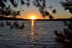
Sunset in Lake Nebagamon | |
 Location of Lake Nebagamon, Wisconsin | |
| Coordinates: 46°30′46″N 91°42′1″W / 46.51278°N 91.70028°WCoordinates: 46°30′46″N 91°42′1″W / 46.51278°N 91.70028°W | |
| Country | United States |
| State | Wisconsin |
| County | Douglas |
| Area[1] | |
| • Total | 14.34 sq mi (37.14 km2) |
| • Land | 12.60 sq mi (32.63 km2) |
| • Water | 1.74 sq mi (4.51 km2) |
| Elevation[2] | 1,152 ft (351 m) |
| Population (2010)[3] | |
| • Total | 1,069 |
| • Estimate (2012[4]) | 1,062 |
| • Density | 84.8/sq mi (32.7/km2) |
| Time zone | Central (CST) (UTC-6) |
| • Summer (DST) | CDT (UTC-5) |
| Area code(s) | 715 and 534 |
| FIPS code | 55-41725[5] |
| GNIS feature ID | 1567743[2] |
Lake Nebagamon is a village in Douglas County, Wisconsin, United States. The population was 1,069 at the 2010 census.
Transportation
U.S. Highway 2, U.S. Highway 53, and Wisconsin Highway 27 are located in the Lake Nebagamon area. County Road F, County Road P, and County Road B are three of the main routes in the community.
History
The name Nebagamon is derived from the Chippewa Indian phrase "Nee-bay-go-moh-win", translated as "place to hunt deer by fire on the water."
Geography
Lake Nebagamon is located at 46°30′46″N 91°42′1″W / 46.51278°N 91.70028°W (46.512894, -91.700351).[6] According to the United States Census Bureau, the village has a total area of 14.34 square miles (37.14 km2), of which, 12.60 square miles (32.63 km2) of it is land and 1.74 square miles (4.51 km2) is water.[1]
Lake Nebagamon is located 26 miles east of the city of Superior.
Demographics
| Historical population | |||
|---|---|---|---|
| Census | Pop. | %± | |
| 1910 | 483 | — | |
| 1920 | 458 | −5.2% | |
| 1930 | 367 | −19.9% | |
| 1940 | 357 | −2.7% | |
| 1950 | 340 | −4.8% | |
| 1960 | 346 | 1.8% | |
| 1970 | 523 | 51.2% | |
| 1980 | 780 | 49.1% | |
| 1990 | 900 | 15.4% | |
| 2000 | 1,015 | 12.8% | |
| 2010 | 1,069 | 5.3% | |
| Est. 2015 | 1,058 | [7] | −1.0% |
2010 census
As of the census[3] of 2010, there were 1,069 people, 446 households, and 321 families residing in the village. The population density was 84.8 inhabitants per square mile (32.7/km2). There were 775 housing units at an average density of 61.5 per square mile (23.7/km2). The racial makeup of the village was 95.9% White, 0.4% African American, 0.3% Native American, 0.9% Asian, 0.6% from other races, and 2.0% from two or more races. Hispanic or Latino of any race were 0.7% of the population.
There were 446 households of which 28.7% had children under the age of 18 living with them, 60.8% were married couples living together, 5.6% had a female householder with no husband present, 5.6% had a male householder with no wife present, and 28.0% were non-families. 21.3% of all households were made up of individuals and 7% had someone living alone who was 65 years of age or older. The average household size was 2.40 and the average family size was 2.75.
The median age in the village was 47.5 years. 22.2% of residents were under the age of 18; 4.7% were between the ages of 18 and 24; 19.4% were from 25 to 44; 38.7% were from 45 to 64; and 14.9% were 65 years of age or older. The gender makeup of the village was 52.5% male and 47.5% female.
2000 census
As of the census[5] of 2000, there were 1,015 people, 428 households, and 294 families residing in the village. The population density was 80.2 people per square mile (31.0/km²). There were 746 housing units at an average density of 58.9 per square mile (22.8/km²). The racial makeup of the village was 98.52% White, 0.20% African American, 0.69% Native American, 0.10% Asian, 0.30% from other races, and 0.20% from two or more races. Hispanic or Latino of any race were 0.79% of the population.
There were 428 households out of which 29.9% had children under the age of 18 living with them, 59.3% were married couples living together, 6.3% had a female householder with no husband present, and 31.1% were non-families. 27.6% of all households were made up of individuals and 12.9% had someone living alone who was 65 years of age or older. The average household size was 2.37 and the average family size was 2.85.
In the village the population was spread out with 25.5% under the age of 18, 4.0% from 18 to 24, 26.1% from 25 to 44, 29.5% from 45 to 64, and 14.9% who were 65 years of age or older. The median age was 42 years. For every 100 females there were 103.8 males. For every 100 females age 18 and over, there were 104.3 males.
The median income for a household in the village was $48,333, and the median income for a family was $59,792. Males had a median income of $41,302 versus $30,156 for females. The per capita income for the village was $23,665. About 2.1% of families and 5.1% of the population were below the poverty line, including 6.0% of those under age 18 and 4.2% of those age 65 or over.
Recreation
The village is the home of Camp Nebagamon, a boys' overnight camp founded in 1929. The camp is located on property originally owned by Weyerhauser Paper Company.
Culture
Lake Nebagamon is one of the places claiming to be the home of the world's heaviest ball of twine.[9][10]
Each year in early July, the town hosts a 5-mile run, known as the "Dragin' Tail Run." Starting at the town's Dairy Queen, the run allows contestants to see the entire town, which consists of Camp Nebagamon, a lake that serves as the town's namesake, the Waterfront Bar and Grill, Bridge's Indianhead Tavern, Sharon's Café, Lawn Beach Supper Club, Ole's Country Market, the Imogene McGrath Memorial Library, three churches that the town houses, Dairy Queen and the Historic Lakefront Auditorium. Participants receive a T-shirt depicting a fireman using a dragon's tail as a fire hose, representing the Lake Nebagamon Fire Dept.'s heavy sponsorship of the event. The 2009 race was held on July 4. The winner finished in 26 minutes, 52 seconds, at a 5:22 mile pace.
Notable people
References
- 1 2 "US Gazetteer files 2010". United States Census Bureau. Archived from the original on 2012-01-24. Retrieved 2012-11-18.
- 1 2 "US Board on Geographic Names". United States Geological Survey. 2007-10-25. Retrieved 2008-01-31.
- 1 2 "American FactFinder". United States Census Bureau. Retrieved 2012-11-18.
- ↑ "Population Estimates". United States Census Bureau. Archived from the original on 2013-06-17. Retrieved 2013-06-24.
- 1 2 "American FactFinder". United States Census Bureau. Archived from the original on 2013-09-11. Retrieved 2008-01-31.
- ↑ "US Gazetteer files: 2010, 2000, and 1990". United States Census Bureau. 2011-02-12. Retrieved 2011-04-23.
- ↑ "Annual Estimates of the Resident Population for Incorporated Places: April 1, 2010 to July 1, 2015". Retrieved July 2, 2016.
- ↑ "Census of Population and Housing". Census.gov. Archived from the original on May 11, 2015. Retrieved June 4, 2015.
- ↑ "JFK's World's Largest Ball of Twine". RoadsideAmerica.com.
- ↑ Tim Hwang. "Twisted: The Battle to Be the World's Largest Ball of Twine". The Atlantic.
External links
| Wikimedia Commons has media related to Lake Nebagamon, Wisconsin. |
Municipalities and communities of Douglas County, Wisconsin, United States | ||
|---|---|---|
| City |  | |
| Villages | ||
| Towns | ||
| CDPs | ||
| Unincorporated communities |
| |
| Indian reservation | ||
| Footnotes | ‡This populated place also has portions in an adjacent county or counties | |