Lake Monticello, Virginia
| Lake Monticello, Virginia | |
|---|---|
| Census-designated place | |
 Location of Lake Monticello, Virginia | |
| Coordinates: 37°55′6″N 78°19′36″W / 37.91833°N 78.32667°WCoordinates: 37°55′6″N 78°19′36″W / 37.91833°N 78.32667°W | |
| Country | United States |
| State | Virginia |
| County | Fluvanna |
| Area | |
| • Total | 9.5 sq mi (24.5 km2) |
| • Land | 8.8 sq mi (22.9 km2) |
| • Water | 0.6 sq mi (1.6 km2) |
| Elevation | 371 ft (113 m) |
| Population (2010) | |
| • Total | 9,920 |
| • Density | 1,121/sq mi (432.7/km2) |
| Time zone | Eastern (EST) (UTC-5) |
| • Summer (DST) | EDT (UTC-4) |
| ZIP code | 22963 |
| Area code(s) | 434 |
| FIPS code | 51-43424[1] |
| GNIS feature ID | 1867591[2] |
| Lake Monticello | |
|---|---|
 | |
| Location | Fluvanna County, Virginia |
| Coordinates | 37°54′50″N 78°18′00″W / 37.91389°N 78.30000°W |
| Type | mesotrophic to eutrophic |
| Catchment area | 5,480 acres (22.2 km2) |
| Basin countries | United States |
| Surface area | 317 acres (128 ha) |
| Surface elevation | 315 ft (96 m) |
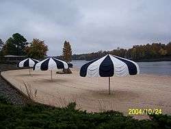
Lake Monticello is a census-designated place (CDP) in Fluvanna County, Virginia, United States. The population was 9,920 at the 2010 census,[3] an increase of over 44% from 2000. The community is centered on a lake of the same name, which is formed by a dam on a short tributary of the nearby Rivanna River. Lake Monticello is part of the Charlottesville Metropolitan Statistical Area. It is a bedroom community of Charlottesville, and to a smaller extent of Richmond. It also has a sizable retirement age population. It is a private gated community.
Geography
Lake Monticello is located in northwestern Fluvanna County at 37°55′6″N 78°19′36″W / 37.91833°N 78.32667°W (37.918286, -78.326803).[4] It is bordered to the northwest by the Albemarle County line, to the northeast by the Rivanna River, to the south by Riverside Drive and South Boston Road, and to the southwest by Virginia State Route 53, the Thomas Jefferson Parkway.[5] VA 53 leads northwest 14 miles (23 km) to Charlottesville, passing Monticello, the estate of Thomas Jefferson, along the way.
According to the United States Census Bureau, the CDP has a total area of 9.5 square miles (24.5 km2), of which 8.8 square miles (22.9 km2) is land and 0.62 square miles (1.6 km2), or 6.59%, is water.[3] Via the Rivanna River, Lake Monticello is part of the James River watershed.
Demographics
As of the census[1] of 2000, there were 6,852 people, 2,754 households, and 2,194 families residing in the CDP. The population density was 780.9 people per square mile (301.7/km²). There were 2,950 housing units at an average density of 336.2/sq mi (129.9/km²). The racial makeup of the CDP was 94.06% White, 3.50% African American, 0.16% Native American, 0.51% Asian, 0.03% Pacific Islander, 0.28% from other races, and 1.46% from two or more races. Hispanic or Latino of any race were 1.49% of the population.
There were 2,754 households out of which 32.1% had children under the age of 18 living with them, 70.8% were married couples living together, 6.7% had a female householder with no husband present, and 20.3% were non-families. 15.8% of all households were made up of individuals and 5.7% had someone living alone who was 65 years of age or older. The average household size was 2.49 and the average family size was 2.77.
In the CDP the population was spread out with 23.6% under the age of 18, 3.7% from 18 to 24, 31.0% from 25 to 44, 23.4% from 45 to 64, and 18.3% who were 65 years of age or older. The median age was 39 years. For every 100 females there were 92.6 males. For every 100 females age 18 and over, there were 89.3 males.
The median income for a household in the CDP was $55,556, and the median income for a family was $63,641. Males had a median income of $43,319 versus $30,332 for females. The per capita income for the CDP was $25,226. About 1.2% of families and 1.8% of the population were below the poverty line, including 1.1% of those under age 18 and 1.3% of those age 65 or over.
References
- 1 2 "American FactFinder". United States Census Bureau. Retrieved 2008-01-31.
- ↑ "US Board on Geographic Names". United States Geological Survey. 2007-10-25. Retrieved 2008-01-31.
- 1 2 "Geographic Identifiers: 2010 Demographic Profile Data (G001): Lake Monticello CDP, Virginia". U.S. Census Bureau, American Factfinder. Retrieved October 19, 2016.
- ↑ "US Gazetteer files: 2010, 2000, and 1990". United States Census Bureau. 2011-02-12. Retrieved 2011-04-23.
- ↑ "TIGERweb". U.S. Census Bureau, Geography Division. Retrieved October 19, 2016.
External links
- Lake Monticello Home Owners Association
- U.S. Geological Survey Geographic Names Information System: Lake Monticello (reservoir)
- U.S. Geological Survey Geographic Names Information System: Lake Monticello (populated place)
Municipalities and communities of Fluvanna County, Virginia, United States | ||
|---|---|---|
| Towns |  | |
| CDPs | ||
| Unincorporated communities |
| |
| Footnotes | ‡This populated place also has portions in an adjacent county or counties | |