Lafayette, Tennessee
| Lafayette, Tennessee | |
|---|---|
| City | |
|
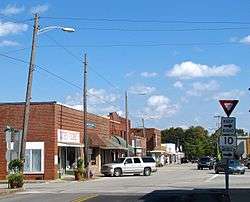
Buildings on the courthouse square | |
 Location of Lafayette, Tennessee | |
| Coordinates: 36°31′32″N 86°1′34″W / 36.52556°N 86.02611°WCoordinates: 36°31′32″N 86°1′34″W / 36.52556°N 86.02611°W | |
| Country | United States |
| State | Tennessee |
| County | Macon |
| Area | |
| • Total | 4.7 sq mi (12.2 km2) |
| • Land | 4.7 sq mi (12.2 km2) |
| • Water | 0.0 sq mi (0.0 km2) |
| Elevation | 958 ft (292 m) |
| Population (2014)Est. | |
| • Total | 4,965 |
| • Density | 1,056/sq mi (407/km2) |
| Time zone | Central (CST) (UTC-6) |
| • Summer (DST) | CDT (UTC-5) |
| ZIP code | 37083 |
| Area code(s) | 615 |
| FIPS code | 47-40160[1] |
| GNIS feature ID | 1290467[2] |
| Website |
www |
Lafayette /ləˈfeɪ.ᵻt/ is a city in Macon County, Tennessee, United States. The population was 4,474 at the 2010 census, up from 3,885 in 2000.[3] It is the county seat of Macon County.[4]
History
Lafayette was founded in 1843 as a county seat for the newly-created Macon County. It was named in honor of the Marquis de Lafayette, of Revolutionary War fame.[5]
Geography
Lafayette is located at 36°31′32″N 86°01′34″W / 36.525595°N 86.026246°W.[6] The city is situated near the center of Macon County, along a relatively broad stretch of the northern Highland Rim. Lafayette straddles a divide between the Barren River and Cumberland River, with streams in the northeastern part of the city (including Town Creek) draining into the former, and streams in the southwestern part of the city draining into the latter.
According to the United States Census Bureau, the city has a total area of 4.4 square miles (11 km2), all land.
Demographics
| Historical population | |||
|---|---|---|---|
| Census | Pop. | %± | |
| 1850 | 210 | — | |
| 1870 | 161 | — | |
| 1890 | 256 | — | |
| 1910 | 678 | — | |
| 1920 | 547 | −19.3% | |
| 1950 | 1,195 | — | |
| 1960 | 1,590 | 33.1% | |
| 1970 | 2,583 | 62.5% | |
| 1980 | 3,808 | 47.4% | |
| 1990 | 3,641 | −4.4% | |
| 2000 | 3,885 | 6.7% | |
| 2010 | 4,474 | 15.2% | |
| Est. 2015 | 4,991 | [7] | 11.6% |
| Sources:[8][9] | |||
As of the census[1] of 2000, there were 3,885 people, 1,718 households, and 1,089 families residing in the city. The population density was 888.4 people per square mile (343.3/km2). There were 1,845 housing units at an average density of 421.9 per square mile (163.0/km2). The racial makeup of the city was 97.89% White, 0.15% African American, 0.33% Native American, 0.39% Asian, 0.26% Pacific Islander, 0.51% from other races, and 0.46% from two or more races. Hispanic or Latino of any race were 2.11% of the population.

There were 1,718 households out of which 26.1% had children under the age of 18 living with them, 49.2% were married couples living together, 10.6% had a female householder with no husband present, and 36.6% were non-families. 34.2% of all households were made up of individuals and 20.1% had someone living alone who was 65 years of age or older. The average household size was 2.21 and the average family size was 2.79.
In the city the population was spread out with 20.6% under the age of 18, 8.4% from 18 to 24, 24.0% from 25 to 44, 25.0% from 45 to 64, and 22.0% who were 65 years of age or older. The median age was 43 years. For every 100 females there were 84.6 males. For every 100 females age 18 and over, there were 81.2 males.
The median income for a household in the city was $25,750, and the median income for a family was $34,125. Males had a median income of $28,994 versus $19,676 for females. The per capita income for the city was $15,348. About 12.1% of families and 18.0% of the population were below the poverty line, including 23.2% of those under age 18 and 24.2% of those age 65 or over.
2008 Tornado
On February 5, 2008 at approximately 10:20 p.m., an EF3 tornado touched down near Lafayette and stayed on the ground with a width of approximately 3/4 mile and traveled for nearly 21 miles (34 km), crossing the county in a southwest to northeast direction. The western half of Macon county was devastated by the tornado with a total of 14 confirmed fatalities. Macon County was equipped with tornado warning sirens, however they were not working at the time; despite the efforts of the local news media and the National Weather Service, many residents were unprepared. This tornado devastated many areas including unincorpated communities southwest of town (causing an explosion at the Piedmont Natural gas transfer station) and north of town (in the Akersville community). As of 2016, some areas still have visible damage.
Economy
The Lafayette and Macon County area is a rural area and its economy mainly relies on the agricultural sector. Macon County is one of the top producers of burley tobacco in Tennessee and the United States. The production of hardwood lumber is also an important industry in the county. There are two local banks with their main offices located in Lafayette. The oldest is Citizens Bank, founded in 1909, and has ten locations in Macon County and surrounding areas. Macon Bank & Trust Co. was founded in 1919 and has seven locations in the area.
Lafayette is home to a few industries. The largest manufacturers in the area are Fleetwood Homes, which is a division of Cavco Industries, Inc., and Tennplasco, which is a division of Manar, Inc.
Recreation
Parks
- Key Park – located on Church Street and includes picnic facilities, a playground, a bandstand, walking tracks and Key Park Log House. The Farmer's Market also sets up shop here.
- Lafayette City Park – located on Days Road and includes picnic facilities, a playground, a swimming pool, a volleyball court, tennis courts and a baseball field.
Golf
- Macon County Golf Course – semi-private, nine-hole course
Education
Lafayette is home to several schools which are run by the Macon County Board of Education. Macon County High School is the high school located in Lafayette, home of the Tigers and Tigerettes. Founded in 1927, the first graduating class consisted of 4 graduates.
Public schools
- Central Elementary School, 2-3
- Fairlane Elementary School, PK-1
- Lafayette Elementary School, 4-5
- Macon County High School, 9-12
- Macon County Junior High School, 6-8
Other publicly funded schools, located outside of Lafayette, include Westside Elementary (K-5) and Red Boiling Springs School (K-12)
Private Schools
- Macon Christian Academy, Pre School to 12
Transportation
Lafayette is located at the crossroads of Tennessee Routes 10 and 52. Route 52 is the main thoroughfare in the city, connecting with Interstate 65 approximately 35 miles away, near Portland. Other secondary state highways include Tennessee State Route 261 and Tennessee State Route 262.
Sneed Boulevard is used as a bypass that connects Route 52 to the Lafayette Industrial Park, which is located in the northern section of the city.
Airport
Located two miles west of downtown, air service in Lafayette is provided by Lafayette Municipal Airport. The facility includes a runway with dimensions of 5,200 by 75 feet.
Notable people
- John Washington Butler, state legislator
- Hillous Butrum - Country music guitarist.
- Rita Coolidge - American singer/songwriter
- Nera White - first woman inducted into the Naismith Memorial Basketball Hall of Fame
- Jett Williams - Country music singer
References
- 1 2 "American FactFinder". United States Census Bureau. Retrieved 2008-01-31.
- ↑ "US Board on Geographic Names". United States Geological Survey. 2007-10-25. Retrieved 2008-01-31.
- ↑ American FactFinder, United States Census Bureau. Accessed: 26 October 2016.
- ↑ "Find a County". National Association of Counties. Retrieved 2011-06-07.
- ↑ Martha Carver, "Macon County," Tennessee Encyclopedia of History and Culture. Retrieved: 26 October 2016.
- ↑ "US Gazetteer files: 2010, 2000, and 1990". United States Census Bureau. 2011-02-12. Retrieved 2011-04-23.
- ↑ "Annual Estimates of the Resident Population for Incorporated Places: April 1, 2010 to July 1, 2015". Retrieved July 2, 2016.
- ↑ "Census of Population and Housing: Decennial Censuses". United States Census Bureau. Retrieved 2012-03-04.
- ↑ "Incorporated Places and Minor Civil Divisions Datasets: Subcounty Resident Population Estimates: April 1, 2010 to July 1, 2012". Population Estimates. U.S. Census Bureau. Retrieved 11 December 2013.
External links
| Wikimedia Commons has media related to Lafayette, Tennessee. |
- Official website
- Municipal Technical Advisory Service entry for Lafayette — information on local government, elections, and link to charter
- Macon County Chronicle
- Macon County Times
Municipalities and communities of Macon County, Tennessee, United States | ||
|---|---|---|
| Cities | ||
| Unincorporated communities | ||