Labrador Current
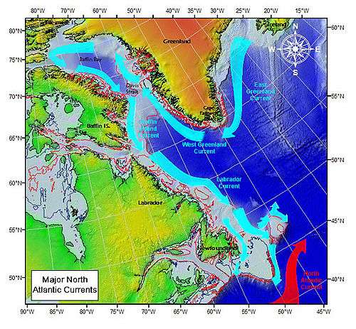
The Labrador Current is a cold current in the North Atlantic Ocean which flows from the Arctic Ocean south along the coast of Labrador and passes around Newfoundland, continuing south along the east coast of Nova Scotia. It is a continuation of the West Greenland Current and the Baffin Island Current.
It meets the warm Gulf Stream at the Grand Banks southeast of Newfoundland. The combination of these two currents produces heavy fogs and has also created one of the richest fishing grounds in the world.
In spring and early summer, this current transports icebergs from the glaciers of Greenland southwards into the trans-Atlantic shipping lanes. The waters of the Labrador Current have a cooling effect on the Canadian Atlantic provinces and USA upper Northeast coast from Maine south to Massachusetts.
The transport of the Labrador Current is believed to contain a large barotropic component. Early estimates indicated that the current may be 30% stronger than geostrophic calculations indicated as a result of a significant barotropic flow component (Hayes and Robe, 1978). Greenberg and Petrie (1988) calculated a total transport of 7.6 sverdrup. (One sverdrup (Sv) is equal to 106 cubic meters per second.) The geostrophic transport was calculated to be just 4.1 Sv (based on IIP sections). With a 30% increase (due to barotropic flow) the transport is only 5.3 Sv so, the high transport values are thought to largely from the inclusion of deep currents indicated by a deep water mooring. Speeds for the Labrador Current are about 0.3–0.5 m/s along the shelf edge (Greenberg and Petrie, Reynaud et al., 1985). Current speeds of 0.3–0.5 m/s were found by Reynaud et al. (1995) for the Labrador Current. Including the barotropic component, they estimate a value of 3 Sv for the continental shelf branch of the Labrador Current and 16 Sv transport for the slope branch of the Labrador Current. The inshore branch of the Labrador Current is approximately 100 km wide and 150 m deep and it passes through Avalon Channel and the splitting of the Labrador Current around Flemish Cap can be seen in the satellite tracked drifters (Petrie and Isenor[1]). Within the Flemish Pass, Petrie and Isenor (1985) report that the width of the Labrador Current is reduced to 50 km with a speed of 0.25 m/s which they believe is actually 0.30 m/s.
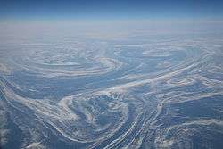
The Labrador Current has a tendency to sometimes go farther south and/or east than normal. This can produce hazardous shipping conditions as it can carry icebergs into an area of the Atlantic where they are not usually found. The current has been known to transport icebergs as far south as Bermuda and as far east as the Azores. The International Ice Patrol was set up to track icebergs, including those found in areas of the ocean where they are rarely located.[2]
References
- ↑ Petrie, B., and A. Isenor, 1985: The near-surface circulation and exchange in the Newfoundland Grand Banks region, Atmosphere-Ocean, 23(3), 209-227: http://www.cmos.ca/Ao/articles/v230301.pdf
- ↑ "Archived copy". Archived from the original on 2009-10-07. Retrieved 2010-01-05. The "Meandering Labrador Current" paragraph