La Vernarède
| La Vernarède | ||
|---|---|---|
|
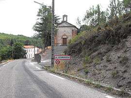
The road into La Vernarède | ||
| ||
 La Vernarède | ||
|
Location within Occitanie region  La Vernarède | ||
| Coordinates: 44°17′23″N 4°00′35″E / 44.2897°N 4.0097°ECoordinates: 44°17′23″N 4°00′35″E / 44.2897°N 4.0097°E | ||
| Country | France | |
| Region | Occitanie | |
| Department | Gard | |
| Arrondissement | Alès | |
| Canton | Génolhac | |
| Intercommunality | Pays Grand'Combien | |
| Government | ||
| • Mayor (2008–2014) | Raymond Pamboutzoglou | |
| Area1 | 5.59 km2 (2.16 sq mi) | |
| Population (2008)2 | 360 | |
| • Density | 64/km2 (170/sq mi) | |
| Time zone | CET (UTC+1) | |
| • Summer (DST) | CEST (UTC+2) | |
| INSEE/Postal code | 30345 / 30530 | |
| Elevation |
307–644 m (1,007–2,113 ft) (avg. 320 m or 1,050 ft) | |
|
1 French Land Register data, which excludes lakes, ponds, glaciers > 1 km² (0.386 sq mi or 247 acres) and river estuaries. 2 Population without double counting: residents of multiple communes (e.g., students and military personnel) only counted once. | ||
.svg.png)
La Vernarède is a commune in the Gard department in southern France.
Population
| Historical population | ||
|---|---|---|
| Year | Pop. | ±% |
| 1876 | 3,894 | — |
| 1881 | 3,515 | −9.7% |
| 1886 | 3,346 | −4.8% |
| 1891 | 3,529 | +5.5% |
| 1896 | 3,319 | −6.0% |
| 1901 | 2,373 | −28.5% |
| 1906 | 2,504 | +5.5% |
| 1911 | 2,248 | −10.2% |
| 1921 | 1,739 | −22.6% |
| 1926 | 1,811 | +4.1% |
| 1931 | 1,461 | −19.3% |
| 1936 | 1,173 | −19.7% |
| 1946 | 1,089 | −7.2% |
| 1954 | 1,282 | +17.7% |
| 1962 | 1,189 | −7.3% |
| 1968 | 943 | −20.7% |
| 1975 | 662 | −29.8% |
| 1982 | 534 | −19.3% |
| 1990 | 440 | −17.6% |
| 1999 | 389 | −11.6% |
| 2008 | 360 | −7.5% |
See also
References
| Wikimedia Commons has media related to La Vernarède. |
This article is issued from Wikipedia - version of the 11/9/2016. The text is available under the Creative Commons Attribution/Share Alike but additional terms may apply for the media files.