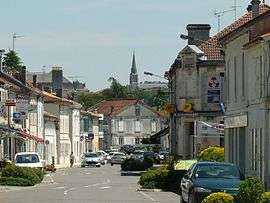
La Roche-Chalais
| La Roche-Chalais | |
|---|---|
 | |
 La Roche-Chalais | |
|
Location within Nouvelle-Aquitaine region  La Roche-Chalais | |
| Coordinates: 45°09′09″N 0°00′35″E / 45.1525°N 0.0097°ECoordinates: 45°09′09″N 0°00′35″E / 45.1525°N 0.0097°E | |
| Country | France |
| Region | Nouvelle-Aquitaine |
| Department | Dordogne |
| Arrondissement | Périgueux |
| Canton | Saint-Aulaye |
| Government | |
| • Mayor (2008–2014) | Jacques Menut |
| Area1 | 89.40 km2 (34.52 sq mi) |
| Population (2008)2 | 2,828 |
| • Density | 32/km2 (82/sq mi) |
| Time zone | CET (UTC+1) |
| • Summer (DST) | CEST (UTC+2) |
| INSEE/Postal code | 24354 / 24490 |
| Elevation |
12–126 m (39–413 ft) (avg. 40 m or 130 ft) |
|
1 French Land Register data, which excludes lakes, ponds, glaciers > 1 km² (0.386 sq mi or 247 acres) and river estuaries. 2 Population without double counting: residents of multiple communes (e.g., students and military personnel) only counted once. | |
La Roche-Chalais is a commune in the Dordogne department in Nouvelle-Aquitaine in southwestern France.
Population
| Historical population | ||
|---|---|---|
| Year | Pop. | ±% |
| 1793 | 1,015 | — |
| 1800 | 1,395 | +37.4% |
| 1806 | 1,484 | +6.4% |
| 1821 | 1,491 | +0.5% |
| 1831 | 2,065 | +38.5% |
| 1836 | 1,910 | −7.5% |
| 1841 | 2,144 | +12.3% |
| 1846 | 2,333 | +8.8% |
| 1851 | 2,427 | +4.0% |
| 1856 | 2,379 | −2.0% |
| 1861 | 2,475 | +4.0% |
| 1866 | 2,556 | +3.3% |
| 1872 | 2,364 | −7.5% |
| 1876 | 2,232 | −5.6% |
| 1881 | 2,430 | +8.9% |
| 1886 | 2,409 | −0.9% |
| 1891 | 1,608 | −33.3% |
| 1896 | 1,509 | −6.2% |
| 1901 | 1,564 | +3.6% |
| 1906 | 1,602 | +2.4% |
| 1911 | 1,535 | −4.2% |
| 1921 | 1,324 | −13.7% |
| 1926 | 1,231 | −7.0% |
| 1931 | 1,303 | +5.8% |
| 1936 | 1,179 | −9.5% |
| 1946 | 1,186 | +0.6% |
| 1954 | 1,134 | −4.4% |
| 1962 | 1,254 | +10.6% |
| 1968 | 1,379 | +10.0% |
| 1975 | 2,997 | +117.3% |
| 1982 | 2,951 | −1.5% |
| 1990 | 2,860 | −3.1% |
| 1999 | 2,804 | −2.0% |
| 2008 | 2,828 | +0.9% |
See also
References
| Wikimedia Commons has media related to La Roche-Chalais. |
This article is issued from Wikipedia - version of the 11/9/2016. The text is available under the Creative Commons Attribution/Share Alike but additional terms may apply for the media files.