La Oliva
For the monastery in Navarre, see Santa María de la Oliva.
| La Oliva | |||
|---|---|---|---|
| Municipality | |||
| |||
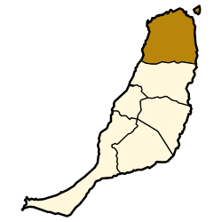 Location in Fuerteventura | |||
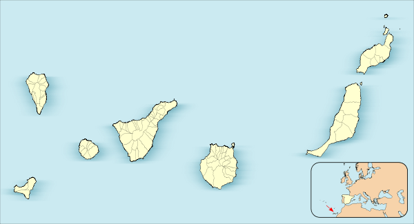 La Oliva Location in Canary Islands | |||
| Coordinates: ES 28°36′40″N 13°55′40″W / 28.61111°N 13.92778°WCoordinates: ES 28°36′40″N 13°55′40″W / 28.61111°N 13.92778°W | |||
| Country | Spain | ||
| Autonomous Community | Canary Islands | ||
| Province | Las Palmas | ||
| Island | Fuerteventura | ||
| Area[1] | |||
| • Total | 356.13 km2 (137.50 sq mi) | ||
| Population (2013)[2] | |||
| • Total | 25,083 | ||
| • Density | 70/km2 (180/sq mi) | ||


La Oliva (pronounced: [la oliˈβa]) is a town and a municipality in the northern part of the island of Fuerteventura in the Province of Las Palmas, Canary Islands, Spain. The population is 25,083 (2013),[2] and the area is 356.13 km².[1] The municipality includes the Lobos Island to the northeast. The largest town of the municipality, Corralejo, is a port town and beach resort at the northernmost point of the island. La Oliva is the historic seat of the island Colonel, who resided in the stately Casa de los Coroneles.
Gallery
 "Montaña Quemada" Canyon
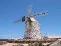 A stone-built windmill near the beach of La Oliva
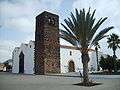 Church of Our Lady of La Candelaria
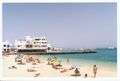 Corralejo beach
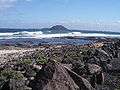 Los Lobos Island
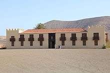
Casa de los Coroneles, La Oliva
See also
References
- 1 2 Instituto Canario de Estadística, area
- 1 2 Instituto Canario de Estadística, population
External links
| Wikimedia Commons has media related to La Oliva. |
 |
Atlantic Ocean | | ||
| Atlantic Ocean | |
Atlantic Ocean | ||
| ||||
| | ||||
| Puerto del Rosario |
This article is issued from Wikipedia - version of the 4/23/2016. The text is available under the Creative Commons Attribution/Share Alike but additional terms may apply for the media files.