La Fueva
| La Fueva (Spanish) A Fueba (Aragonese) | ||
|---|---|---|
|
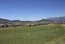
Landscape in La Fueva. | ||
| ||
 La Fueva (Spanish) Location in Spain. | ||
| Coordinates: ES 42°22′11″N 0°16′20″W / 42.36972°N 0.27222°W | ||
| Country | Spain | |
| Autonomous community | Aragon | |
| Province | Huesca | |
| Comarca | Sobrarbe | |
| Government | ||
| • Mayor | José Ramón Laplana Buetas | |
| Area | ||
| • Total | 218.85 km2 (84.50 sq mi) | |
| Elevation | 630 m (2,070 ft) | |
| Population (2010) | ||
| • Total | 619 | |
| • Density | 2.8/km2 (7.3/sq mi) | |
| Demonym(s) | Fuevanos or Fovanos | |
| Time zone | CET (UTC+1) | |
| • Summer (DST) | CEST (UTC+2) | |

La Fueva (in Aragonese: A Fueba;[1] and officially "La Fueva-A Fueba"[2]) is a municipality located in the province of Huesca, Aragon, western Spain. As of 2010, the municipality has a population of 619 inhabitants.
The main settlement, and municipal seat, is the village of Tierrantona. The ruins of the Real Monasterio de San Victorián are located in La Fueva municipal term, at the feet of the Peña Montañesa.
See also
References
- ↑ As shown in the Legislative Decree 2/2006 of 27 December, of the Government of Aragon, by the revised text of the Law on Comarcal Demarcation of Aragon is approved.
- ↑ (Spanish) «Law 5/2003 of creation of the Comarca of Sobrarbe in a program of the Government of Aragon, published in the BOE of February 26, 2003. Consulted the November 12, 2010.
External links
This article is issued from Wikipedia - version of the 8/8/2016. The text is available under the Creative Commons Attribution/Share Alike but additional terms may apply for the media files.