La Désirade Airport
| La Désirade Airport Grande Anse Airport | |||||||||||
|---|---|---|---|---|---|---|---|---|---|---|---|
| IATA: DSD – ICAO: TFFA | |||||||||||
| Summary | |||||||||||
| Airport type | Public | ||||||||||
| Serves | La Désirade | ||||||||||
| Elevation AMSL | 10 ft / 3 m | ||||||||||
| Coordinates | 16°17′50″N 61°05′00″W / 16.29722°N 61.08333°WCoordinates: 16°17′50″N 61°05′00″W / 16.29722°N 61.08333°W | ||||||||||
| Map | |||||||||||
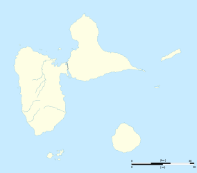 DSD Location of the airport in Guadeloupe | |||||||||||
| Runways | |||||||||||
| |||||||||||
La Désirade Airport (IATA: DSD, ICAO: TFFA) is an airport serving La Désirade, the easternmost island of Guadeloupe.
The airport is on the south shore, with water off both ends, and high terrain to the northeast.
See also
.svg.png) Guadeloupe portal
Guadeloupe portal Aviation portal
- Transport in Guadeloupe
- List of airports in Guadeloupe
References
- ↑ Airport information for DSD at Great Circle Mapper.
- ↑ Google Maps - La Désirade
External links
This article is issued from Wikipedia - version of the 10/7/2016. The text is available under the Creative Commons Attribution/Share Alike but additional terms may apply for the media files.