L'Île-Dorval, Quebec
| L'Île-Dorval | |
|---|---|
| City | |
|
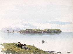
Dorval Island as painted by Frances Anne Hopkins, 1866. | |
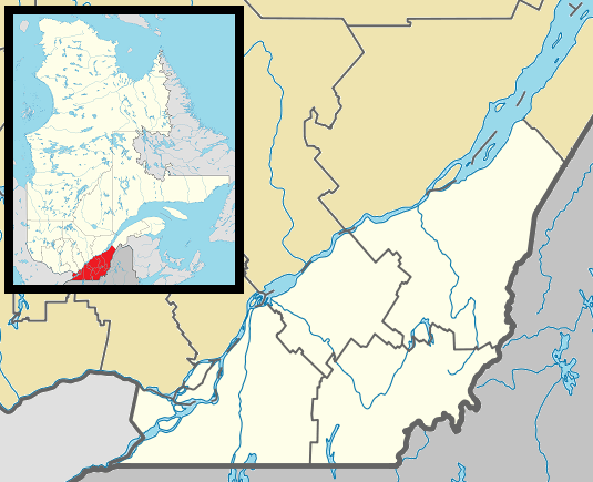
 Montreal and surrounding islands with L'Île-Dorval shown in red. | |
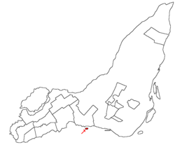
 L'Île-Dorval Location in southern Quebec. | |
| Coordinates: 45°25′56″N 73°44′29″W / 45.43222°N 73.74139°WCoordinates: 45°25′56″N 73°44′29″W / 45.43222°N 73.74139°W[1] | |
| Country |
|
| Province |
|
| Region | Montreal |
| RCM | None |
| Constituted | January 1, 2006 |
| Government[2][3] | |
| • Mayor | Gisèle Chapleau |
| • Federal riding | Dorval—Lachine—LaSalle |
| • Prov. riding | Marquette |
| Area[2][4] | |
| • Total | 0.20 km2 (0.08 sq mi) |
| • Land | 0.18 km2 (0.07 sq mi) |
| Population (2011)[4] | |
| • Total | 5 |
| • Density | 27.7/km2 (72/sq mi) |
| • Pop 2006-2011 |
|
| • Dwellings | 59 |
| Time zone | EST (UTC−5) |
| • Summer (DST) | EDT (UTC−4) |
| Postal code(s) | H9S 5W4 |
| Area code(s) | 514 and 438 |
| Website |
liledorvalisland |
L'Île-Dorval is a city and an island in southwestern Quebec, Canada, in Lac Saint-Louis off the Island of Montreal. It lies a short distance offshore from the city of Dorval and is connected with a seasonal ferry service.
A cottaging spot, it had only 5 permanent residents as of the Canada 2011 Census, making it the smallest municipality in Canada both in area and population. In the 2001 census the official population had dropped to zero, according to Statistics Canada. However, because not only permanent residents but also property owners are eligible to vote in municipal elections in Québec, there were 50 registered voters in 2004.
On January 1, 2002, as part of the 2002–2006 municipal reorganization of Montreal, it merged with the city of Montreal to become part of the borough of Dorval–L'Île-Dorval. After a change of government and a 2004 referendum it became independent once again, effective January 1, 2006.
See also
References
- ↑ Reference number 388465 of the Commission de toponymie du Québec (French)
- 1 2 Ministère des Affaires municipales, des Régions et de l'Occupation du territoire: L'Île-Dorval
- ↑ Parliament of Canada Federal Riding History: NOTRE-DAME-DE-GRÂCE--LACHINE (Quebec)
- 1 2 2011 Statistics Canada Census Profile: L'Île-Dorval, Quebec
External links
- Voting right in Québec; Directeur général des élections du Québec
- Results of June 20, 2004 municipal referendums; Directeur général des élections du Québec