L'Étang-Salé
| L'Étang-Salé | ||
|---|---|---|
|
Beach of L'Étang-Salé | ||
| ||
 | ||
| Coordinates: 21°15′58″S 55°22′01″E / 21.2661°S 55.3669°ECoordinates: 21°15′58″S 55°22′01″E / 21.2661°S 55.3669°E | ||
| Country | France | |
| Overseas region and department | Réunion | |
| Arrondissement | Saint-Pierre | |
| Canton | L'Étang-Salé | |
| Intercommunality | Villes Solidaires | |
| Government | ||
| • Mayor (2014-2020) | Jean-Claude Lacouture | |
| Area1 | 38.65 km2 (14.92 sq mi) | |
| Population (2012)2 | 13,647 | |
| • Density | 350/km2 (910/sq mi) | |
| INSEE/Postal code | 97404 / 97427 | |
| Elevation |
0–1,781 m (0–5,843 ft) (avg. 31 m or 102 ft) | |
|
1 French Land Register data, which excludes lakes, ponds, glaciers > 1 km² (0.386 sq mi or 247 acres) and river estuaries. 2 Population without double counting: residents of multiple communes (e.g., students and military personnel) only counted once. | ||
.svg.png)
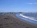
L'Étang-Salé (French for The Salty Pond) is a commune in the department and region of Réunion. It is bordered by the communes of Les Avirons and Saint-Louis. Within the commune is the Étang-Salé forest. There is also a beach with black sand in the commune that is a popular surfing spot.
Demographie
| Year | 1967 | 1974 | 1981 | 1990 | 1999 | 2006 | 2012 |
|---|---|---|---|---|---|---|---|
| Population | 6 510 | 6 610 | 7 479 | 8 769 | 11 755 | 13 266 | 13 647 |
| From the year 1962 on: No double counting—residents of multiple communes (e.g. students and military personnel) are counted only once. | |||||||
Economy and tourism
- there is an industrial zone in L'Étang-Salé
- a popular surfing beach in L'Étang-Salé-les-Bains
- several hotels
- an 18-hole golf course
- Croc' Park - a crocodile park
Images
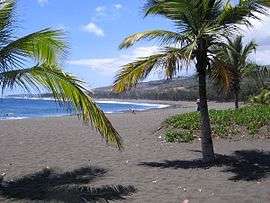
 The beach of L'Étang-Salé
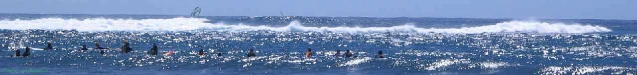
 Surfer at L'Étang-Salé
 Forest of L'Étang-Salé
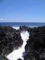 The Gouffre - a lava formation at the coast
See also
References
External links
| Wikimedia Commons has media related to L'Étang-Salé. |
This article is issued from Wikipedia - version of the 4/11/2016. The text is available under the Creative Commons Attribution/Share Alike but additional terms may apply for the media files.