Kure Atoll
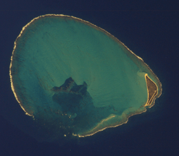 Satellite image of Kure Atoll (north is towards the upper-left corner) | |
 Kure Atoll | |
| Geography | |
|---|---|
| Location | Pacific Ocean |
| Coordinates | 28°25′N 178°20′W / 28.417°N 178.333°W |
| Archipelago | Northwestern Hawaiian Islands |
| Total islands | 2 |
| Major islands | Green Island |
| Area | 0.862 km2 (0.333 sq mi) |
| Length | 9.3 km (5.78 mi) |
| Width | 7.7 km (4.78 mi) |
| Administration | |
| State | Hawaii |
| County | Honolulu County |
| Demographics | |
| Population | 0 (2012) |
| Additional information | |
| Time zone |
|
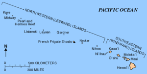
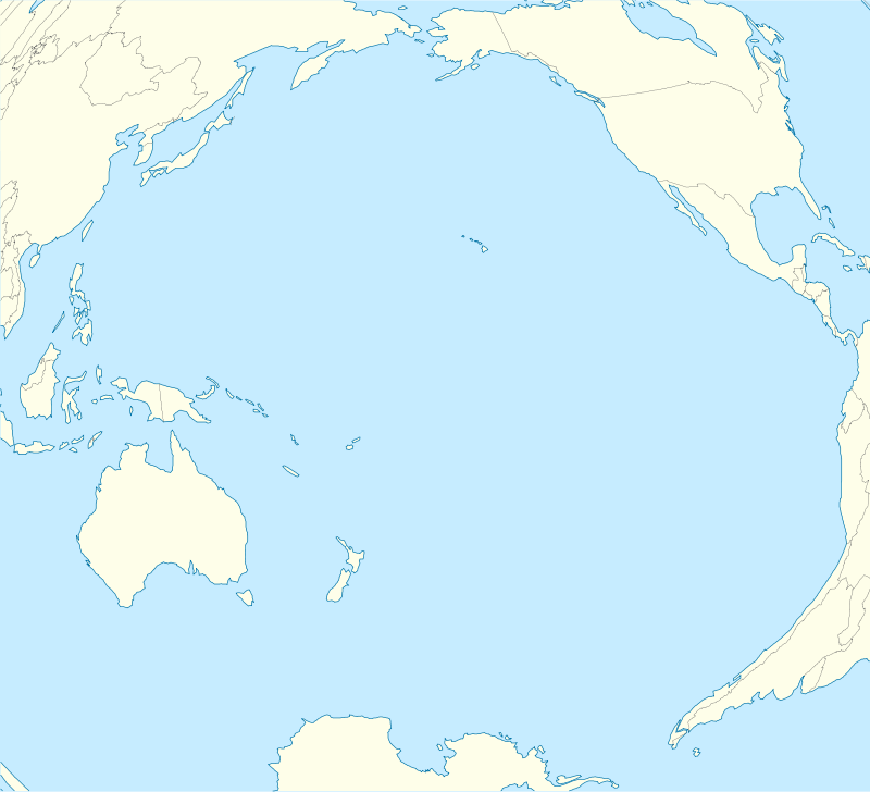
Kure Atoll (/ˈkʊəriː/; Hawaiian: Mokupāpapa) or Ocean Island is an atoll in the Pacific Ocean 48 nautical miles (89 km; 55 mi) beyond Midway Atoll in the Northwestern Hawaiian Islands at 28°25′N 178°20′W / 28.417°N 178.333°WCoordinates: 28°25′N 178°20′W / 28.417°N 178.333°W. The only land of significant size is called Green Island and is habitat for hundreds of thousands of seabirds. A short, unused and unmaintained runway and a portion of one building, both from a former United States Coast Guard LORAN station, are located on the island. Politically it is part of Hawaii, although separated from the rest of the state by Midway, which is a separate unorganized territory.
Geography
The International Date Line lies approximately 100 miles (87 nmi/160 km) to the west. Surprisingly, although located to the west of Midway Atoll, Kure Atoll has a timezone +1 hour ahead at UTC-10:00 (the same as the rest of Hawaii). Kure is the northern-most coral atoll in the world.[1] It consists of a 6-mile (10 km) wide nearly circular barrier reef surrounding a shallow lagoon and several sand islets. There is a total land area of 213.097 acres (86.237 ha), with Green Island on the southeast side[2] having 191.964 acres (77.685 ha) of this total. A growing number of Hawaiian monk seals (Monachus schauinslandi) haul out on its beaches.[3]
Climate
Data chart below has been taken from Midway Atoll due to a lack of any weather stations present on Kure Atoll.
Kure Atoll features a tropical savanna climate (Köppen Aw) with very pleasant year-round temperatures. Rainfall is evenly distributed throughout the year, with only two months being able to be classified as dry season months (May and June).
| Climate data for Kure Atoll | |||||||||||||
|---|---|---|---|---|---|---|---|---|---|---|---|---|---|
| Month | Jan | Feb | Mar | Apr | May | Jun | Jul | Aug | Sep | Oct | Nov | Dec | Year |
| Record high °F (°C) | 80 (27) |
81 (27) |
81 (27) |
82 (28) |
87 (31) |
89 (32) |
92 (33) |
92 (33) |
92 (33) |
89 (32) |
88 (31) |
82 (28) |
92 (33) |
| Average high °F (°C) | 70 (21) |
70 (21) |
71 (22) |
72 (22) |
76 (24) |
81 (27) |
83 (28) |
84 (29) |
84 (29) |
80 (27) |
76 (24) |
73 (23) |
76.7 (24.8) |
| Daily mean °F (°C) | 66 (19) |
66 (19) |
67 (19) |
69 (21) |
72 (22) |
77 (25) |
79 (26) |
80 (27) |
80 (27) |
77 (25) |
73 (23) |
69 (21) |
72.9 (22.8) |
| Average low °F (°C) | 62 (17) |
62 (17) |
63 (17) |
64 (18) |
68 (20) |
73 (23) |
75 (24) |
75 (24) |
75 (24) |
72 (22) |
69 (21) |
65 (18) |
68.6 (20.4) |
| Record low °F (°C) | 49 (9) |
50 (10) |
51 (11) |
53 (12) |
55 (13) |
61 (16) |
63 (17) |
64 (18) |
64 (18) |
59 (15) |
55 (13) |
51 (11) |
49 (9) |
| Average precipitation inches (mm) | 5.0 (127) |
3.8 (97) |
3.0 (76) |
2.5 (64) |
2.3 (58) |
2.2 (56) |
3.3 (84) |
4.3 (109) |
3.5 (89) |
3.5 (89) |
3.8 (97) |
4.1 (104) |
41.3 (1,050) |
| Average precipitation days | 16 | 14 | 12 | 11 | 9 | 9 | 15 | 15 | 15 | 14 | 14 | 16 | 160 |
| Source: Weatherbase[4] | |||||||||||||
Geological history
The geological history of Kure is generally similar to Midway, but Kure lies close to what is called the Darwin Point, the latitude at which reef growth just equals reef destruction by various physical forces. As Kure continues to be slowly carried along to the northwest by the motion of the Pacific Plate, it will move into waters too cool for coral and coralline algae growth to keep up with isostatic subsidence of the mountain. Barring unforeseen evolution, it will then begin to join the other volcanic and reef-topped remnants of the Hawaiian-Emperor Chain to the northwest, all of which are now seamounts.[3][5]
Human exploration and use

In the Hawaiian language the term Mokupāpapa was used for any flat island with reefs.[6] The northwestern islands are associated with Kāne Milohai in Hawaiian mythology. The brother of Pele (creator of the islands) was left to stand guard for travelers.[7] Before the mid-19th century, Kure Atoll was visited by several ships and given new names each time. Sometimes spelled Cure, its English name was for a Russian navigator who sighted the atoll.[8] It was officially named Kure Island in 1924 and then Kure Atoll in 1987.[9]
Many crews were stranded on Kure Atoll after being shipwrecked on the surrounding reefs and had to survive on the local seals, turtles, and birds. The shipwrecks remain on the reef today, including the USS Saginaw. Because of these incidents, King Kalākaua sent Colonel J. H. Boyd to Kure as his Special Commissioner. On September 20, 1886, he took possession of the island for the Hawaiian government. The King ordered that a crude house be built on the island, with tanks for holding water and provisions for any other unfortunates who might be cast away there. But the provisions were stolen within a year and the house soon fell into ruins.[10]
Largely neglected for most of its history, during World War II Kure was routinely visited by U.S. Navy patrols from nearby Midway to ensure that the Japanese were not using it to refuel submarines or flying boats from submarine-tankers for attacks elsewhere in the Hawaiian chain. During the Battle of Midway, a Japanese Nakajima B5N "Kate" bomber, operating from aircraft carrier Hiryū, piloted by Lieutenant Kikuchi Rokurō, and which had been involved in the initial Japanese attack on Midway's US installations, crash-landed near Kure after being damaged by US fighters.[11] Once ashore, Lt. Kikuchi and the two other members of his crew (Warrant Officer Yumoto Noriyoshi and Petty Officer (1st Class) Narasaki Hironori) refused capture and were either killed or committed suicide when an American landing party tried to capture them.[11]


Kure is located within a major current which washes up debris from the Great Pacific Garbage Patch, such as fishing nets and large numbers of cigarette lighters, on the island. These pose threats to the local animals, especially birds, whose skeletons are frequently found with plastic in the stomach cavity.[3][12]
On October 16, 1998, the longline fishing vessel Paradise Queen II ran aground on the eastern edge of Green Island of Kure Atoll, spilling approximately 4,000 gallons of diesel fuel before recovery operations could commence. Debris from that shipwreck continued to pollute the reef and shoreline for many years, endangering wildlife and damaging the coral reef. The long-term impact of this and other wrecks within the Northwestern Hawaiian Islands (NWHI) highlight the dangers to sensitive habitats in the area. To help ensure their protection, the Papahānaumokuākea Marine National Monument was designated a Particularly Sensitive Sea Area (PSSA) in 2008 by the International Maritime Organization.[13][14] In addition to avoiding specific areas, owners must identify when their ship enters and leaves the PSSA's 10 nautical mile wide reporting area so a timely response can be taken should there be a maritime emergency.
From 1960 to 1992, a United States Coast Guard LORAN station was located on Green Island. A short coral runway was built on the island to support Coast Guard operations,[10] but it was abandoned and is currently unusable.[15] Although there is no permanent human population, the atoll is formally part of the City and County of Honolulu.[16] It became a state wildlife sanctuary in 1981.[17] Since 1993 the Hawaii Department of Land and Natural Resources and volunteers from the Kure Atoll Conservancy group have helped to restore the atoll to a more natural state.[18] Jean-Michel Cousteau produced a video on a voyage to Kure which first aired in 2006.[19] Since 2010 the Division of Forestry and Wildlife has had a year-round presence on Kure Atoll.
Amateur radio
Because of its particularly remote location, Kure Island has been the scene of several amateur radio DX expeditions, or DX-peditions. Because the radio propagation path between Kure and Europe runs right over the North Polar region, opportunities for distant communication with Kure are particularly popular among European amateurs. Some of the DXpeditions to Kure were:
- 1969 – Callsign: KH6NR/KH6 – From November 11 to November 14, 1969, Marine Staff Sergeant Don Chilcote, KH6GKV (now VE6NN), and Navy ICFN Gene Lewis, KH6HDB (now W5LE), operated from Kure Island, using the U.S. Navy Reserve Training Center, Honolulu's callsign.[20]
- 1971–72 – Callsign: KH6EDY—The U.S. Coast Guard Loran Station Kure Island's callsign.
- 1973–74 – Callsign: KH6HDB – From September 1973 to September 1974, Gene Lewis,KH6HDB (now W5LE), operated from Kure Island. Lewis had been one of the two operators to activate Kure during the one week DXpedition of KH6NR/KH6 during November 1969. He subsequently joined the Coast Guard for the express purpose of getting to spend a one-year tour of duty on Kure Island.[21]
- 1997 – Event call sign: K7K. This was a joint scientific/radio operation including four fish and wildlife scientists and the eight members of the Midway-Kure DX Foundation's 1996 Midway team. The team included four scientists from the United States Fish and Wildlife Service.[22]
- 2005 – Event call sign: K7C. The team consisted of 12 amateur radio operators from the United States, Canada, and Germany.[20]
Gallery
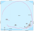 Bathymetric map of Kure Atoll
 Satellite image of Kure Atoll
 NASA astronaut image of Kure Atoll (2004/2/22)
_(20159194319).jpg) Photo of Green Island shot from the air (1968/2/27)
Photo of Green Island shot from the air (1968/2/27) Young Masked Boobies Sula dactylatra on Green Island, Kure Atoll
 Scaevola taccada (habit with sooty terns). Location: Kure Atoll, inland
 The flower of Verbesina encelioides at near camp of Kure Atoll
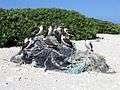 Young Masked Boobies Sula dactylatra sitting on marine debris. Green Island, Kure Atoll
References
- ↑ Reynolds, M.H., Berkowitz, P., Courtot, K.N., Krause, C. M. (editors) (2012). Predicting sea-level rise vulnerability of terrestrial habitat and wildlife of the Northwestern Hawaiian Islands: U.S. Geological Survey Open-File Report 2012–1182 (PDF). USGS. p. 7.
- ↑ U.S. Geological Survey Geographic Names Information System: Green Island
- 1 2 3 Safina, Carl (2003). Eye of the albatross : visions of hope and survival (1st Owl Books ed.). New York: H. Holt. ISBN 9780805062298. Retrieved 19 February 2015.
- ↑ "Midway Island, Midway Islands Travel Weather Averages (Weatherbase)". weatherbase.com. Retrieved 22 November 2016.
- ↑ "Kure Atoll (Moku Pāpapa)". Papahānaumokuākea Marine National Monument. National Oceanic and Atmospheric Administration. Retrieved 3 February 2015.
- ↑ Mary Kawena Pukui and Samuel Hoyt Elbert (2003). "lookup of moku papapa ". in Hawaiian Dictionary. Ulukau, the Hawaiian Electronic Library, University of Hawaii Press. Retrieved March 9, 2011.
- ↑ ʻAha Pūnana Leo and Hale Kuamoʻo (2003). "lookup of Kānemilohaʻi ". in Māmaka Kaiao: a modern Hawaiian vocabulary. Ulukau, the Hawaiian Electronic Library, University of Hawaii Press. Retrieved March 9, 2011.
- ↑ Mary Kawena Pukui, Samuel Hoyt Elbert and Esther T. Mookini (2004). "lookup of Kure ". in Place Names of Hawai'i. Ulukau, the Hawaiian Electronic Library, University of Hawaii Press. Retrieved March 9, 2011.
- ↑ U.S. Geological Survey Geographic Names Information System: Kure Atoll
- 1 2 Mark J. Rauzon (2001). Isles of Refuge: Wildlife and history of the northwestern Hawaiian Islands. University of Hawaii Press. ISBN 0-8028-5088-X.
- 1 2 Jonathan B. Parshall; Anthony P. Tully (2005). Shattered Sword: The Untold Story of the Battle of Midway. Dulles, Virginia: Potomac Books. pp. 200, 204, 516, 553 note 45, note 56. ISBN 1-57488-923-0.
- ↑ Papahānaumokuākea Marine National Monument Kure Atoll
- ↑ "Designation of the Papahānaumokuākea Marine National Monument as a Particularly Sensitive Sea Area" (PDF). International Maritime Organization (IMO). Retrieved February 19, 2015.
- ↑ Shallanberger, Robert J. (February 2006). "History of Management in the Northwestern Hawaiian Islands" (PDF). Atoll Research Bulletin. National Museum of Natural History, Smithsonian Institution (543): 26. Retrieved 19 February 2015.
- ↑ "Hawaiian Monk Seal Population Assessment Field Camps In The Northwestern Hawaiian Islands". National Oceanic and Atmospheric Administration (NOAA). Retrieved February 3, 2015.
- ↑ "Kure Atoll, including Green Island: Blocks 1023 and 1024, Census Tract 114.98, Honolulu County, Hawaii". 2000 Census. United States Census Bureau. Retrieved March 9, 2011.
- ↑ U.S. Geological Survey Geographic Names Information System: Kure Atoll State Wildlife Sanctuary
- ↑ "Kure Atoll Conservancy". volunteer web site. 2009. Retrieved March 9, 2011.
- ↑ "Voyage to Kure". Jean-Michel Cousteau: Ocean Adventures. KQED-TV. 2006. Retrieved March 9, 2011.
- 1 2 "The 2005 Cordell Expedition to Kure Atoll". www.cordell.org. Cordell Expeditions. Retrieved 3 February 2015.
- ↑ "QRZ Callsign Database Search by QRZ.COM". qrz.com. Retrieved 22 November 2016.
- ↑ "k7k.html". qsl.net. Retrieved 22 November 2016.
External links
| Wikimedia Commons has media related to Kure Atoll. |
- Quick Facts on the Kure Atoll from the PBS Ocean Adventures site
- Northwestern Hawaiian Islands Coral Reef Ecosystem Reserve
- List of DXpeditions to Kure Island
- Papahānaumokuākea Marine National Monument Information Management System