Kuntur Puna
| Kuntur Puna | |
|---|---|
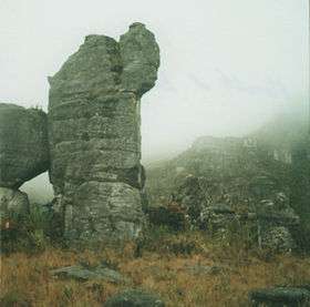 A rock on the mountain Kuntur Puna | |
| Highest point | |
| Coordinates | 6°03′53″S 78°17′27″W / 6.06472°S 78.29083°WCoordinates: 6°03′53″S 78°17′27″W / 6.06472°S 78.29083°W |
| Geography | |
 Kuntur Puna Peru | |
| Location | Peru, Amazonas Region, Luya Province, Utcubamba Province |
| Parent range | Andes |
Kuntur Puna (Quechua kuntur condor, puna an ecoregion near the Andes,[1] "condor puna", hispanicized spelling Condor Puna, Condorpuna, Cóndor Puna, Cóndorpuna) is a mountain in the Andes of Peru. It is located in the Amazonas Region, Luya Province, Conila District, and in the Utcubamba Province, in the districts Jamalca and Lonya Grande.[2][3] It is one of the highest mountains of the area.[2]
See also
References
- ↑ Teofilo Laime Ajacopa, Diccionario Bilingüe Iskay simipi yuyayk'ancha, La Paz, 2007 (Quechua-Spanish dictionary)
- 1 2 "Cerro Condor Puna". mincetur. Retrieved March 30, 2014.
- ↑ escale.minedu.gob.pe - UGEL map of the Utcubamba Province (Amazonas Region)
This article is issued from Wikipedia - version of the 12/6/2015. The text is available under the Creative Commons Attribution/Share Alike but additional terms may apply for the media files.