Kunia Camp, Hawaii
Not to be confused with Kunya.
| Kunia Camp | |
|---|---|
| Unincorporated community | |
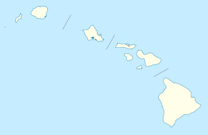 Kunia Camp Location within the state of Hawaii | |
| Coordinates: 21°27′48″N 158°3′55″W / 21.46333°N 158.06528°WCoordinates: 21°27′48″N 158°3′55″W / 21.46333°N 158.06528°W | |
| Country | United States |
| State | Hawaii |
| County | Honolulu |
| Elevation | 883 ft (269 m) |
| Time zone | Hawaii-Aleutian (HAST) (UTC-10) |
| • Summer (DST) | HADT (UTC-9) |
| ZIP codes | 96759 |
| GNIS feature ID | 365354 |
Kunia Camp (also called Kunia) is an unincorporated community on the island of Oahu in Honolulu County, Hawaii, United States. It lies along Hawaii Route 750 northwest of downtown Honolulu, the county seat of Honolulu County.[1] Its elevation is 883 feet (269 m).[2] Although it is unincorporated, it has a post office (under the name of Kunia), with the ZIP code of 96759.[3]
The community was a plantation village for a Del Monte pineapple plantation. The plantation closed in 2006; two years later, the community's land was given to the Hawaii Agriculture Research Center, allowing its residents to keep their leases.[4] The community was added to the National Register of Historic Places in 2014.[5]
References
- ↑ Rand McNally. The Road Atlas '08. Chicago: Rand McNally, 2008, p. 30.
- ↑ U.S. Geological Survey Geographic Names Information System: Kunia Camp, Hawaii, Geographic Names Information System, 1981-02-06. Accessed 2008-04-08.
- ↑ Zip Code Lookup
- ↑ David, Mari-Ela (May 29, 2008). "Kunia Camp Residents Welcome Plan to Preserve Plantation". Hawaii News Now. Retrieved January 20, 2015.
- ↑ "Weekly List of Actions Taken on Properties: 12/01/14 Through 12/05/14". National Park Service. Retrieved January 20, 2015.
Islands, municipalities, and communities of Honolulu County, Hawaii, United States | ||
|---|---|---|
| CDPs |
|  |
| Unincorporated communities | ||
This article is issued from Wikipedia - version of the 1/21/2015. The text is available under the Creative Commons Attribution/Share Alike but additional terms may apply for the media files.