Kungsholmen
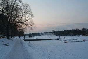
Kungsholmen is an island in Lake Mälaren in Sweden, part of central Stockholm. It is situated north of Riddarfjärden and considered part of the historical province Uppland. Its area is 3.9 km2 (1.5 sq mi) with a perimeter of 8.9 km (5.5 mi). The highest point is at Stadshagsplan at 47 metres (154 ft). The total population is 56,754 (December 31, 2007).[1]
Administratively, it is subdivided into the five districts Kungsholmen, Marieberg, Fredhäll, Kristineberg and Stadshagen.
History
Establishment
Franciscan monks from the Grey Friar's Abbey, Stockholm, began living on the island in the 15th century. Because of this, the island was named Munklägret (the Monks' encampment). The monks subsisted on cattle-breeding and fishing. They also managed the brickyard Själakoret at Rålambshov. As a result of the Swedish Reformation, which was concluded at the parliament in Västerås 1527, the monks were expelled and the area became property of the crown.
At the end of the 16th century, Johan III (son of Gustav Vasa) established an additional brickyard on the northern bank of the island. In 1635 the first bridge to Munklägret was built.
A few years later Queen Kristina donated large areas of land in the western part of the island to some of the generals from the Thirty Years War. They built magnificent entails and laid out great gardens. 1644 the crown donated the eastern part of Munklägret to the authorities of the city of Stockholm, which then also gets its first city plan. Three years later the remainder of the island was donated.
In order to facilitate migration to Munklägret privileges were given to artisans and manufacturers. For example, they were allowed to set up operations there without having to belong to the guilds and they were exempted from tax for ten years. In 1672 Munklägret became a separate parish (Kungsholmen) and the whole island was renamed Kungsholmen.
Industrialization
When the Swedish Empire collapsed in the beginning of the 18th century the crown embarked on a generous economic policy to develop Kungsholmen. The entails were turned into factories and hospitals. In Hornsberg a cotton manufacture was established, at Marieberg a porcelain factory.
In the early 19th century the military began to settle in Kungsholmen, which at the time was still a sparsely populated idyll.
When Samuel Owen settled in Kungsholmen, it had begun developing into a marked district factories and workers. This development was accentuated when the Bolinder brothers start building up their business at Klara Sjö, west of the Kungsbron, (King's Bridge) in the mid-19th century. The company AB Separator was established at the end of the 19th century. AB Separator would soon become a worldwide group of companies and at the beginning of the 20th century had more than 2,000 employees.
The industrial breakthrough led to a huge population explosion. The population grew from just over 4,000 people in 1860 to 26,000 in 1890. During the 1880s several apartment blocks were built to remedy the housing shortage. Claës Lundin wrote about these houses: "With one or two exceptions, they give no honor to the decade." Kungsholmen was commonly referred to as "Svältholmen." ("Famine Island")
Modern Kungsholmen
In the early 20th century a radical structural change took place on Kungsholmen. The traits from the old industrial district are swept away and instead housing and public institutions were erected. St. Görans’ church was built in 1910. At the division of the Kungsholmen parish in 1925, the new parish was named after the church.
The residential areas in Fredhäll and in Kristineberg were built in the 1930s after a functionalist city plan. The bridges Västerbron and Tranebergsbron were also built the same decade, and Sankt Eriksbron received its current dimensions. The Stockholm metro was drawn through Kungsholmen in the 1950s, first out to Vällingby and later also to Järvafältet. At this time the military moved out and the large hospital Serafen is supplanted (on another location) by the more modern Saint Göran Hospital. [2]

Prominent buildings and structures
- Stockholm City Hall, by architect Ragnar Östberg, and built 1911-1923.
- Stockholm Court House from 1909-1915.
- Kristineberg Palace from around 1750.
- Functionalist buildings along the southern waterfront Norr Mälarstrand.
- Art Deco buildings flanking the bridge Sankt Eriksbron.
- Dagens Nyheter Tower, completed in 1964.
- Västerbron, completed in 1935.
Bridges leading to Kungsholmen
- From Norrmalm:
- From Solna:
- From Bromma:
- From Lilla Essingen:
- Mariebergsbron
- Fredhällsbron (part of the Essingeleden motorway.)
- From Södermalm:
See also
| Wikivoyage has a travel guide for Kungsholmen. |
References
- ↑ "Area and population density by City district" (in Swedish). USK - stockholm.se.
- ↑ "Translated from 'Historik'".
Coordinates: 59°20′N 18°2′E / 59.333°N 18.033°E