Kulosaari
| Kulosaari Brändö | |
|---|---|
| Helsinki Subdivision | |
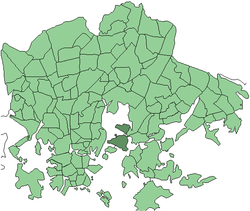 Position of Kulosaari within Helsinki | |
| Country |
|
| Region | Uusimaa |
| Sub-region | Greater Helsinki |
| Municipality | Helsinki |
| Subdivision number | 42 |
| District | Southeastern |
| Area | 1.81 km2 (0.70 sq mi) |
| Population (2004) | 3,770 |
| • Density | 2,083/km2 (5,390/sq mi) |
| Postal codes | 00570 |
| Neighbouring subdivisions |
Herttoniemenranta Länsi-Herttoniemi Mustikkamaa-Korkeasaari Sörnäinen Tullisaari |
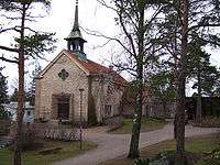
Kulosaari (Swedish: Brändö) is an island and a suburb in Helsinki, Finland. It is also the 42nd neighbourhood of the city. Construction of villas on the island started in the beginning of the 20th century, and a bridge from Sörnäinen was opened in 1919. Kulosaari was an independent municipality since 1922 until 1946, when it was merged to Helsinki.
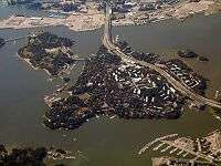
Trams served the island from 1910 to 1951 – before the first bridge was completed, ferries were used to transport the trams. In 1982 Kulosaari got its own subway station, an original station of the Helsinki Metro. An important highway called Itäväylä, serving Helsinki's eastern suburbs, goes through the island, cutting it in two halves. There are plans to cover part of the highway to make room for housing development, but due to the economy of Helsinki and negative attitudes towards the project by the local inhabitants work on this plan is unlikely to be started in the near future.
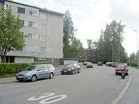
Kulosaari is home to 3,700 people (2003), and has a size of 1.81 square kilometres (0.70 sq mi). Although some low-rise apartment blocks were built in the 1960s, the area is still rather secluded and wealthy having mostly free-standing villas.
The island is host to both Swedish-speaking and Finnish-speaking primary schools and the KSYK (Kulosaaren Yhteiskoulu, Kulosaari Secondary School) international secondary school, as well as Brändö Gymnasium, a gymnasium for Swedish-speaking Finns.
Politics
Results of the Finnish parliamentary election, 2011 in Kulosaari:
- National Coalition Party 43.7%
- Swedish People's Party 14.5%
- Green League 13.7%
- Social Democratic Party 9.0%
- True Finns 7.4%
- Left Alliance 5.4%
- Centre Party 3.5%
- Christian Democrats 1.5%
Coordinates: 60°11′N 25°01′E / 60.183°N 25.017°E
| Wikimedia Commons has media related to Kulosaari. |