Kremmling, Colorado
| Town of Kremmling, Colorado | |
|---|---|
| Statutory Town | |
|
Tourist-oriented wooden structure in Kremmling | |
 Location in Grand County and the state of Colorado | |
| Coordinates: 40°3′26″N 106°23′9″W / 40.05722°N 106.38583°WCoordinates: 40°3′26″N 106°23′9″W / 40.05722°N 106.38583°W | |
| Country |
|
| State |
|
| County[1] | Grand |
| Founded | 1881 |
| Incorporated (town) | May 14, 1904[2] |
| Government | |
| • Type | Statutory Town[1] |
| Area | |
| • Total | 1.3 sq mi (3.4 km2) |
| • Land | 1.3 sq mi (3.4 km2) |
| • Water | 0 sq mi (0 km2) |
| Elevation[3] | 7,313 ft (2,229 m) |
| Population (2000) | |
| • Total | 1,578 |
| • Density | 1,213.8/sq mi (464.1/km2) |
| Time zone | Mountain (MST) (UTC-7) |
| • Summer (DST) | MDT (UTC-6) |
| ZIP code[4] | 80459 |
| Area code(s) | 970 Exchange: 724 |
| FIPS code | 08-41560 |
| GNIS feature ID | 0204655 |
| Website | Town of Kremmling |

The Town of Kremmling is a Statutory Town in Grand County, Colorado, United States. The town population was 1444 at the 2010 United States Census. The town sits along the upper Colorado River in the lower arid section of Middle Park between Byers Canyon and Gore Canyon. The town was founded in 1881 during the Colorado Silver Boom days, but the lack of mineral resources in the nearby mountains made the town grow very slowly in the early days.
History
The settlement started with only a general store, run by a man named Rudolph "Kare" Kremmling, built on the north side of Muddy Creek. In 1881, two brothers, Aaron and John Kinsey, made part of their ranch into a town and called it Kinsey City. Kare moved his store across the river to the new site and soon people were calling this place Kremmling. The original post office was called Kinsey City and ran from 1881 to 1885, with Kare Kremmling the first postmaster. The name Kremmling was not officially recognized until 1895. After the Moffat railroad—the Denver, Northwestern & Pacific—arrived in July 1906, Kremmling became the county's central shipping point. It was incorporated May 14, 1904. In the 20th century, ranching became the main industry in the valley in the vicinity of the town. In 1906, Kasper Schuler built the first brick building in town. The Schuler bottling works occupied the first floor, while the Schuler House, a boarding house run by Miss Kienholz, occupied the second. In 1933, the building became the Hotel Eastin.
Photojournalist W. Eugene Smith made his 1948 LIFE magazine photo essay "Country Doctor" in Kremmling.
Geography
Kremmling is located at 40°3′26″N 106°23′9″W / 40.05722°N 106.38583°W (40.057240, -106.385896).[5]
According to the United States Census Bureau, the town has a total area of 1.3 square miles (3.4 km2), all of it land.
The town is located approximately at the mouth of both the Blue River, which descends from the south, and Muddy Creek, which descends from the north. This location provides valley access to Dillon, Colorado, and the ski resorts of summit county, and Rabbit Ears Pass (renowned for world-class snowmobiling) at the Continental Divide, which then descends into Steamboat Springs.
Kremmling is also where the Blue River and Muddy Creek join the headwaters of the Colorado River, which comes in from the East and then passes West through Gore Canyon. This confluence is the primary reason Kremmling was founded.
Demographics
| Historical population | |||
|---|---|---|---|
| Census | Pop. | %± | |
| 1910 | 141 | — | |
| 1920 | 254 | 80.1% | |
| 1930 | 261 | 2.8% | |
| 1940 | 567 | 117.2% | |
| 1950 | 623 | 9.9% | |
| 1960 | 576 | −7.5% | |
| 1970 | 764 | 32.6% | |
| 1980 | 1,296 | 69.6% | |
| 1990 | 1,166 | −10.0% | |
| 2000 | 1,578 | 35.3% | |
| 2010 | 1,444 | −8.5% | |
| Est. 2015 | 1,457 | [6] | 0.9% |
As of the census of 2010, there were 1,444 people in Kremmling.
As of the census[8] of 2000, there were 1,578 people, 595 households, and 423 families residing in the town. The population density was 1,185.9 people per square mile (458.1/km²). There were 646 housing units at an average density of 485.5 per square mile (187.5/km²). The racial makeup of the town was 92.90% White, 0.06% African American, 0.25% Native American, 0.25% Asian, 0.13% Pacific Islander, 4.12% from other races, and 2.28% from two or more races. Hispanic or Latino of any race were 8.56% of the population.
There were 595 households out of which 38.8% had children under the age of 18 living with them, 56.3% were married couples living together, 8.4% had a female householder with no husband present, and 28.9% were non-families. 24.4% of all households were made up of individuals and 6.7% had someone living alone who was 65 years of age or older. The average household size was 2.58 and the average family size was 3.07.
In the town the population was spread out with 29.0% under the age of 18, 8.4% from 18 to 24, 33.6% from 25 to 44, 20.8% from 45 to 64, and 8.1% who were 65 years of age or older. The median age was 34 years. For every 100 females there were 101.8 males. For every 100 females age 18 and over, there were 109.0 males.
The median income for a household in the town was $45,605, and the median income for a family was $51,023. Males had a median income of $38,333 versus $25,385 for females. The per capita income for the town was $19,687. About 8.2% of families and 8.1% of the population were below the poverty line, including 13.6% of those under age 18 and 1.6% of those age 65 or over.
Climate
This climate type is dominated by the winter season, a long, bitterly cold period with short, clear days, relatively little precipitation mostly in the form of snow, and low humidity. According to the Köppen Climate Classification system, Kremmling has a subarctic climate, abbreviated "Dfc" on climate maps.[9]
| Climate data for Kremmling, Colorado | |||||||||||||
|---|---|---|---|---|---|---|---|---|---|---|---|---|---|
| Month | Jan | Feb | Mar | Apr | May | Jun | Jul | Aug | Sep | Oct | Nov | Dec | Year |
| Average high °C (°F) | 28 (−2) |
32 (0) |
43 (6) |
54 (12) |
64 (18) |
75 (24) |
81 (27) |
79 (26) |
72 (22) |
60 (16) |
42 (6) |
29 (−2) |
55 (13) |
| Average low °C (°F) | 1 (−17) |
2 (−17) |
15 (−9) |
23 (−5) |
31 (−1) |
37 (3) |
43 (6) |
42 (6) |
33 (1) |
23 (−5) |
13 (−11) |
2 (−17) |
22 (−6) |
| Average precipitation mm (inches) | 0.8 (20) |
0.6 (15) |
0.7 (18) |
0.9 (23) |
1.3 (33) |
1.1 (28) |
1.4 (36) |
1.6 (41) |
1.2 (30) |
0.9 (23) |
0.7 (18) |
0.8 (20) |
11.9 (302) |
| Source: Weatherbase [10] | |||||||||||||
See also
References
- 1 2 "Active Colorado Municipalities". State of Colorado, Department of Local Affairs. Archived from the original on November 22, 2010. Retrieved 2007-09-01.
- ↑ "Colorado Municipal Incorporations". State of Colorado, Department of Personnel & Administration, Colorado State Archives. 2004-12-01. Retrieved 2007-09-02.
- ↑ "US Board on Geographic Names". United States Geological Survey. 2007-10-25. Retrieved 2008-01-31.
- ↑ "ZIP Code Lookup". United States Postal Service. Archived from the original (JavaScript/HTML) on November 23, 2010. Retrieved October 21, 2007.
- ↑ "US Gazetteer files: 2010, 2000, and 1990". United States Census Bureau. 2011-02-12. Retrieved 2011-04-23.
- ↑ "Annual Estimates of the Resident Population for Incorporated Places: April 1, 2010 to July 1, 2015". Retrieved July 2, 2016.
- ↑ "Census of Population and Housing". Census.gov. Archived from the original on May 11, 2015. Retrieved June 4, 2015.
- ↑ "American FactFinder". United States Census Bureau. Archived from the original on September 11, 2013. Retrieved 2008-01-31.
- ↑ Climate Summary for Kremmling, Colorado
- ↑ "Weatherbase.com". Weatherbase. 2013. Retrieved on October 2, 2013.
External links
| Wikimedia Commons has media related to Kremmling, Colorado. |
- Town of Kremmling website
- Kremmling Area Chamber of Commerce website
- CDOT map of the Town of Kremmling
Municipalities and communities of Grand County, Colorado, United States | ||
|---|---|---|
| Towns | 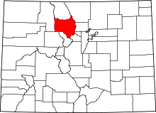 | |
| CDPs | ||
| Unincorporated communities | ||
