Korita na Krasu
| Korita na Krasu | |
|---|---|
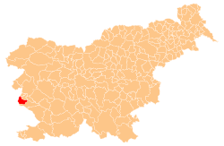
 Korita na Krasu Location in Slovenia | |
| Coordinates: 45°50′2.78″N 13°37′4.37″E / 45.8341056°N 13.6178806°ECoordinates: 45°50′2.78″N 13°37′4.37″E / 45.8341056°N 13.6178806°E | |
| Country |
|
| Traditional region | Littoral |
| Statistical region | Gorizia |
| Municipality | Miren-Kostanjevica |
| Area | |
| • Total | 1.04 km2 (0.40 sq mi) |
| Elevation | 225.3 m (739.2 ft) |
| Population (2002) | |
| • Total | 46 |
| [1] | |
Korita na Krasu (pronounced [kɔˈɾiːta na ˈkɾaːsu]) is a settlement west of Kostanjevica na Krasu in the Municipality of Miren-Kostanjevica in the Littoral region of Slovenia, close to the border with Italy.[2]
Name
The name of the settlement was changed from Korita to Korita na Krasu in 1955.[3]
Mass grave
Korita na Krasu is the site of a mass grave possibly associated with the Second World War. The Korita Cavern Mass Grave (Slovene: Grobišče Kaverna v Koritah) is located on the slope of a shallow valley in the hills about 270 m south of the crossroads in the settlement and 80 m east of the road to Sela na Krasu. Although the grave contains human remains, the configuration of the shaft casts doubt on whether it is a concealed grave from the war.[4]
References
- ↑ Statistical Office of the Republic of Slovenia
- ↑ Miren-Kostanjevica municipal site
- ↑ Spremembe naselij 1948–95. 1996. Database. Ljubljana: Geografski inštitut ZRC SAZU, DZS.
- ↑ Korita Cavern Mass Grave on Geopedia (Slovene)
External links
| Settlements | Administrative centre: Miren
|  |
|---|---|---|
| Landmarks | ||
| Notable people | ||