Korgen
| Korgen herred | |
|---|---|
| Former Municipality | |
| Municipality ID | NO-1830 |
| Adm. Center | Korgen |
| Created from | Hemnes in 1918 |
| Merged into | Hemnes in 1964 |
| Korgen | |
|---|---|
| Village | |
|
View of the local church | |
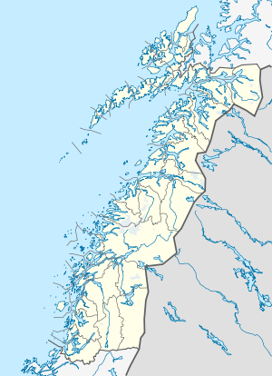 Korgen  Korgen Location in Nordland | |
| Coordinates: 66°04′35″N 13°49′19″E / 66.07639°N 13.82194°ECoordinates: 66°04′35″N 13°49′19″E / 66.07639°N 13.82194°E | |
| Country | Norway |
| Region | Northern Norway |
| County | Nordland |
| District | Helgeland |
| Municipality | Hemnes |
| Area[1] | |
| • Total | 0.88 km2 (0.34 sq mi) |
| Elevation[2] | 16 m (52 ft) |
| Population (2013)[1] | |
| • Total | 875 |
| • Density | 994/km2 (2,570/sq mi) |
| Time zone | CET (UTC+01:00) |
| • Summer (DST) | CEST (UTC+02:00) |
| Post Code | 8646 Korgen |

Korgen is a village and a former municipality in Nordland county, Norway. The village is also the administrative center of the municipality of Hemnes. The former municipality is the southern part of the present-day municipality of Hemnes.
The village of Korgen is the largest village and the administrative center of the municipality of Hemnes. Korgen is connected by road to Mo i Rana, Mosjøen, and Bleikvassli. The 0.88-square-kilometre (220-acre) village has a population (2013) of 875. The population density is 994 inhabitants per square kilometre (2,570/sq mi).[1]
Korgen Church is a cruciform church dating back to 1863. It was built of timber and has 450 seats. Korgen Sports Club (Korgen Idrettslag) was founded in 1935 as a sports club for Korgen. The sports club has sports like skiing, soccer, orienteering and team handball.[3] The village is located along European route E06 and Norwegian County Road 806.[4]
History
The village of Korgen has been around for a long time, but the municipality of Korgen was only in existence for a short time. The municipality of Korgen was established on 1 July 1918 when it was separated from the large municipality of Hemnes. Initially, the municipality had 1,369 residents. Less than 45 years later, on 1 January 1964, the municipality ceased to exist when it was merged with Hemnes, part of Sør-Rana, and part of Hattfjelldal to create a new, larger municipality of Hemnes. Prior to the merger, there were 3,033 residents in Korgen municipality.[5] Krogen was also used as a satellite prison camp during the World War Two, mainly for Yugoslavian population.
Industry
The Norwegian state owned electricity company Statkraft operates electricity production facilities including the Nedre Røssåga power plants located in Vesterli in Korgen and Øvre Røssåga power plants located in Bleikvasslia. The development of these plants were started in 1948 and was completed in 1955. Statkraft has also built a regional office, located near the municipality building in Korgen.[6]
Geography
Korgen is situated inland and is surrounded by mountains. Southwest towards Mosjøen lies the Korgfjellet (Vesterfjellet) mountain range, to the east is Klubben, and to the north towards Mo i Rana is Kangsen. Korgen the location of Okstindan, the mountain range which includes the mountain Oksskolten, the highest mountain in North Norway.
Korgfjellet
Many Norwegians have heard about Korgen because of the notorious Korgfjellet mountain range which in situated between Hemnes and Vefsn municipalities. The mountains form the boundary in a north-south direction between Korgen and Elsfjord. Korgfjellet had frequently has divided the region in half due to poor road conditions and traffic accidents during the winter. This condition is now avoided after the finishing of the Korgfjell Tunnel in 2005.
Notable residents
- Gerd-Liv Valla - leader of the Norwegian Confederation of Trade Unions
- Christen J. Finbak (1904–1954), chemist and physicist
- Kristen Tobias Rivertz (1862–1937), architect
Twin towns – Sister cities
Korgen is twinned with: Prokuplje, Serbia
References
- 1 2 3 Statistisk sentralbyrå (1 January 2013). "Urban settlements. Population and area, by municipality.".
- ↑ "Korgen" (in Norwegian). yr.no. Retrieved 2011-12-06.
- ↑ "Korgen Idrettslag". KlubbenOnline.
- ↑ Store norske leksikon. "Korgen" (in Norwegian). Retrieved 2011-12-06.
- ↑ Jukvam, Dag (1999). "Historisk oversikt over endringer i kommune- og fylkesinndelingen" (PDF) (in Norwegian). Statistisk sentralbyrå.
- ↑ Røssåga (Statkraft)\
External links
| Wikimedia Commons has media related to Korgen. |
- Korgen Church
- Korgen Camp
- Korgen Mountain Inn
- Race from Bleikvasslia to Korgen
- Korgen IL (football team)