Konibodom
| Konibodom Konibodom | |
|---|---|
| Town and Jamoat | |
| Coordinates: 40°17′N 70°25′E / 40.283°N 70.417°E | |
| Country |
|
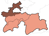
| Province | Sughd |
| Founded | 7th century |
| Government | |
| • Type | Republic |
| • Chief | Shamsiddinov Hiloliddin |
| Area | |
| • Town and Jamoat | 67 km2 (26 sq mi) |
| • Urban | 829 km2 (320 sq mi) |
| Elevation[1] | 410 m (1,350 ft) |
| Population (2007 est.)[2] | |
| • Urban | 47,100 |
| Time zone | UTC+5 |
| Website | www.konibodom.tj |
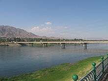
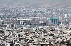
Konibodom (Tajik: Конибодом; Persian: کانیبادام) is a city and jamoat in the Sughd province of northern Tajikistan, in western Fergana Valley.[1] It has a population of 47,100 (2007 Estimate).[2]
Geography
Climate
The Köppen Climate Classification sub-type for Konibodom is "BSk" or a Tropical and Subtropical Steppe Climate. The average annual temperature is 14°C (57.2°F). The warmest month is July with an average temperature of 27.4°C (81.3°F) and the coolest month is January with an average temperature of -0.6°C (30.9°F). The average annual precipitation is 465.5mm (18.3") and has an average of 68.9 days with precipitation. The wettest month is March with an average of 77.7mm (3.1") of precipitation and the driest month is August with an average of 1.9mm (0.08") of precipitation.[1]
| Climate data for Konibodom | |||||||||||||
|---|---|---|---|---|---|---|---|---|---|---|---|---|---|
| Month | Jan | Feb | Mar | Apr | May | Jun | Jul | Aug | Sep | Oct | Nov | Dec | Year |
| Daily mean °C (°F) | −0.6 (30.9) |
1.7 (35.1) |
8.6 (47.5) |
16.0 (60.8) |
21.0 (69.8) |
25.6 (78.1) |
27.4 (81.3) |
25.3 (77.5) |
20.4 (68.7) |
13.8 (56.8) |
7.3 (45.1) |
1.9 (35.4) |
14.0 (57.2) |
| Average precipitation mm (inches) | 52.1 (2.051) |
54.9 (2.161) |
77.7 (3.059) |
69.9 (2.752) |
52.3 (2.059) |
12.0 (0.472) |
7.7 (0.303) |
1.9 (0.075) |
5.0 (0.197) |
39.7 (1.563) |
43.0 (1.693) |
49.3 (1.941) |
465.5 (18.327) |
| Average precipitation days (≥ 0.1 mm) | 7.6 | 8.0 | 9.4 | 9.1 | 8.1 | 3.6 | 1.9 | 1.1 | 1.7 | 5.1 | 6.0 | 7.3 | 68.9 |
| Average relative humidity (%) | 75.7 | 73.0 | 65.1 | 58.1 | 49.9 | 39.2 | 39.5 | 43.1 | 46.1 | 56.7 | 66.8 | 75.3 | 57.4 |
| Source: "The Climate of Konibodom". Weatherbase. Retrieved 4 August 2014. | |||||||||||||
References
Coordinates: 40°17′N 70°25′E / 40.283°N 70.417°E
| Rank | Name | Administrative division | Pop. | ||||||
|---|---|---|---|---|---|---|---|---|---|
 Dushanbe 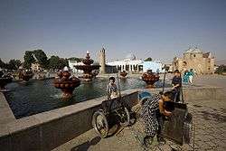 Khujand |
1 | Dushanbe | Dushanbe | 775,800 | 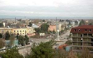 Qurghonteppa  Kulob | ||||
| 2 | Khujand | Sughd | 169,700 | ||||||
| 3 | Qurghonteppa | Khatlon | 101,600 | ||||||
| 4 | Kulob | Khatlon | 99,700 | ||||||
| 5 | Istaravshan | Sughd | 58,600 | ||||||
| 6 | Vahdat | Region of Republican Subordination | 52,900 | ||||||
| 7 | Tursunzoda | Region of Republican Subordination | 50,900 | ||||||
| 8 | Konibodom | Sughd | 48,900 | ||||||
| 9 | Isfara | Sughd | 45,900 | ||||||
| 10 | Panjakent | Sughd | 40,000 | ||||||