Komi Republic
| Komi Republic Республика Коми (Russian) Коми Республика (Komi) | |||
|---|---|---|---|
| — Republic — | |||
| |||
|
| |||
| |||
|
| |||
| Political status | |||
| Country | Russia | ||
| Federal district | Northwestern[2] | ||
| Economic region | Northern[3] | ||
| Established | December 5, 1936[4] | ||
| Capital | Syktyvkar | ||
| Government (as of January 2014) | |||
| • Head[5] | Sergey Gaplikov[6] | ||
| • Legislature | State Council[5] | ||
| Statistics | |||
| Area (as of the 2002 Census)[7] | |||
| • Total | 415,900 km2 (160,600 sq mi) | ||
| Area rank | 13th | ||
| Population (2010 Census)[8] | |||
| • Total | 901,189 | ||
| • Rank | 58th | ||
| • Density[9] | 2.17/km2 (5.6/sq mi) | ||
| • Urban | 76.9% | ||
| • Rural | 23.1% | ||
| Population (January 2013 est.) | |||
| • Total | 880,639[10] | ||
| Time zone(s) | MSK (UTC+03:00)[11] | ||
| ISO 3166-2 | RU-KO | ||
| License plates | 11 | ||
| Official languages | Russian;[12] Komi[13] | ||
| Official website | |||


The Komi Republic (Russian: Респу́блика Ко́ми, Respublika Komi; Komi: Коми Республика, Komi Respublika) is a federal subject of Russia (a republic). Its capital is the city of Syktyvkar. Population: 901,189 (2010 Census).[8]
Geography
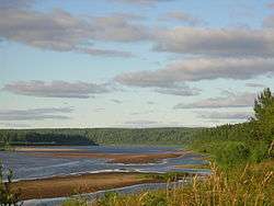
The republic is situated to the west of the Ural mountains, in the north-east of the East European Plain. Forests cover over 70% of the territory and swamps cover approximately 15%.
- Area: 415,900 square kilometers (160,600 sq mi)
- Borders (all internal): Nenets (NW/N), Yamalo-Nenets (NE/E), Khanty–Mansi (E), Sverdlovsk (SE), Perm Krai (S), Kirov (S/SW), and Arkhangelsk (W).
- Highest point: Mount Narodnaya (1,894 m)
- Maximum N→S distance: 785 kilometers (488 mi)
- Maximum E→W distance: 695 kilometers (432 mi)
Rivers
Major rivers include:
Lakes
There are many lakes in the republic. Major lakes include:
- Sindorskoye Lake
- Yam-Ozero Lake
Natural resources
The republic's natural resources include coal, oil, natural gas, gold, diamonds and timber. Native reindeer are in abundance, and have been intentionally bred for human usage by the indigenous population.
Around 32,800 km² of mostly boreal forest (as well as some alpine tundra and meadows) in the Republic's Northern Ural Mountains have been recognized in 1995 as a UNESCO World Heritage site, Virgin Komi Forests. It is the first natural UNESCO World Heritage site in Russia and the largest expanse of virgin forests in Europe. The site includes two pre-existing protected areas: Pechora-Ilych Nature Reserve (created in 1930) and Yugyd Va National Park (created in 1994).
Climate
Winters in the republic are long and cold, and the summers, while short, are quite warm.
- Average January temperature: −17 °C (1 °F) (southern parts) to −20 °C (−4 °F) (northern parts)
- Average July temperature: 11 °C (52 °F) (northern parts) to 15 °C (59 °F) (southern parts)
- Lowest recorded temperature: −58.1 °C (−72.6 °F) (village of Ust-Shchuger)
- Average annual precipitation: 625 mm (24.6 in)
Manpupuner and the 7 Strong Men rock formations
Deemed one of the Seven Wonders of Russia, Komi Republic is home to Manpupuner (Man-Pupu-Nyer), a mysterious site in the northern Ural mountains, in the Troitsko-Pechorsky District, made out of seven rock towers bursting out of the flat plateau known as the "7 Strong Men." Manpupuner is a very popular attraction in Russia, but not on an international level. Information regarding its origin is scarce. We know however that their height and abnormal shapes make the top of these rock giants inaccessible even to experienced rock-climbers.
Administrative divisions
History

The Komi first appear in the records of the Novgorod Republic in the 12th century, when Novgorodian (East Slavic) traders travelled to the Perm region in search of furs and animal hides. The Komi territories came under the influence of Muscovy in the late Middle Ages (late 15th to early 16th centuries). The site of Syktyvkar has been settled since the 16th century. It was known as Sysolskoye (Сысольскoe). In 1780, under Catherine the Great, it was renamed to Ust-Sysolsk (Усть-Сысольск) and used as a penal colony.
Starting from the expedition led by Alexander von Keyserling in 1843, the Komi territory was most extensively explored in the 19th and the beginning of the 20th centuries by the Russians, who found ample reservoirs of various minerals, as well as timber, to exploit. After the founding of the Soviet Union, the Komi-Zyryan Autonomous Oblast was established on August 22, 1921,[14] and on December 5, 1936, it was reorganized into the Komi Autonomous Soviet Socialist Republic with its administrative center located at the town of Syktyvkar.
Many of the "settlers" who came in the early 20th century were prisoners of the Gulag who were sent by the hundreds of thousands to perform forced labor in the Arctic regions of the USSR. Towns sprang up around labor-camp sites, which were initially carved out of the untouched tundra and taiga by gangs of prisoners. The first mine, "Rudnik No. 1," became the city of Vorkuta, and the other towns of the region have similar origins: "Prisoners planned and built all of the republic's major cities, not just Ukhta but also Syktyvkar, Pechora, Vorkuta, and Inta. Prisoners built Komi's railways and roads, as well as its original industrial infrastructure."[15]
Demographics
Population
Population: 901,189 (2010 Census);[8] 1,018,674 (2002 Census);[16] 1,261,024 (1989 Census).[17]
| 17-12-1926 | 17-01-1939 | 17-01-1959 | 15-01-1970 | 17-01-1979 | 17-01-1989 | 09-10-2002 | 14-10-2010 | |
|---|---|---|---|---|---|---|---|---|
| Total population | 207,314 | 318,996 | 806,199 | 964,802 | 1,110,361 | 1,250,847 | 1,018,674 | 901,189 |
| Average annual population growth | +1.7% | +1.6% | +1.3% | -1.6% | -1.5% | |||
| Males | 46% | 49% | 52% | 50% | 51% | 50% | 48% | |
| Females | 54% | 51% | 48% | 50% | 49% | 50% | 52% | |
| Females per 1000 males | ||||||||
| Proportion urban | 4.4% | 9.1% | 59.4% | 61.9% | 70.8% | 75.5% | 75.3% | |
| Territory (km2) | 434,150 | 415,900 | 415,900 | 415,900 | 415,900 | 415,900 | 415,900 | 415,900 |
| Population density/km2 | 0.5 | 0.8 | 1.9 | 2.3 | 2.7 | 3.0 | 2.4 | 2.2 |
Vital statistics
| Average population (x 1000) | Live births | Deaths | Natural change | Crude birth rate (per 1000) | Crude death rate (per 1000) | Natural change (per 1000) | Total fertlity rate | |
|---|---|---|---|---|---|---|---|---|
| 1920 | 4 760 | 4 353 | 407 | |||||
| 1930 | 10 256 | 6 574 | 3 682 | |||||
| 1940 | 14 976 | 12 134 | 2 842 | |||||
| 1945 | 6 432 | 6 185 | 247 | |||||
| 1950 | 534 | 20 087 | 6 002 | 14 085 | 37.6 | 11.2 | 26.4 | |
| 1960 | 836 | 25 578 | 5 010 | 20 568 | 30.6 | 6.0 | 24.6 | |
| 1965 | 938 | 18 956 | 5 241 | 13 715 | 20.2 | 5.6 | 14.6 | |
| 1970 | 970 | 16 462 | 6 276 | 10 186 | 17.0 | 6.5 | 10.5 | |
| 1975 | 1 044 | 18 899 | 7 284 | 11 615 | 18.1 | 7.0 | 11.1 | |
| 1980 | 1 137 | 20 685 | 9 169 | 11 516 | 18.2 | 8.1 | 10.1 | |
| 1981 | 1 153 | 21 244 | 9 103 | 12 141 | 18.4 | 7.9 | 10.5 | |
| 1982 | 1 169 | 23 420 | 8 758 | 14 662 | 20.0 | 7.5 | 12.5 | |
| 1983 | 1 185 | 23 806 | 9 250 | 14 556 | 20.1 | 7.8 | 12.3 | |
| 1984 | 1 199 | 24 217 | 9 486 | 14 731 | 20.2 | 7.9 | 12.3 | |
| 1985 | 1 213 | 23 303 | 9 334 | 13 969 | 19.2 | 7.7 | 11.5 | |
| 1986 | 1 228 | 24 176 | 8 112 | 16 064 | 19.7 | 6.6 | 13.1 | |
| 1987 | 1 242 | 23 616 | 8 544 | 15 072 | 19.0 | 6.9 | 12.1 | |
| 1988 | 1 256 | 20 916 | 8 930 | 11 986 | 16.7 | 7.1 | 9.5 | |
| 1989 | 1 256 | 18 481 | 8 857 | 9 624 | 14.7 | 7.1 | 7.7 | |
| 1990 | 1 244 | 16 930 | 9 321 | 7 609 | 13.6 | 7.5 | 6.1 | 1.873 |
| 1991 | 1 231 | 15 589 | 9 665 | 5 924 | 12.7 | 7.9 | 4.8 | |
| 1992 | 1 214 | 13 880 | 11 426 | 2 454 | 11.4 | 9.4 | 2.0 | |
| 1993 | 1 199 | 12 158 | 14 642 | - 2 484 | 10.1 | 12.2 | - 2.1 | |
| 1994 | 1 174 | 11 835 | 16 074 | - 4 239 | 10.1 | 13.7 | - 3.6 | |
| 1995 | 1 145 | 11 105 | 15 057 | - 3 952 | 9.7 | 13.2 | - 3.5 | 1.317 |
| 1996 | 1 124 | 10 900 | 13 674 | - 2 774 | 9.7 | 12.2 | - 2.5 | |
| 1997 | 1 106 | 10 388 | 12 244 | - 1 856 | 9.4 | 11.1 | - 1.7 | |
| 1998 | 1 087 | 10 793 | 11 545 | - 752 | 9.9 | 10.6 | - 0.7 | |
| 1999 | 1 068 | 9 680 | 12 253 | - 2 573 | 9.1 | 11.5 | - 2.4 | |
| 2000 | 1 050 | 9 906 | 13 594 | - 3 688 | 9.4 | 12.9 | - 3.5 | 1.219 |
| 2001 | 1 036 | 10 325 | 13 968 | - 3 643 | 10.0 | 13.5 | - 3.5 | 1.272 |
| 2002 | 1 021 | 11 177 | 15 265 | - 4 088 | 10.9 | 15.0 | - 4.0 | 1.374 |
| 2003 | 1 004 | 11 462 | 15 810 | - 4 348 | 11.4 | 15.8 | - 4.3 | 1.401 |
| 2004 | 987 | 11 489 | 15 210 | - 3 721 | 11.6 | 15.4 | - 3.8 | 1.397 |
| 2005 | 971 | 10 975 | 15 074 | - 4 099 | 11.3 | 15.5 | - 4.2 | 1.332 |
| 2006 | 955 | 10 872 | 13 519 | - 2 647 | 11.4 | 14.1 | - 2.8 | 1.318 |
| 2007 | 941 | 11 523 | 12 304 | - 781 | 12.2 | 13.1 | - 0.8 | 1.406 |
| 2008 | 928 | 11 719 | 12 270 | - 551 | 12.6 | 13.2 | - 0.6 | 1.452 |
| 2009 | 916 | 11 868 | 12 182 | - 314 | 13.0 | 13.3 | - 0.3 | 1.62 |
| 2010 | 903 | 11 648 | 11 819 | - 171 | 12.9 | 13.1 | - 0.2 | 1.63 |
| 2011 | 11 715 | 11 097 | + 443 | 13.0 | 12.4 | + 0.6 | 1.71 | |
| 2012 | 890 | 12 418 | 10 830 | + 1 588 | 14.0 | 12.2 | + 1.8 | 1.88 |
| 2013 | 876 | 12 436 | 10 484 | + 1 952 | 14.2 | 12.0 | + 2.2 | 1.96 |
| 2014 | 868 | 12 291 | 10 621 | + 1 670 | 14.2 | 12.2 | + 2.0 | 2.01 |
| 2015 | 861 | 11 797 | 10 666 | + 1 131 | 13.6 | 12.3 | + 1.3 | 2.00(e) |
Regional vital statistics for 2011
Source:[18]
| District | Birth Rate | Death Rate | Natural Growth Rate | Whites as % of Pop | Native Komi and Nenets as % of Pop |
|---|---|---|---|---|---|
| Komi Republic | 13.0 | 12.4 | 96.05% | 3.95% | |
| Syktyvkar | 12.5 | 10.2 | 97.61% | 2.39% | |
| Vorkuta | 11.8 | 9.7 | 92.33% | 7.67% | |
| Vuktyl | 11.2 | 12.6 | 95.27% | 4.73% | |
| Inta | 11.1 | 12.6 | 95.40% | 4.60% | |
| Pechora | 13.0 | 13.6 | 96.89% | 3.11% | |
| Sosnogorsk | 12.6 | 14.4 | 97.02% | 2.98% | |
| Usinsk | 14.7 | 9.0 | 86.04% | 13.96% | |
| Ukhta | 11.0 | 10.7 | 96.20% | 3.80% | |
| Izhemsky | 19.1 | 18.8 | 99.62% | 0.38% | |
| Knyazhpogostsky | 11.6 | 15.9 | 95.50% | 4.50% | |
| Koygorodsky | 16.2 | 18.3 | 97.89% | 2.11% | |
| Kortkerossky | 16.9 | 18.6 | 98.86% | 1.14% | |
| Priluzsky | 15.6 | 18.4 | 98.98% | 1.02% | |
| Syktyvdinsky | 17.3 | 13.3 | 98.11% | 1.89% | |
| Sysolsky | 16.4 | 17.6 | 98.37% | 1.63% | |
| Troitsko-Pechorsky | 14.0 | 17.9 | 97.80% | 2.20% | |
| Udorsky | 15.6 | 13.1 | 95.33% | 4.67% | |
| Ust-Vymsky | 12.0 | 15.8 | 96.48% | 3.52% | |
| Ust-Kulomsky | 19.2 | 18.9 | 98.96% | 1.04% | |
| Ust-Tsilemsky | 16.1 | 15.4 | 99.62% | 0.38% | |
Ethnic groups
According to the 2010 Census,[8] ethnic Russians make up 65.1% of the republic's population, while the ethnic Komi are only 23.7%. Other groups include Ukrainians (4.2%), Tatars (1.3%), Belarusians (1%), Ethnic Germans (0.6%), Chuvash (0.6%), Azeris (0.6%), and a host of smaller groups, each accounting for less than 0.5% of the total population.
| Ethnic group |
1926 census (1926 territory)1 |
1926 census (present territory) |
1939 census | 1959 census | 1970 census | 1979 census | 1989 census | 2002 census | 2010 census2 | |||||||||
|---|---|---|---|---|---|---|---|---|---|---|---|---|---|---|---|---|---|---|
| Number | % | Number | % | Number | % | Number | % | Number | % | Number | % | Number | % | Number | % | Number | % | |
| Komi | 191,245 | 92.2% | 195,400 | 86.9% | 231,301 | 72.5% | 245,074 | 30.4% | 276,178 | 28.6% | 280,798 | 25.3% | 291,542 | 23.3% | 256,464 | 25.2% | 202,348 | 23.7% |
| Russians | 13,731 | 6.6% | 28,300 | 12.6% | 70,226 | 22.0% | 389,995 | 48.4% | 512,203 | 53.1% | 629,523 | 56.7% | 721,780 | 57.7% | 607,021 | 59.6% | 555,963 | 65.1% |
| Ukrainians | 34 | 0.0% | 200 | 0.1% | 6,010 | 1.9% | 80,132 | 9.9% | 82,955 | 8.6% | 94,154 | 8.5% | 104,170 | 8.3% | 62,115 | 6.1% | 36,082 | 4.2% |
| Nenets | 2,080 | 1.0% | 1,000 | 0.4% | 508 | 0.2% | 374 | 0.0% | 369 | 0.0% | 366 | 0.0% | 376 | 0.0% | 708 | 0.1% | ||
| Tatars | 33 | 0.0% | 709 | 0.2% | 8,459 | 1.0% | 11,906 | 1.2% | 17,836 | 1.6% | 25,980 | 2.1% | 15,680 | 1.5% | 10,779 | 1.3% | ||
| Belarusians | 11 | 0.0% | 3,323 | 1.0% | 22,339 | 2.8% | 24,706 | 2.6% | 24,763 | 2.2% | 26,730 | 2.1% | 15,212 | 1.5% | 8,859 | 1.0% | ||
| Others | 180 | 0.1% | 6,919 | 2.2% | 59,826 | 7.4% | 56,485 | 5.9% | 62,921 | 5.7% | 80,269 | 6.4% | 61,474 | 6.0% | 40,272 | 4.7% | ||
| 1 The territory of the Komi AO was different from the Komi Republic.
2 Excluding 46,886 people who were registered from administrative databases, and could not declare an ethnicity. It is estimated that the proportion of ethnicities in this group is the same as that of the declared group.[19] | ||||||||||||||||||
Religion

According to a 2012 official survey[20] 30.2% of the population of Komi adheres to the Russian Orthodox Church, 4% are unaffiliated generic Christians, 1% are Rodnovers or Komi native religious believers, 1% are Muslims, 1% are Orthodox Christians not belonging to churches or members of non-Russian Orthodox churches, 1% are Old Believers, and 0.4% are members of the Catholic Church. In addition, 41% of the population declared to be "spiritual but not religious", 14% is atheist, and 6.4% follows other religions or failed to answer the question.[20]
Politics
The head of government in the Komi Republic is the Head of the Republic. As of 2010, the head of the republic is Vyacheslav Gayzer.
The State Council is the legislature.
Economy
The Komi Republic's major industries include oil processing, timber, woodworking, natural gas and electric power industries. Major industrial centers are Syktyvkar, Inta, Pechora, Sosnogorsk, Ukhta, and Vorkuta.
Natural gas transportation and distribution is conducted by Komigaz.
Transportation
Railroad transportation is very well developed. The most important railroad line is Kotlas–Vorkuta–Salekhard, which is used to ship most goods in and out of the republic. The rivers Vychegda and Pechora are navigable. There are airports in Syktyvkar, Ukhta, and Vorkuta.
In 1997, total railroad trackage was 1,708 km, automobile roads 4,677 km.
Education
There are over 450 secondary schools in the republic (with ~180,000 students). The most important higher education facilities include Syktyvkar State University and Ukhta State Technical University.
Sports
Stroitel used to play in Russian Bandy Super League for a long time. Now the team plays in Russian Bandy Supreme League, the second highest division. In 2016 the authorities presented a five-year plan to develop bandy in the republic.
See also
- Music of the Komi Republic
- Komi-Permyak Okrug
- Komi mythology
- Udoria
- Extreme points of Europe
- Valery Leontiev
References
Notes
- ↑ Law #XII-20/5
- ↑ Президент Российской Федерации. Указ №849 от 13 мая 2000 г. «О полномочном представителе Президента Российской Федерации в федеральном округе». Вступил в силу 13 мая 2000 г. Опубликован: "Собрание законодательства РФ", №20, ст. 2112, 15 мая 2000 г. (President of the Russian Federation. Decree #849 of May 13, 2000 On the Plenipotentiary Representative of the President of the Russian Federation in a Federal District. Effective as of May 13, 2000.).
- ↑ Госстандарт Российской Федерации. №ОК 024-95 27 декабря 1995 г. «Общероссийский классификатор экономических регионов. 2. Экономические районы», в ред. Изменения №5/2001 ОКЭР. (Gosstandart of the Russian Federation. #OK 024-95 December 27, 1995 Russian Classification of Economic Regions. 2. Economic Regions, as amended by the Amendment #5/2001 OKER. ).
- ↑ Komi ASSR. Administrative-Territorial Structure, p. 5
- 1 2 Constitution, Article 8
- ↑ Official website of the Komi Republic. Sergey Gaplikov (Russian)
- ↑ Федеральная служба государственной статистики (Federal State Statistics Service) (2004-05-21). "Территория, число районов, населённых пунктов и сельских администраций по субъектам Российской Федерации (Territory, Number of Districts, Inhabited Localities, and Rural Administration by Federal Subjects of the Russian Federation)". Всероссийская перепись населения 2002 года (All-Russia Population Census of 2002) (in Russian). Federal State Statistics Service. Retrieved 2011-11-01.
- 1 2 3 4 Russian Federal State Statistics Service (2011). "Всероссийская перепись населения 2010 года. Том 1" [2010 All-Russian Population Census, vol. 1]. Всероссийская перепись населения 2010 года (2010 All-Russia Population Census) (in Russian). Federal State Statistics Service. Retrieved June 29, 2012.
- ↑ The density value was calculated by dividing the population reported by the 2010 Census by the area shown in the "Area" field. Please note that this value may not be accurate as the area specified in the infobox is not necessarily reported for the same year as the population.
- ↑ Komi Republic Territorial Branch of the Federal State Statistics Service. Оценка численности населения по городам, районам, городским населённым пунктам Республики Коми на 1 января 2012 г., 2013 г. и в среднем за 2012 год (Russian)
- ↑ Правительство Российской Федерации. Федеральный закон №107-ФЗ от 3 июня 2011 г. «Об исчислении времени», в ред. Федерального закона №271-ФЗ от 03 июля 2016 г. «О внесении изменений в Федеральный закон "Об исчислении времени"». Вступил в силу по истечении шестидесяти дней после дня официального опубликования (6 августа 2011 г.). Опубликован: "Российская газета", №120, 6 июня 2011 г. (Government of the Russian Federation. Federal Law #107-FZ of June 31, 2011 On Calculating Time, as amended by the Federal Law #271-FZ of July 03, 2016 On Amending Federal Law "On Calculating Time". Effective as of after sixty days following the day of the official publication.).
- ↑ Official on the whole territory of Russia according to Article 68.1 of the Constitution of Russia.
- ↑ Constitution of the Komi Republic, Article 67
- ↑ Коми Автономная Советская Социалистическая Республика. Great Soviet Encyclopedia.
- ↑ Anne Applebaum, Gulag: A History (Random House, Inc., 2004: ISBN 1-4000-3409-4), pp. 78, 82.
- ↑ Russian Federal State Statistics Service (May 21, 2004). "Численность населения России, субъектов Российской Федерации в составе федеральных округов, районов, городских поселений, сельских населённых пунктов – районных центров и сельских населённых пунктов с населением 3 тысячи и более человек" [Population of Russia, Its Federal Districts, Federal Subjects, Districts, Urban Localities, Rural Localities—Administrative Centers, and Rural Localities with Population of Over 3,000] (XLS). Всероссийская перепись населения 2002 года [All-Russia Population Census of 2002] (in Russian). Retrieved August 9, 2014.
- ↑ Demoscope Weekly (1989). "Всесоюзная перепись населения 1989 г. Численность наличного населения союзных и автономных республик, автономных областей и округов, краёв, областей, районов, городских поселений и сёл-райцентров" [All Union Population Census of 1989: Present Population of Union and Autonomous Republics, Autonomous Oblasts and Okrugs, Krais, Oblasts, Districts, Urban Settlements, and Villages Serving as District Administrative Centers]. Всесоюзная перепись населения 1989 года [All-Union Population Census of 1989] (in Russian). Институт демографии Национального исследовательского университета: Высшая школа экономики [Institute of Demography at the National Research University: Higher School of Economics]. Retrieved August 9, 2014.
- ↑ http://www.gks.ru/dbscripts/munst/munst87/DBInet.cgi
- ↑ http://www.perepis-2010.ru/news/detail.php?ID=6936
- 1 2 3 Arena - Atlas of Religions and Nationalities in Russia. Sreda.org
- ↑ 2012 Survey Maps. "Ogonek", № 34 (5243), 27/08/2012. Retrieved 24-09-2012.
Sources
- 17 февраля 1994 г. «Конституция Республики Коми», в ред. Закона №67-РЗ от 23 октября 2015 г. «О внесении изменений в Конституцию Республики Коми». Вступил в силу 10 марта 1994 г. (за исключением отдельных положений). Опубликован: "Красное знамя", №45, 10 марта 1994 г. (February 17, 1994 Constitution of the Komi Republic, as amended by the Law #67-RZ of October 23, 2015 On Amending the Constitution of the Komi Republic. Effective as of March 10, 1994 (with the exception of several clauses).).
- Государственный Совет Республики Коми. Закон №XII-20/5 от 6 июня 1994 г. «О государственном гимне Республики Коми», в ред. Закона №44-РЗ от 4 июля 2006 г «О внесении изменений и дополнения в Закон Республики Коми "О Государственном гимне Республики Коми"». Вступил в силу 11 июня 1994 г. (за исключением отдельных положений). Опубликован: "Красное Знамя", №109, 11 июня 1994 г. (State Council of the Komi Republic. Law #XII-20/5 of June 6, 1994 On the State Anthem of the Komi Republic, as amended by the Law #44-RZ of July 4, 2006 On Amending and Supplementing the Law of the Komi Republic "On the State Anthem of the Komi Republic". Effective as of June 11, 1994 (with the exception of certain clauses).).
- "Коми АССР. Административно-территориальное деление на 1 июля 1968 г." Коми книжное издательство. Сыктывкар, 1968. (Komi ASSR. Administrative-Territorial Structure as of July 1, 1968)
Further reading
- Pearson, M., Ojanen, P., Havimo, M., Kuuluvainen, T. & Vasander, H. (eds.) 2007. On the European Edge — Journey through Komi Nature and Culture. University of Helsinki Department of Forest Ecology Publications 36. 216 p. ISBN 978-952-10-3898-3.
- Strogoff, M., Brochet, P. & Auzias, D. 2005. Guidebook Komi Republic. Avant-Garde Publishers, Moscow. 176. p. ISBN 5-86394-255-X.
External links
| Wikimedia Commons has media related to Komi. |
- (Russian) Official site of the Republic of Komi
- (Russian) All news of the Republic of Komi
- (Russian) Website of Syktyvkar City - The Capital of the Republic of Komi
- (Russian) Official website of the Vorkuta City
- Official site of the Syktyvkar State University)
- (Russian) Official site of the Syktyvkar State University)
- (Russian) Official site of the Ukhta State Technical University
- (Russian) Snowboarding in Komi Republic
- (Russian) History Komi
- Map of the Komi Republic
- Historic-demographic note on the Nenets of the Komi Republic
- Virgin Komi Forests at Natural Heritage Protection Fund
| |||||||||||||||||||||||||||||||
| |||||||||||||||||||||||||||||||
