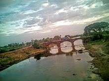
Kolakaluru
| Kolakaluru కొలకలూరు | |
|---|---|
| Village | |
|
Kolakaluru railway station signboard | |
 Kolakaluru Location in Andhra Pradesh, India | |
| Coordinates: 16°18′19″N 80°37′06″E / 16.3052°N 80.6182°ECoordinates: 16°18′19″N 80°37′06″E / 16.3052°N 80.6182°E | |
| Country | India |
| State | Andhra Pradesh |
| District | Guntur |
| Mandal | Tenali |
| Government[1] | |
| • Type | Panchayati raj |
| • Body | Kolakaluru gram panchayat |
| • Sarpanch | Kalisetty Lakshmi Nancharamma |
| Area[2] | |
| • Total | 250 km2 (100 sq mi) |
| Elevation[3] | 17 m (56 ft) |
| Population (2011)[4] | |
| • Total | 15,607 |
| • Density | 62/km2 (160/sq mi) |
| Languages | |
| • Official | Telugu |
| Time zone | IST (UTC+5:30) |
| PIN | 522307 |

Kolakaluru is a village in Guntur district of the Indian state of Andhra Pradesh. It is located in Tenali mandal of Tenali revenue division.[2][5]
History
The 13th and 14th century inscriptions related to Chola dynasty, Prataparudra II on temples and excavation of ancient treasures, depicts the historical significance of the region around the village.[6]
Geography
Kolakaluru is located at 16°18′19″N 80°37′06″E / 16.3052°N 80.6182°E and at an altitude of 14 m (46 ft).[3] The village is spread over an area of 250 km2 (97 sq mi).[2]
Demographics
As of 2011 census, Kolakaluru had a population of 15,607. The total population constitute, 7,731 males and 7,876 females —a sex ratio of 1019 females per 1000 males. 1,500 children are in the age group of 0–6 years, of which 758 are boys and 742 are girls. The average literacy rate stands at 70.89% with 10,001 literates, significantly higher than the state average of 67.41%.[4][7]
Government and politics
Kolakaluru gram panchayat is the local self-government of the village.[1][8] The panchayat is divided into wards and each ward is represented by an elected ward member. The ward members are headed by a sarpanch and the present sarpanch is Kalisetty Lakshmi Nancharamma.[9][10] B.Srinivasa Rao is the secretary of the panchayat.[11]
Kolakaluru in Tenali mandal is represented by Tenali assembly constituency of Andhra Pradesh Legislative Assembly.[12] The present MLA representing the constituency is Alapati Rajendra Prasad of Telugu Desam Party.[13]
Transport

Guntur-Nandivelugu road passes through the village and connects it with the district headquarter.[14] Kolakaluru railway station is situated on the mutual Howrah-Chennai and New Delhi–Chennai main lines. It is administered under Vijayawada railway division of South Central Railway zone.[15]
Education
The primary and secondary school education is imparted by government, aided and private schools, under the School Education Department of the state.[16][17] The total number of students enrolled in primary, upper primary and high schools of the village are 1,731.[18]
There are 15 schools which include, six private, eight Mandal Parishad and ZPHS, an other type of school as well.[19][20][21]
See also
References
- 1 2 "Kolakaluru Village Panchayat". National Panchayat Portal. Retrieved 6 May 2016.
- 1 2 3 "District Census Handbook – Guntur" (PDF). Census of India. The Registrar General & Census Commissioner. pp. 14,408. Retrieved 13 May 2016.
- 1 2 "Maps, Weather, and Airports for Kolakaluru, India". fallingrain.com.
- 1 2 "Census 2011". The Registrar General & Census Commissioner, India. Retrieved 26 July 2014.
- ↑ "District Level Mandal wise List of Villages in Andhra Pradesh" (PDF). Chief Commissioner of Land Administration. Retrieved 23 June 2016.
- ↑ A Manual of the Kistna District, in the Presidency of Madras: Compiled for the Government of Madras. Lawrence Asylum Press. 1883. p. 213. Retrieved 4 July 2016.
- ↑ "Literacy of AP (Census 2011)" (PDF). Official Portal of Andhra Pradesh Government. p. 43. Retrieved 5 September 2014.
- ↑ "Gram Panchayat Identification Codes" (PDF). Saakshar Bharat Mission. p. 120. Retrieved 5 July 2016.
- ↑ Social Science. Vk Publications. p. 117. ISBN 9788179732144.
- ↑ "List of elected Sarpanchas in Grampanchayat of Guntur district, 2013" (PDF). State Election Commission. Retrieved 5 June 2016.
- ↑ "Local Body Officials of DUGGIRALA Grama Panchayat". Area Profiler. Retrieved 7 May 2016.
- ↑ "Delimitation of Parliamentary and Assembly Constituencies Order, 2008" (pdf). Election Commission of India. p. 22. Retrieved 11 October 2014.
- ↑ "Member's Report". Andhra Pradesh Legislature Assembly. Retrieved 12 October 2014.
- ↑ "Traffic restrictions for TDP meet". The Hindu. 2008-11-05. ISSN 0971-751X. Retrieved 2016-05-12.
- ↑ "Kolakalur railway station info". India Rail Info. Retrieved 30 July 2014.
- ↑ "School Education Department" (PDF). School Education Department, Government of Andhra Pradesh. Retrieved 7 November 2016.
- ↑ "The Department of School Education – Official AP State Government Portal | AP State Portal". www.ap.gov.in. Retrieved 7 November 2016.
- ↑ "Student Information Report". Commissionerate of School Education. Child info 2015–16, District School Education – Andhra Pradesh. Retrieved 8 November 2016.
- ↑ "CSE". cse.ap.gov.in. Retrieved 28 November 2016.
- ↑ "DSE - Department of School Education". cse.ap.gov.in. Retrieved 28 November 2016.
- ↑ "DCEB,Guntur". dcebguntur.com. Retrieved 28 November 2016.
| Wikimedia Commons has media related to Kolakaluru. |