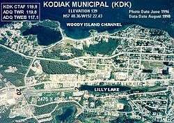
Kodiak Municipal Airport
| Kodiak Municipal Airport | |||||||||||
|---|---|---|---|---|---|---|---|---|---|---|---|
 | |||||||||||
| IATA: KDK – ICAO: PAKD – FAA LID: KDK | |||||||||||
| Summary | |||||||||||
| Airport type | Public | ||||||||||
| Owner | City of Kodiak | ||||||||||
| Serves | Kodiak, Alaska | ||||||||||
| Elevation AMSL | 139 ft / 42 m | ||||||||||
| Coordinates | 57°48′21″N 152°22′26″W / 57.80583°N 152.37389°W | ||||||||||
| Runways | |||||||||||
| |||||||||||
| Statistics (2006) | |||||||||||
| |||||||||||
Kodiak Municipal Airport (IATA: KDK[2], ICAO: PAKD[3], FAA LID: KDK) is a city-owned public-use airport located two nautical miles (4 km) northeast of the central business district of Kodiak, a city on Kodiak Island in the U.S. state of Alaska.[1]
The FAA's National Plan of Integrated Airport Systems for 2007-2011 categorized this as commercial service airport.[4] However, that classification last applied in calendar year 2004 when the airport had 6,963 passenger boardings (enplanements). That number decreased to 703 in 2005, 6 in 2006, and none in 2007.[5]
Facilities and aircraft
Kodiak Municipal Airport has one runway designated 2/20 with a 2,475 by 40 ft (754 x 12 m) asphalt and gravel surface.[1] For the 12-month period ending December 31, 2006, the airport had 300 aircraft operations, an average of 25 per month, all of which were general aviation.[1]
Four years prior to that the airport had 11,200 aircraft operations in 12 months, 54% general aviation and 46% air taxi.[6]
References
- 1 2 3 4 FAA Airport Master Record for KDK (Form 5010 PDF), effective 2008-07-31.
- ↑ KDK: Kodiak Municipal Airport, Alaska. Aviation Safety Network. Retrieved 2008-09-17.
- ↑ PAKD: Kodiak Municipal Airport, Alaska. AirNav.com. Retrieved 2008-09-17.
- ↑ National Plan of Integrated Airport Systems: 2007-2011. Federal Aviation Administration. 2006-10-06.
- ↑ Passenger Boarding and All-Cargo Data. Federal Aviation Administration. Retrieved 2008-09-17.
- ↑ FAA Airport Master Record for KDK, retrieved 2007-03-15.
External links
- Alaska FAA airport diagram (GIF)
- Resources for this airport:
- Airport information for KDK at AirNav
- Aeronautical chart for KDK at SkyVector
- Accident history for KDK at Aviation Safety Network