Kobryn
| Kobryn Кобрын | |||
|---|---|---|---|
|
Kobryn, centre of town | |||
| |||
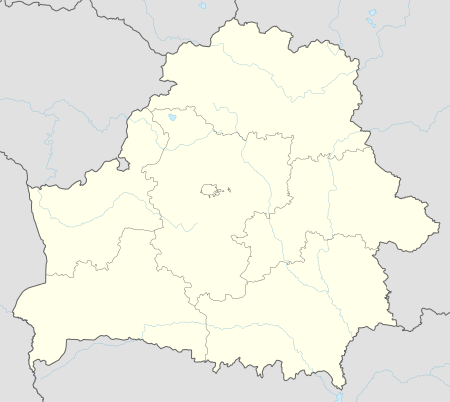 Kobryn Location in Belarus | |||
| Coordinates: 52°13′0″N 24°22′0″E / 52.21667°N 24.36667°E | |||
| Country |
| ||
| Region | Brest Region | ||
| District | Kobryn District | ||
| Founded | 1287 | ||
| Government | |||
| • Chairman | Aleksandr Zozulya | ||
| Area | |||
| • Total | 26 km2 (10 sq mi) | ||
| Population (2009) | |||
| • Total | 51,166 | ||
| • Density | 2,000/km2 (5,100/sq mi) | ||
| [1] | |||
| Time zone | EET (UTC+2) | ||
| • Summer (DST) | EEST (UTC+3) | ||
| Postal code | 225301—225306, 225860 | ||
| Area code(s) | +375 1642 | ||
| License plate | 1 | ||
| Website | Official website (Russian) | ||


Kobryn (Belarusian: Ко́брын; Russian: Кобрин; Ukrainian: Кобринь; Polish: Kobryń; Yiddish: קאברין) is a city in the Brest Region of Belarus and the center of the Kobryn District. The city is located in the southwestern corner of Belarus where the Mukhavets River and Dnepr-Bug Canal meet. The city lies about 52 km east of the city of Brest. Kobryn is located at Latitude 52.12.58N and Longitude 24.21.59E. It is at an altitude of 485 feet. It is a station on the Brest – Homiel railway line. As of 1995, the population was around 51,500. Sometimes the name of the city is written as Kobrin which is a transliteration from Russian.
History
In prehistoric times it was inhabited by the ancient Baltic Yotvingian tribe. At various times, the city had belonged to Lithuania and Poland, Imperial Russia, and the Byelorussian SSR following World War II.

First mentioned in the 11th century, since the late 13th century the town was owned by the princes of Volhynian Vladimir. In the early 14th century the town formed part of the Grand Duchy of Lithuania. A seat of a powiat authorities, between 1589 and 1766 it was a free city of the Polish-Lithuanian Commonwealth, located on Magdeburg Law. This allowed for a large number of Jews to settle in the area following the 16th century. The Jewish population in 1900 was 6,738.[2]
After the Partitions of Poland of 1795, the town was annexed by Imperial Russia. Occupied by Germany during World War I, following the Polish-Bolshevik War it was handed to Poland under the terms of the Treaty of Riga and became a seat of a powiat within the Polesie Voivodeship. During the Polish Defensive War of 1939 the town was the scene of heavy fighting between the Polish 60th Infantry Division of Colonel Adam Epler and the German 19th Panzer Corps of General Heinz Guderian. After three days of fighting, the Poles withdrew southwards. Between 1939 and 1941 the town was occupied by the Soviet Union, then from 23 June 1941 to 20 July 1944 by Nazi Germany and administered as a part of Reichskommissariat Ukraine. During the latter period, the majority of Jewish inhabitants were first amassed in a ghetto and then murdered by the Nazis in their extermination camps. In 1944, the town was occupied once more by the USSR and attached to the Byelorussian SSR. Since 1991, it is a part of Republic of Belarus.
See also
References
- ↑ "World Gazetteer". Archived from the original on 2013-01-11.
- ↑ JewishGen.org
Further reading
- T.A.Khvagina (2005) POLESYE from the Bug to the Ubort, Minsk Vysheysha shkola, ISBN 978-985-06-1153-6 (in Belarusian, Russian and English)
- Ye.N.Meshechko, A.A.Gorbatsky (2005) Belarusian Polesye: Tourist Transeuropean Water Mains, Minsk. (in Russian, English and Polish)
External links
| Wikimedia Commons has media related to Kobryn. |
- Coat of Arms
- Photos on Radzima.org
- Jewish Kobrin – Your Virtual Shtetl
- Pictures of Kobrin
- Kobryn cemetery
- A virtual tour of the city Kobrin
| Districts (raiony) |  | |
|---|---|---|
| Cities | ||
Coordinates: 52°13′N 24°22′E / 52.217°N 24.367°E