Ko Samui
| Ko Samui เกาะสมุย | |
|---|---|
| Island | |
|
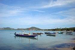
Lipa Noi Beach | |
 Ko Samui | |
| Coordinates: TH 9°30′N 100°00′E / 9.500°N 100.000°ECoordinates: TH 9°30′N 100°00′E / 9.500°N 100.000°E | |
| Country | Thailand |
| Province | Surat Thani |
| Area | |
| • Total | 228.7 km2 (88.3 sq mi) |
| Highest elevation | 635 m (2,083 ft) |
| Lowest elevation | 0 m (0 ft) |
| Population (2012) | |
| • Total | 62,500 |
| • Density | 270/km2 (710/sq mi) |
| Time zone | ICT (UTC+7) |
| Country code | +66 |
Ko Samui (or Koh Samui, Thai: เกาะสมุย, pronounced [kɔ̀ʔ sā.mūj]) is an island off the east coast of the Kra Isthmus, Thailand. Geographically in the Chumphon Archipelago, it is part of Surat Thani Province, though as of 2012, Ko Samui was granted Municipality status and thus is now locally self-governing. Ko Samui is Thailand's second-largest island after Phuket, with an area of 228.7 km2, a population of over 63,000 and a hotel occupancy rate of 73 percent as the number of visitors increases.[1] Abundant tourist resources, sandy beaches, coral reefs, and coconut trees are present on the island.
History
The island was probably first inhabited about 15 centuries ago, settled by fishermen from the Malay Peninsula[2] and southern China. It appears on Chinese maps dating back to 1687, under the name Pulo Cornam. The name samui is mysterious in itself. Perhaps it is an extension of the name of one of the native trees, mui. Some people believe that the word "samui" derives from the Malay word "saboey", or "safe haven", although there appears to be no credible corroboration of this. Ko is the Thai word for "island".
Until the late-20th century, Ko Samui was an isolated self-sufficient community, having little connection with the mainland of Thailand.[3] The island was without roads until the early 1970s, and the 15 km journey from one side of the island to the other could involve a whole-day trek through the mountainous central jungles.
Ko Samui's economy now is based primarily on a successful tourist industry, as well as exports of coconut and rubber.
Economic growth has brought not only prosperity, but also major changes to the island's environment and culture.[4]
Geography

Ko Samui is in the Gulf of Thailand, about 35 km northeast of Surat Thani town (9°N, 100°E). It is the most significant island in the Chumphon Archipelago. The island measures some 25 km at its widest point. To the north are the populated resort islands of Ko Phangan, Ko Tao, and Ko Nang Yuan. Close to Bangrak in NE Samui is the small uninhabited island of Ko Som, and to the northeast of Chaweng is the tiny Ko Matlang. In the southern direction are Ko Taen, Ko Matsum each of which have very small tourist facilities. To the far west are 44 other islands which together compose the Mu Ko Ang Thong National Park which is accessible by a day-trip boat tour from Ko Samui.
The central part of Ko Samui is the mostly unspoiled, natural tropical jungle, including the largest mountain named Khao Pom, peaking at 635 meters. The various lowland and coastal areas are connected by Route 4169, which is a 51 km road, running primarily along the coastline and encircling the bulk of the island. Many other concrete roads branch off from 4169 to service other areas.
On the west coast of the island is the original capital, Nathon, which still houses many government offices, as well as two of the island's five major piers. Nathon is the major port for vehicular and goods transportation from the mainland; it is the centre of the fishing industry, though the seat of the regional government has been relocated further south. Nathon is the home of the public hospital. Being the location of the main port and the closest inhabited area to the mainland provided the impetus for Nathon becoming the commercial centre for Samui locals. More recently, the transition from dependence on the local coconut industry along with the continued growth and development of the tourist industry, as well as the northeastern location of the airport, has led to the increase of commercial activity in Chaweng and Bophut.
Climate
Ko Samui features a tropical savanna climate under Köppen’s climate classification. The island has only has one true dry season month, with the average monthly precipitation in February falling below 60 mm (2 in), the threshold for a tropical dry season month. The climate is warm and humid for most of the year. However, in comparison to Phuket and most of the rest of southern Thailand, Samui's weather is relatively drier (Samui receives about 1,960 mm rain per year, Phuket 2,220 mm (87 in), while Phuket's Wet Season is spread over 6–8 months, Ko Samui's has only two months with more than 212 mm (8 in) of rain). The heaviest precipitation is typically seen in the months of October and November.[5] For the rest of the year, given the tropical climate, rain showers are brief; 20–60 minutes duration is typical.
| Climate data for Ko Samui (1981–2010) | |||||||||||||
|---|---|---|---|---|---|---|---|---|---|---|---|---|---|
| Month | Jan | Feb | Mar | Apr | May | Jun | Jul | Aug | Sep | Oct | Nov | Dec | Year |
| Record high °C (°F) | 33.4 (92.1) |
33.9 (93) |
35.4 (95.7) |
36.5 (97.7) |
36.3 (97.3) |
36.2 (97.2) |
36.0 (96.8) |
35.8 (96.4) |
35.4 (95.7) |
34.1 (93.4) |
34.0 (93.2) |
32.3 (90.1) |
36.5 (97.7) |
| Average high °C (°F) | 29.0 (84.2) |
29.4 (84.9) |
30.6 (87.1) |
32.0 (89.6) |
32.6 (90.7) |
32.5 (90.5) |
32.2 (90) |
32.1 (89.8) |
31.7 (89.1) |
30.5 (86.9) |
29.6 (85.3) |
29.2 (84.6) |
31.0 (87.8) |
| Daily mean °C (°F) | 26.8 (80.2) |
27.4 (81.3) |
28.2 (82.8) |
29.1 (84.4) |
28.9 (84) |
28.7 (83.7) |
28.3 (82.9) |
28.2 (82.8) |
27.9 (82.2) |
27.2 (81) |
26.8 (80.2) |
26.6 (79.9) |
27.8 (82) |
| Average low °C (°F) | 24.2 (75.6) |
25.0 (77) |
25.6 (78.1) |
26.1 (79) |
25.7 (78.3) |
25.5 (77.9) |
25.1 (77.2) |
25.2 (77.4) |
24.8 (76.6) |
24.3 (75.7) |
24.1 (75.4) |
23.9 (75) |
25.0 (77) |
| Record low °C (°F) | 18.6 (65.5) |
19.5 (67.1) |
21.0 (69.8) |
22.0 (71.6) |
22.1 (71.8) |
20.6 (69.1) |
19.9 (67.8) |
21.7 (71.1) |
19.4 (66.9) |
21.4 (70.5) |
20.3 (68.5) |
18.8 (65.8) |
18.6 (65.5) |
| Average rainfall mm (inches) | 86.2 (3.394) |
54.4 (2.142) |
80.8 (3.181) |
83.1 (3.272) |
155.9 (6.138) |
124.1 (4.886) |
116.3 (4.579) |
110.9 (4.366) |
121.7 (4.791) |
309.8 (12.197) |
506.6 (19.945) |
210.3 (8.28) |
1,960.1 (77.169) |
| Average rainy days | 11.0 | 5.6 | 5.9 | 8.6 | 15.6 | 13.7 | 14.4 | 15.2 | 16.2 | 19.6 | 19.2 | 13.7 | 158.7 |
| Average relative humidity (%) | 83 | 82 | 82 | 81 | 80 | 78 | 78 | 78 | 80 | 85 | 85 | 82 | 81 |
| Mean monthly sunshine hours | 198.4 | 214.7 | 238.7 | 201.0 | 192.2 | 150.0 | 155.0 | 151.9 | 144.0 | 145.7 | 174.0 | 176.7 | 2,142.3 |
| Mean daily sunshine hours | 6.4 | 7.6 | 7.7 | 6.7 | 6.2 | 5.0 | 5.0 | 4.9 | 4.8 | 4.7 | 5.8 | 5.7 | 5.9 |
| Source #1: Thai Meteorological Department[6] | |||||||||||||
| Source #2: Office of Water Management and Hydrology, Royal Irrigation Department (sun and humidity)[7] | |||||||||||||
Administration
Ko Samui is an amphoe (district) of Surat Thani Province, divided into seven sub-districts (tambon). The complete island is one city municipality (thesaban nakhon). The district covers the island, as well as the Ang Thong archipelago and some other small islands nearby.
|
 |
Economy
Historically, the island's economy has been based on subsistence agriculture and fishing, with coconuts as the main cash crop. From the 1980s onwards, tourism has become an economic factor and is now the dominant industry. Ko Samui transport links have made it a destination for tourists seeking to explore the other islands in the area.[3]
Transportation

Samui Airport is a private airport built and owned by Bangkok Airways, which is still the main operator and was the only airline with services to Ko Samui from mainland Thailand since the airport's construction in 1989. Due to its use of locally produced palm leaves and a natural, open-air cooling system, the terminal complex received an Environment Impact Assessment Award under the guidance of Prasert Prasarttong-Osoth. Ko Samui airport is built in an open style, drawing connections between it and traditional Thai housing, resulting in a beautiful entrepot to the island. In 2009, the airport handled 1.3 million passengers and 17,707 aircraft operations.[8] The airport is now additionally served by Thai Airways International to Bangkok, Firefly Airlines to Kuala Lumpur and Penang, and SilkAir to Singapore.
Flights from Samui to Phuket and other Thai destinations are available, and in 2012, the Thai government announced the possibility of a second Ko Samui airport due to complaints of high airport fees.[9]
Following the reopening of Don Mueang airport in early 2012, Air Asia offered flights from Kuala Lumpur to Surat Thani Airport. Flights began on 6 February 2012.[10]
Several ferries connect the island with the mainland, including two car/passenger ferries (Raja Ferries and Seatran), and connect Don Sak to piers in the west of the island, in Lipa Noi and in Nathon. Public buses to all parts of the mainland operate from a new bus station north of Nathon. Privately operated Songthaews circle the ring road like a bus service with fixed fees mostly only in the daytime, and private taxis which charged a fixed, flat fee depending on the destination. The emergence of NaviGo Samui, a mobile application taxi service has given tourists and locals an alternative to the more expensive regular taxis.
Tourism
The expansion of tourism in Ko Samui has resulted in growth of building resorts, bungalows, and luxury private villas on the island. The island's total inventory of 17,479 hotel rooms in 2013 will be augmented by an additional 459 new rooms by 2015. A gradual shift in demand is seeing more Asian visitors and families, but the top three source markets have been Germany, the UK, and Thailand, which contribute a combined 27 percent share. Bangkok Airways continues to modernise its fleet with new Airbuses, phasing out older ATR 72 propeller planes, which will provide an 189,000 additional airline seats for Samui travelers. Bangkok Airways has already increased the number of daily flights from 36 to 50.[11]
Events and festivals
- Buffalo Fighting Festival: One of the best-known festivals on Ko Samui is the Buffalo Fighting Festival[12] which is held on special occasions such as New Year's Day and Songkran. Unlike Spanish bullfighting, the fighting on Ko Samui is fairly harmless. The fighting season varies according to some ancient customs and ceremonies. The buffalo are beautifully decorated with ribbons and gold-painted leaves. Before the contest, which lasts just two rounds, monks spray the buffalos with holy water. The winning owner typically takes home millions of baht in prize money.
- Samui Regatta: The Samui Regatta is a sailing tournament held every year. The tournament is internationally known and competitors come from as far away as Australia, Singapore, Japan and China. The event began in 2002.[13]
- Ten Stars Samui Art Party: A recurring cultural event bringing together art lovers, local Thai and international artists, and their new, original artworks. The annual event, hosted at various high-end resorts and other high-end venues on the island, focus on building the art community on Ko Samui, with presentations by featured artists.
- Samui Triathlon: The International Triathlon Union organizes this event every year. This event draws more than five hundred participants from around the world.[14]
- Koh Samui THA Midnight Run: The Koh Samui Midnight Run is a charity run organized by the Thai Hotel Association (THA) and the Thai Association of Ko Samui (TAKS) on the island of Ko Samui. It is a yearly event usually held in March. With up to 2000 participants, the run is one of the biggest on Samui and in Thailand. Participants will run 5 km or 10 km around the buzzy and lively streets of Chaweng Beach. The first run was held in 2013.[15]
Medical care
Samui has four private hospitals: Samui International Hospital;[16] Thai International;[17] Bandon Hospital;[18] and Bangkok Hospital Samui.[19] The government hospital is in Nathon.[20]
Local food
Local food products of Ko Samui and Surat Thani Province include salted eggs and rambutan.
See also
References
- ↑ "Samui hotels cash in on tourism boom". Bangkok Post. 2014-04-03. Retrieved 12 Feb 2015.
- ↑ Joe Bindloss; Steven Martin; Wendy Taylor. Thailand's Islands and Beaches. Lonely Planet. p. 199. ISBN 1-74059-500-9.
- 1 2 "Koh Samui". Koh Samui.
- ↑ Levy, Adrian; Scott-Clark, Cathy (2006-04-08). "Danger in paradise". The Guardian. Retrieved 12 Feb 2015.
- ↑ "Weather in Thailand". Travelfish.org. Retrieved 2013-11-15.
- ↑ "Climatological Data for the Period 1981–2010". Thai Meteorological Department. p. 23. Retrieved 7 August 2016.
- ↑ "ปริมาณการใช้น้ำของพืชอ้างอิงโดยวิธีของ Penman Monteith (Reference Crop Evapotranspiration by Penman Monteith)" (PDF) (in Thai). Office of Water Management and Hydrology, Royal Irrigation Department. p. 108. Retrieved 7 August 2016.
- ↑ "Koh Samui Airport, Thailand". airport-technology.com. Kable. 2013. Retrieved 18 Jan 2014.
- ↑ "Samui may get second airport". Bangkok Post. 2012-04-18. Retrieved 2013-11-15.
- ↑ "AirAsia's new routes from Kuala Lumpur to Thailand, Indonesia". Budget Airline Guide. Budget Airline Guide. 12 December 2011. Retrieved 18 January 2014.
- ↑ http://centreforaviation.com/analysis/bangkok-airways-part-2-plans-for-further-network-fleet--partnership-portfolio-expansion-for-2016-256648
- ↑ "Buffalo Fight Festival". Bangkok Post Travel. Bangkok Post. Retrieved 12 Feb 2015.
- ↑ "Samui Regatta". Samui Regatta. Retrieved 12 Feb 2015.
- ↑ "Samui Triathlon". Triathlon Samui. Retrieved 12 Feb 2015.
- ↑ "Koh Samui Midnight Run". Koh Samui Midnight Run. Retrieved 22 Feb 2016.
- ↑ Samui International Hospital. Retrieved on 21 March 2015.
- ↑ Thai International Hospital. Retrieved on 21 March 2015.
- ↑ "Samui's Leading First Class Medical Center | Bandon International Hospital Samui". Bandon International Hospital Samui. Retrieved 2016-04-28.
- ↑ Bangkok Samui Hospital. Retrieved on 21 March 2015.
- ↑ Koh Samui Hospitals (Thai Visa Samui)
Gallery
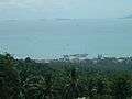 Mountainside view of Nathon
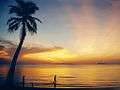 Lipa Noi Beach
 Bo Phut Beach
- Sunrise, Ko Samui
- Samui International Airport
 Aerial view of Chaweng
 Laem Yai Cape from Bang Po Beach
 Chaweng Beach between Lamai and Chaweng
 Namuang Waterfall
.jpg) Big Buddha Temple (Wat Phra Yai)
Big Buddha Temple (Wat Phra Yai).jpg) Buddha statue, Big Buddha Temple (Wat Phra Yai)
Buddha statue, Big Buddha Temple (Wat Phra Yai)
External links
| Wikimedia Commons has media related to Ko Samui. |
 Ko Samui travel guide from Wikivoyage
- Surat Thani travel guide from Wikivoyage