Knickerbocker, Texas
| Knickerbocker | |
|---|---|
| Unincorporated community | |
 Knickerbocker  Knickerbocker Location within the state of Texas | |
| Coordinates: 31°16′0″N 100°37′23″W / 31.26667°N 100.62306°WCoordinates: 31°16′0″N 100°37′23″W / 31.26667°N 100.62306°W | |
| Country | United States |
| State | Texas |
| County | Tom Green |
| Elevation | 2,051 ft (625 m) |
| Time zone | Central (CST) (UTC-6) |
| • Summer (DST) | CDT (UTC-5) |
| ZIP codes | 76939 |
| GNIS feature ID | 1360716 |
Knickerbocker is an unincorporated community in southwestern Tom Green County, Texas, United States. It lies along FM 2335 southwest of the city of San Angelo, the county seat of Tom Green County.[1] Its elevation is 2,051 feet (625 m).[2] Although Knickerbocker is unincorporated, it has a post office, with the ZIP code of 76939.[3]
Named for Washington Irving's character Diedrich Knickerbocker by early settlers related to Irving, the community quickly became significant, being the most important community in the county aside from San Angelo. Agriculture was long the community's mainstay, between grain farming and sheep ranching. The first settlers in the area arrived in 1875, and the first townsite was established along Dove Creek; Knickerbocker's post office was established in 1881 and rebuilt in 1896 and 1936. The community was moved in 1889 around a nearby hill in order to have better access to water. Local children were able to attend school in Knickerbocker starting in 1889, but the school was closed and merged into Christoval's system in 1956.[4]
References
- ↑ Rand McNally. The Road Atlas '08. Chicago: Rand McNally, 2008, p. 99.
- ↑ U.S. Geological Survey Geographic Names Information System: Knickerbocker, Texas
- ↑ Zip Code Lookup
- ↑ Knickerbocker, Texas, Handbook of Texas Online, 2008-01-17. Accessed 2008-08-11.
External links
- Knickerbocker, Texas from the Handbook of Texas Online
Municipalities and communities of Tom Green County, Texas, United States | ||
|---|---|---|
| City | 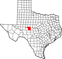 | |
| CDPs | ||
| Other unincorporated communities | ||
| Ghost town | ||