Kneiff
| Kneiff | |
|---|---|
 The summit of Kneiff | |
| Highest point | |
| Elevation | 560 m (1,840 ft) |
| Listing | Country high point |
| Coordinates | 50°9′27.7″N 6°2′13.8″E / 50.157694°N 6.037167°ECoordinates: 50°9′27.7″N 6°2′13.8″E / 50.157694°N 6.037167°E |
| Geography | |
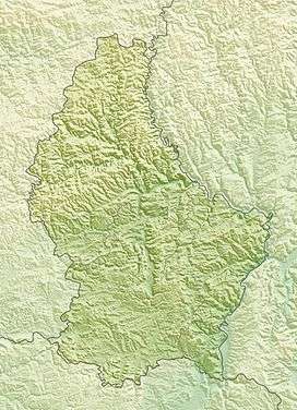 Kneiff Luxembourg | |
| Location |
Troisvierges, Luxembourg |
| Geology | |
| Mountain type | Hill |
Kneiff is a hill in the commune of Troisvierges, in northern Luxembourg, near the tripoint shared with Belgium and Germany. At 560 metres, it is the highest point in the country; it is 1 m taller than Buurgplaatz,[1] which is often erroneously considered Luxembourg's highest point. It lies close to the town of Wilwerdange.
References
- ↑ ACT (Administration du Cadastre et de la Topographie) Regional Map R1 Clervaux - Huldange 1:20000 (2003) shows 'Kneiff' at 560m and 'Buergplaz' at 559m.
This article is issued from Wikipedia - version of the 5/13/2016. The text is available under the Creative Commons Attribution/Share Alike but additional terms may apply for the media files.