Kissufim
| Kissufim כִּסּוּפִים, כיסופים | |
|---|---|
|
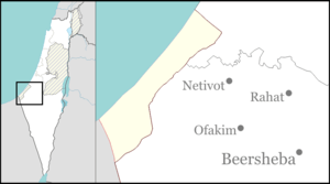
Map of Kissufim on a sign in the kibbutz. | |
 Kissufim | |
| Coordinates: 31°22′27″N 34°23′58″E / 31.37417°N 34.39944°ECoordinates: 31°22′27″N 34°23′58″E / 31.37417°N 34.39944°E | |
| District | Southern |
| Council | Eshkol |
| Affiliation | Kibbutz Movement |
| Founded | 1951 |
| Founded by | American and South American immigrants |
| Population (2015)[1] | 235 |
| Name meaning | Yearning |
| Website | www.kissufim.org.il |

Kissufim (Hebrew: כִּסּוּפִים, lit. Yearning) is a community in the northwestern Negev desert in Israel. Located adjacent to the Gaza Strip at an altitude of 92 metres above sea level, it falls under the jurisdiction of Eshkol Regional Council. In 2015 it had a population of 235.
History
The village was established in 1951 by Zionist youth movement members from the United States and South America. It is part of the Shalom bloc of Israeli settlement meant to secure Israel's southern border with the Gaza Strip from the numerous Palestinian Fedayeen infiltrations. The national government has recently financed building additions to each home which also serve as bomb shelters, with reinforced concrete.
Economy
The kibbutz economy largely relies on its milk production, chicken farming, a citrus grove which is being phased out, an avocado orchard, and renting out land to the Israel Defense Forces. Avocados are the primary income and Kissufim is one of the only producers of Avocados in Israel during the summer months. Income from land rented from the IDF helps cover the pension costs and other agricultural land is managed by neighboring villages, with profits split.
At one point it had a factory that produced plastic frames for glasses and raised chinchillas for their fur. Both endeavours were economic failures. The village also houses an archaeological museum (named after Ami Saull, father of Dror Shaul) displaying artifacts found in the surrounding area. Kissufim is currently undergoing a process of privatization in which homes will soon be owned by individuals rather than the collective.
Kissufim crossing
The nearby crossing into the Gaza Strip, named for the kibbutz, was the main route for traffic into the Gush Katif Israeli settlement bloc. It was permanently closed to inbound Israeli civilian traffic on 15 August 2005 as part of the disengagement plan. The last Israeli soldier left the Gaza strip and closed the gate at dawn of 12 September 2005, completing the Israeli withdrawal from the Gaza Strip.[2]
Notable residents
- Dror Shaul, a filmmaker
- Avihu Medina
References
- ↑ "List of localities, in Alphabetical order" (PDF). Israel Central Bureau of Statistics. Retrieved 16 October 2016.
- ↑ Israel completes Gaza withdrawal BBC News, 12 September 2006
External links
- Official website (Hebrew)
- Kissufim Negev Information Centre
- 15-minute movie on Kissufim in the 1950s Steven Spielberg Jewish Film Archive
- Kissufim Bo HaBayta article