Kisecik Canyon
| Kisecik Canyon Kisecik Kanyonu | |
|---|---|
| Hidden Heaven (Saklı Cennte) | |
|
Kisecik Canyon and its creek | |
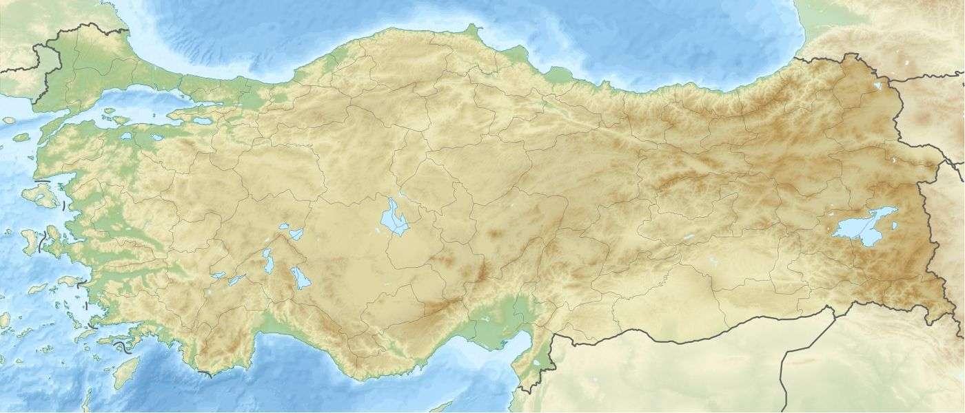 Kisecik Canyon Location of Kisecik Canyon in Turkey | |
| Floor elevation | 420 m (1,380 ft) |
| Long-axis direction | east - west |
| Geography | |
| Coordinates | 37°06′18″N 34°38′54″E / 37.10500°N 34.64833°ECoordinates: 37°06′18″N 34°38′54″E / 37.10500°N 34.64833°E |
| Watercourses | Creek |

Kisecik Canyon (Turkish: Kisecik Kanyonu), aka Saklı Cennet ("Hidden Heaven"), is a canyon in Mersin Province, Turkey.
The canyon at 37°06′18″N 34°38′54″E / 37.10500°N 34.64833°E is located in the Toros Mountains. Administratively, it is a part of Çamlıyayla ilçe (district) of Mersin Province,[1] at an elevation of 420 m (1,380 ft). Although it is named after the nearest village Kesecik, its shortest road is from Sarıkavak village which is about 7 kilometres (4.3 mi) to the canyon.[2] The distance from the canyon to Çamlıyayla is 24 km (15 mi) and to Mersin is 76 km (47 mi). The canyon is locally dubbed Saklı Cennet ("Hidden Heaven").[1]
The road between Sarıkavak and the canyon is a popular hiking course. It is stabilized only descending about 500 m (1,600 ft) downhill. Visitors reach a small pond, which is fed by a creek, a tributary of Berdan River in the canyon. The canyon is very narrow, with steep slopes. It takes about six hours to pass through the canyon by foot on a tough trail. The creek offers recreational outdoor activities like swimming and rafting.[1][3]
References
- 1 2 3 Çömez, Derviş (2016-08-18). "Kisecik kanyonu doğa tutkunlarını bekliyor". Habrtürk (in Turkish). Retrieved 2016-10-30.
- ↑ Map page
- ↑ On line news (Turkish)