Kirribilli, New South Wales
| Kirribilli Sydney, New South Wales | |||||||||||||
|---|---|---|---|---|---|---|---|---|---|---|---|---|---|
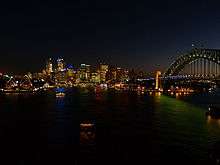
 The Kirribilli peninsula (foreground) in Sydney Harbour | |||||||||||||
| Population | 3,668 (2011 census)[1] | ||||||||||||
| • Density | 7,300/km2 (19,000/sq mi) | ||||||||||||
| Postcode(s) | 2061 | ||||||||||||
| Area | 0.5 km2 (0.2 sq mi) | ||||||||||||
| Location | 3 km (2 mi) north of Sydney CBD | ||||||||||||
| LGA(s) | North Sydney Council | ||||||||||||
| State electorate(s) | North Shore | ||||||||||||
| Federal Division(s) | North Sydney | ||||||||||||
| |||||||||||||
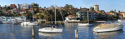
Kirribilli is a suburb of Sydney, in the state of New South Wales, Australia. One of the city's most established and affluent neighbourhoods, it is located three kilometres north of the Sydney central business district, in the local government area administered by North Sydney Council. Kirribilli is a harbourside suburb, sitting on the Lower North Shore of Sydney Harbour.[2] Kirribilli House is one of the two official residences of the Prime Minister of Australia.
History
The name Kirribilli is derived from an Aboriginal word Kiarabilli, which means 'good fishing spot'. The suburb initially formed in the vicinity of Jeffrey Street and was subsequently part of a grant to James Milson (1785-1872), after whom Milsons Point was named. The area was largely covered in native bush. As the decades passed, the land was cleared bit by bit and sub-divided, first for the construction of large family residences during the 1840s, secondly for the erection of Victorian terrace houses from the 1860s onwards, and finally for 20th-Century flats.
Prominent early landowners in Kirribilli included members of the Campbell, Jeffrey and Gibbes families. Colonel John George Nathaniel Gibbes (1787-1873), the Collector of Customs for New South Wales, built 'Wotonga' - the forerunner of Admiralty House - in 1842-43 on a 5-acre (20,000 m2) site which he leased, and then purchased, from the Campbells. Gibbes' son, William John Gibbes, lived nearby in Beulah House during the 1840s. Beulah was later lived in by the Riley and Lasseter families. Eventually, the house was demolished and its grounds subdivided into numerous residential blocks which were put up for public auction in 1905.[3]
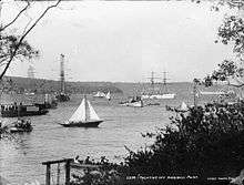
The Kirribilli area opened up further for development with the completion of the Sydney Harbour Bridge in 1932, which linked the municipality of North Sydney directly by road and rail with the CBD of the City of Sydney.
Landmarks
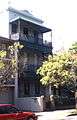
Kirribilli is one of Australia's older suburbs, with the first land grants in the area being granted by the colonial government during the 1790s. A scattering of Georgian and Gothic-revival houses and mansions were built in the 1830s, '40s and '50s. Most of these have since been razed. Originally, Kirribilli formed part of the Parish of St Leonard's and was served by a private ferry service. In a process which began in the 1860s, the area's old estates were subdivided. New residential streets were laid out and terrace houses, Victorian villas and, later, blocks of apartments erected. During the early decades of the 20th century, Kirribilli's shoreline was dominated by a large, multi-storey brick warehouse which was eventually torn down to make way for housing.
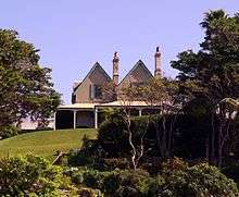
The suburb contains Kirribilli House (the official Sydney residence of the Prime Minister of Australia), Admiralty House (the official Sydney residence of the Governor-General of Australia), and the headquarters and marina of the Royal Sydney Yacht Squadron located on the former Carabella mansion. The Sydney headquarters of ASIO was formerly at 31 Carabella Street.[4] The Sydney Flying Squadron is located adjoining Milson Park, formerly Kirribilli Park.
Admiralty House, originally a private dwelling belonging to Colonel John George Nathaniel Gibbes, is Kirribilli's oldest extant building, the earliest portions of which date to 1842. Kirribilli House was built next door by Adolphus Frederick Feez, a wealthy merchant, in 1854-55.
The following buildings are on the Register of the National Estate:[5]
- St Aloysius' College, Upper Pitt Street
- St Aloysius' College's junior school (formerly Kirribilli Public School), Burton Street
- Loreto Convent (formerly Elamang), Carabella Street
- Kirribilli Neighbourhood Centre, Fitzroy Street
- Sunnyside (house and grounds), Holbrook Avenue [6]
- Kirribilli House, Kirribilli Avenue
- Admiralty House and Lodge, Kirribilli Point
 Karlsrue, Fitzroy Street
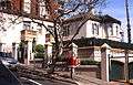 Craiglea House, Upper Pitt Street
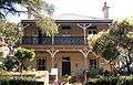 Burnleigh, Carabella Street
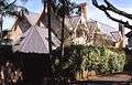 Sunnyside, Holbrook Avenue
Transport
Kirribilli supports the northern end of the Sydney Harbour Bridge. The Warringah Freeway provides a link south to the Sydney CBD and north to Chatswood. Kirribilli is serviced by rail, bus and ferry services.
Milsons Point railway station is the closest train stop. It forms part of the North Shore, Northern & Western Line of the Sydney Trains network. It is located next to the main shopping streets, and has frequent services to the Sydney CBD and the North Shore.
Sydney Buses operate regular services from Kirribilli to many parts of northern Sydney. The 269 bus service runs a loop within the Kirribilli - Milsons Point - McMahons Point - North Sydney railway station area on weekdays.
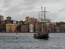
There are four operating ferry wharves near Kirribilli, serviced by both public and private ferries. They are:
- On the eastern side is Kirribilli wharf, part of the Sydney Ferries Neutral Bay service. The wharf is one stop from Circular Quay and has two services per hour in each direction. Kirribilli Wharf also has a small local cafe serving coffees, cakes, and newspapers to commuters and many local regulars.
- At the southernmost tip of Kirribilli is the Beulah Street Wharf. This small wharf was dropped from public Sydney Ferries services when an inner harbour ferry route was cancelled, though was briefly pressed into service between 7–13 February 2011 and again on 27–28 October 2012 while the main Kirribilli wharf was undergoing maintenance. In 2005, private operator Matilda Cruises started using Beulah Street Wharf as part of their Matilda Express loop from Circular Quay to Darling Harbour but it was suspended by 2006. Outside ferry hours, Beulah Street Wharf is frequently used for fishing and recreation and being directly north of the Sydney Opera House, offers spectacular harbour views.
- On the eastern side of the Sydney Harbour Bridge, Jeffreys Street Wharf is also no longer used by Sydney Ferries, with just a few services by Matilda Cruises. It is still used by private charter services, but is more popular as a fishing location. The panoramic views of the Opera House, Circular Quay, and the Harbour Bridge make Jeffrey Street a popular location for wedding photography.
- On the western side of the Bridge is Milsons Point ferry wharf, which carries many more services than the Kirribilli wharves and joins Kirribilli to the CBD, the inner harbour, and along the Parramatta River to Parramatta.
Commercial area
Kirribilli has a small shopping strip opposite Milsons Point railway station. The 'Kirribilli Markets' are held on the fourth Saturday of each month, on the lawns of the former Kirribilli Bowling Club. The markets contain a mixture of new and second-hand clothing, bric-a-brac, jewellery, and food-and-drink stands.
Schools
The two main schools in the suburb are St Aloysius' College and Loreto Kirribilli.
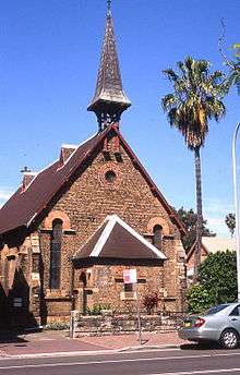 St John the Baptist's Anglican Church, Broughton Street
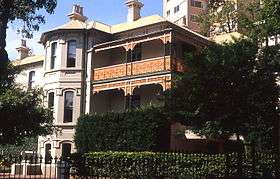 Senior School, St Aloysius College, Upper Pitt Street
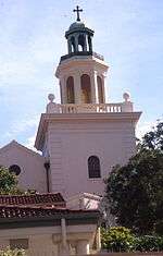 Chapel, Loreto Convent
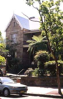 Kirribilli Neighbourhood Centre, Fitzroy Street
Churches
- Our Lady Star of the Sea Catholic Church, part of North Sydney Parish
- St John's Anglican Church ("Church by the Bridge")
Culture
Kirribilli is the home of Australia's oldest continuously operating professional theatre company, The Ensemble Theatre. Located in a converted boatshed, it shows productions of contemporary works by both Australian and International playwrights.
See also
Streets
- Beulah Street, Bligh Street, Bradley Avenue, Broughton Street, Burton Street, Carabella Street, Clark Road, Crescent Place, Elamang Avenue, Ennis Road, Fitzroy Street, Hipwood Street, Holbrook Avenue, Humphrey Place, Jeffrey(s) Street, Kirribilli Avenue, McBurney Lane, McDougall Street, Olympic Drive, Parkes Street, Peel Street, Pitt Street, Robertson Lane, Upper Pitt Street, Waruda Street, Willoughby Street, Winslow Lane, Winslow Street
Landmark buildings, structures and heritage
- Kirribilli House
- Admiralty House
- Sydney Harbour Bridge
- Reserve Bank of Australia
- Kirribilli Neighbourhood Centre
- Jeffrey(s) Street
- Church by the Bridge
- Huntingdon ('the Don'), Holbrook Avenue
Tourism, theatres and sport
- Luna Park Sydney
- Royal Sydney Yacht Squadron
- Ensemble Theatre
- Sydney Flying Squadron
- The Miguel Pro Playhouse
Transport
Schools
Suburbs and localities
- Lavender Bay
- North Sydney
- Milsons Point
- Milson Park
- Careening Cove
Other
References
- ↑ Australian Bureau of Statistics (31 October 2012). "Kirribilli (State Suburb)". 2011 Census QuickStats. Retrieved 5 November 2012.
- ↑ Gregorys Sydney Street Directory, Gregorys Publishing Company, 2007
- ↑ The Book of Sydney Suburbs, Frances Pollon, Angus and Robertson, 1990
- ↑ Dunn, Ross Spies Win Battle of the Trees' Sydney Morning Herald 19 June 1985
- ↑ The Heritage of Australia, Macmillan Company, 1981
- ↑ http://www.news.com.au/finance/real-estate/sunnyside-the-mirror-image-of-kirribilli-house-sets-new-suburb-record/story-fnd91nhy-1227161614686
External links
| Wikimedia Commons has media related to Kirribilli, New South Wales. |
- Ian Hoskins (2008). "Kirribilli". Dictionary of Sydney. Retrieved 27 September 2015. [CC-By-SA]
- Kirribilli Markets
- Kirribilli Wharf ferry services
- 269 local bus service
- Matilda Express services to Beulah Street Wharf
- Parliamentary discussion of the condition of Kirribilli wharves
Coordinates: 33°51′02″S 151°12′53″E / 33.85045°S 151.21477°E