Kiowa, Colorado
| Kiowa, Colorado | |
|---|---|
| Home Rule Municipality | |
|
Kiowa, Colorado | |
 Location in Elbert County and the State of Colorado | |
| Coordinates: 39°20′39″N 104°27′46″W / 39.34417°N 104.46278°WCoordinates: 39°20′39″N 104°27′46″W / 39.34417°N 104.46278°W | |
| Country |
|
| State |
|
| County | Elbert County Seat[1] |
| Incorporated | December 30, 1912[2] |
| Government | |
| • Type | Home Rule Municipality[1] |
| Area | |
| • Total | 0.9 sq mi (2.3 km2) |
| • Land | 0.9 sq mi (2.3 km2) |
| • Water | 0 sq mi (0 km2) |
| Elevation[3] | 6,378 ft (1,944 m) |
| Population (2010) | |
| • Total | 723 |
| • Density | 817/sq mi (315.3/km2) |
| Time zone | MST (UTC-7) |
| • Summer (DST) | MDT (UTC-6) |
| ZIP code[4] | 80117 |
| Area code(s) | Both 303 and 720 |
| FIPS code | 08-40790 |
| GNIS feature ID | 0185146 |
| Website |
www |

The town of Kiowa is a home rule municipality and the county seat of Elbert County, Colorado, United States.[5] The town population was 723 at the 2010 United States Census,[6] up from 581 at the 2000 census.
History
The town was named for the Kiowa people.[7] Settled in 1859, it was originally named "Wendling" after an early settler.[8] It was called "Middle Kiowa" from the 1860s until 1912,[8] when it was incorporated and the word "Middle" was dropped.[9] It became the county seat of Elbert County in 1874.[8] Kiowa suffered from major flooding in 1935.[8]
Geography
Kiowa is located in western Elbert County at 39°20′39″N 104°27′46″W / 39.34417°N 104.46278°W (39.344207, −104.462714),[10] on the east side of Kiowa Creek, a north-flowing tributary of the South Platte River. Colorado State Highway 86 passes through the town, leading east 44 miles (71 km) to Limon and west 23 miles (37 km) to Castle Rock. The town of Elizabeth is 7 miles (11 km) west on SH 86.
According to the United States Census Bureau, Kiowa has a total area of 0.89 square miles (2.3 km2), all of it land.[6]
Demographics
| Historical population | |||
|---|---|---|---|
| Census | Pop. | %± | |
| 1920 | 148 | — | |
| 1930 | 185 | 25.0% | |
| 1940 | 195 | 5.4% | |
| 1950 | 173 | −11.3% | |
| 1960 | 195 | 12.7% | |
| 1970 | 235 | 20.5% | |
| 1980 | 206 | −12.3% | |
| 1990 | 275 | 33.5% | |
| 2000 | 581 | 111.3% | |
| 2010 | 723 | 24.4% | |
| Est. 2015 | 748 | [11] | 3.5% |
As of the census[13] of 2000, there were 581 people, 227 households, and 152 families residing in the town. However, outside of this incorporated town's limits there are several thousand other new residents of this fast-growing county. The population density was 1,190.3 people per square mile (457.8/km2). There were 243 housing units at an average density of 497.9 per square mile (191.5/km2). The racial makeup of the town was 94.49% White, 0.34% African American, 0.86% Native American, 0.17% Asian, 1.20% from other races, and 2.93% from two or more races. Hispanic or Latino of any race were 4.30% of the population.
There were 227 households, out of which 41.4% had children under the age of 18 living with them, 52.4% were married couples living together, 11.0% had a female householder with no husband present, and 33.0% were non-families. 24.2% of all households were made up of individuals, and 9.3% had someone living alone who was 65 years of age or older. The average household size was 2.52 and the average family size was 3.10.
In the town the population was spread out, with 30.5% under the age of 18, 9.0% from 18 to 24, 36.3% from 25 to 44, 17.0% from 45 to 64, and 7.2% who were 65 years of age or older. The median age was 32 years. For every 100 females there were 106.0 males. For every 100 females age 18 and over, there were 100.0 males.
The median income for a household in the town was $40,809, and the median income for a family was $42,353. Males had a median income of $34,875 versus $26,071 for females. The per capita income for the town was $17,885. About 7.0% of families and 6.8% of the population were below the poverty line, including 6.3% of those under age 18 and none of those age 65 or over.
Religion
- Kiowa Creek Community Church
- Majestic View Church
- Nazarene Church
- Graceway Bible Church
- Our Lady of the Visitation Parish
See also
References
- 1 2 "Active Colorado Municipalities". State of Colorado, Department of Local Affairs. Retrieved 2007-12-06.
- ↑ "Colorado Municipal Incorporations". State of Colorado, Department of Personnel & Administration, Colorado State Archives. 2004-12-01. Retrieved 2007-09-02.
- ↑ "US Board on Geographic Names". United States Geological Survey. 2007-10-25. Retrieved 2008-01-31.
- ↑ "ZIP Code Lookup" (JavaScript/HTML). United States Postal Service. Retrieved October 21, 2007.
- ↑ "Find a County". National Association of Counties. Retrieved 2011-06-07.
- 1 2 "Geographic Identifiers: 2010 Demographic Profile Data (G001): Kiowa town, Colorado". American Factfinder. U.S. Census Bureau. Retrieved January 25, 2016.
- ↑ "Profile for Kiowa, Colorado, CO". ePodunk. Retrieved 2012-07-14.
- 1 2 3 4 "Kiowa's story". Town of Kiowa. 2014. Retrieved 2015-10-07.
- ↑ "Kiowa, Colorado". City-Data.com. Retrieved 2012-07-13.
- ↑ "US Gazetteer files: 2010, 2000, and 1990". United States Census Bureau. 2011-02-12. Retrieved 2011-04-23.
- ↑ "Annual Estimates of the Resident Population for Incorporated Places: April 1, 2010 to July 1, 2015". Retrieved July 2, 2016.
- ↑ "Census of Population and Housing". Census.gov. Retrieved June 4, 2015.
- ↑ "American FactFinder". United States Census Bureau. Retrieved 2008-01-31.
External links
Municipalities and communities of Elbert County, Colorado, United States | ||
|---|---|---|
| Towns | 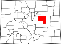 | |
| CDP | ||
| Unincorporated communities | ||
