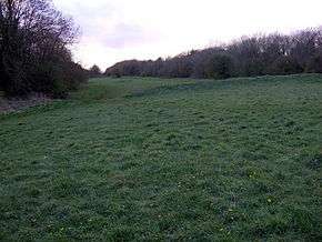
Kings Weston Hill
 King's Weston hill fort | |
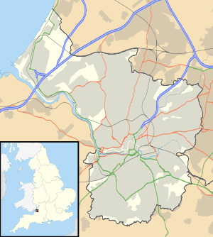 Shown within Bristol | |
| Location | near Henbury |
|---|---|
| Region | Bristol, England |
| Coordinates | 51°30′1.93″N 2°38′25.14″W / 51.5005361°N 2.6403167°WCoordinates: 51°30′1.93″N 2°38′25.14″W / 51.5005361°N 2.6403167°W |
| Type | Hill fort |
| History | |
| Periods | Iron Age |
| Site notes | |
| Condition | some damage |
Kings Weston Hill (grid reference ST556781) is a hill in the north of Bristol, England. It forms a ridge about 1 mile (1.6 km) long, extending from Henbury to Shirehampton and separating Lawrence Weston to the north from Coombe Dingle to the south. The hill is a public open space managed as part of the Blaise Castle Estate. It takes its name from the settlement of Kings Weston, now absorbed into Lawrence Weston.
At the eastern end of Kings Weston Hill is the site of an Iron Age hill fort, which is a Scheduled Ancient Monument.[1]
The hill is located between Kings Weston House to the southwest, and Blaise Castle to the northeast, and the hill is also the site of a tower for television broadcasting.
References
- ↑ "Scheduled Ancient Monuments in Bristol" (PDF). Bristol City Council. Retrieved 2007-05-07.
- "Kings Weston Hill". Megalithic Portal.
This article is issued from Wikipedia - version of the 8/21/2016. The text is available under the Creative Commons Attribution/Share Alike but additional terms may apply for the media files.